
Featured Photo: Memorial Day in Gettysburg, A Historic Tradition

Women and children reverently carry bouquets to lay upon the graves in the cemetery. Photo by Lewis Reed, ca. early 1900s.
Memorial Day in Gettysburg holds a significant place in American history, marked by a long-standing tradition of remembrance and commemoration. The Memorial Day parade and ceremony in Gettysburg is recognized as one of the oldest continuously held ceremonies in the United States. A poignant visual record of this tradition is captured in the photograph taken by Lewis Reed. This image depicts local women and children walking en route to the Soldiers National Cemetery to lay flowers. This act of laying flowers is a symbolic gesture of remembrance, a practice that continues to this day.
Gettysburg National Cemetery is the final resting place for 3,512 Union soldiers. This cemetery is not only a burial ground, but also a site of historical significance, as it is where President Abraham Lincoln delivered his iconic Gettysburg Address in 1863.
Then & Now: Monrovia Post Office
This post is a continuation of a series of “Then & Now” images from Lewis Reed’s Photo Collection alongside photographs of how they appear today. Lewis Reed worked hard to preserve a visual history of Montgomery County, Maryland and surrounding areas long before automobiles were even around. As early as 1905, he toured on his motorcycle across the states of Maryland, Virginia, and Washington, D.C. and took photographs of many historic locations. Taken approximately 114 years apart, you can see how the Post Office of Monrovia Maryland looks almost the same from over a century ago.
Monrovia Post Office (THEN): On November 15, 1901, the Monrovia Post Office was one of the first places in the U.S. to participate in the Rural Free Delivery (RFD) experiment established by the U.S. Post Office. RFD was established on an experimental basis in 1896. In 1902, it became an official part of the Post Office Department’s services.
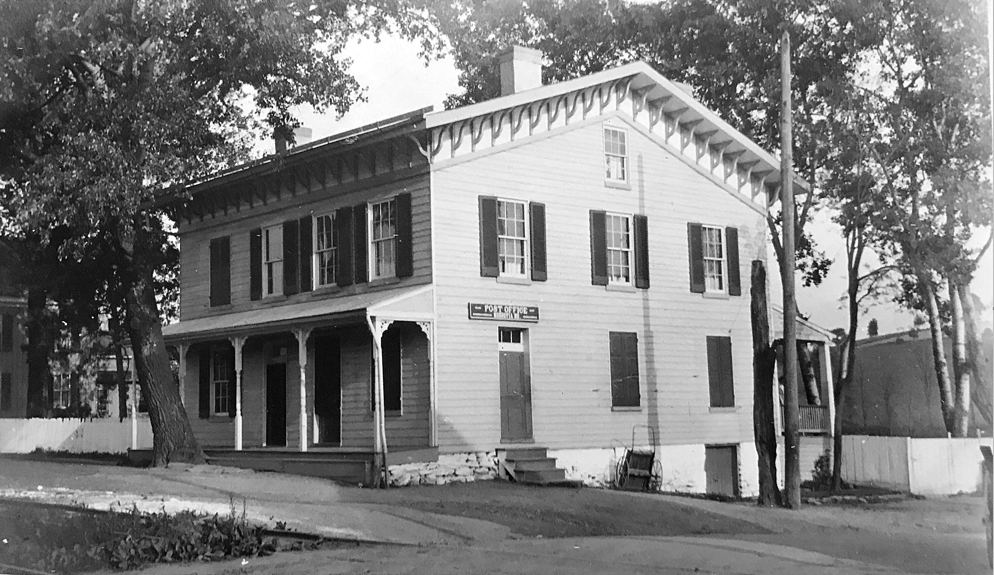
Monrovia Post Office, 1910. Photo by Lewis Reed
Monrovia Post Office (NOW): The little village of Monrovia is today not much more than an underpass, a post office, and a few abandoned buildings. The old post office building is now an Office Park area in Monrovia.
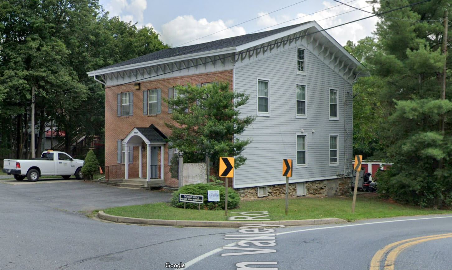
This google image of Monrovia Post Office today is still very recognizable.
Source: Wikipedia
First RDF Maryland
Back in Time: Roadside Springs
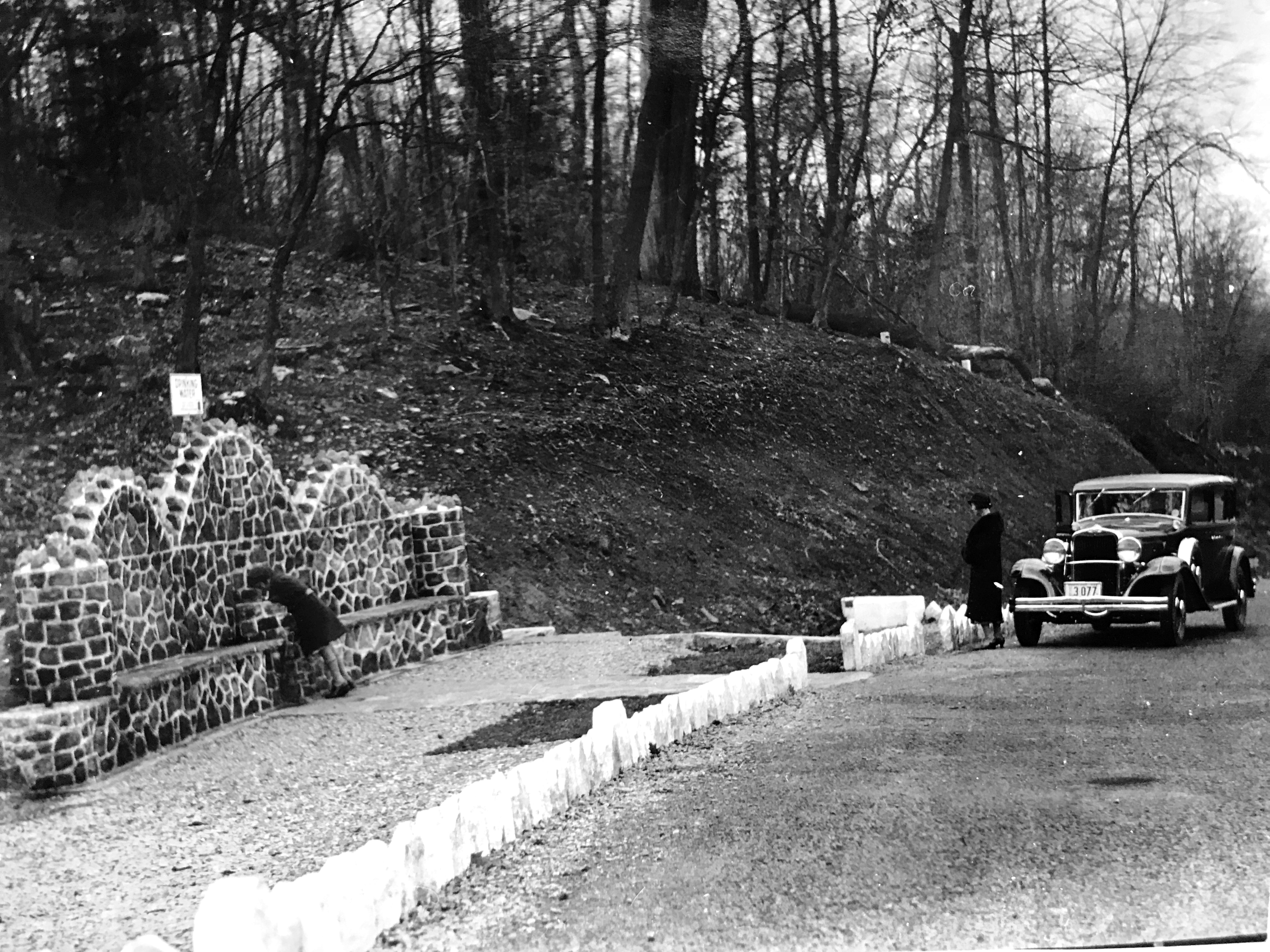
Early 1930s roadside spring. The sign above the wall reads, “drinking water”. Fountains like these were placed along roads to give motorists an opportunity to stop for a drink. The child at the fountain is Lewis Reed’s daughter, Mary Jane, and the woman standing next to the circa 1930s Dodge Sedan is his wife, Ethelene. Photo by Lewis Reed.
Imagine a time when automobiles lacked air conditioning, highway travel was young and life moved at a much slower pace. Back in the day, it was more about the journey than the destination. As better roads allowed motorists to travel increased distances it became apparent that they would need places to stop along the way. The model of place that led to the establishment of waysides and roadside parks was initiated by the traveling public. Stopping sites emerged in rural areas where commercial establishments were not available. Often they appeared in areas of scenic interest or merely in places where there was room for a car to pull off the roadway. These earliest waysides materialized out of necessity, when motorists needed to wanted to stop they pulled off and parked along the roadside.
The photo was taken by Lewis Reed on one of his many cross country road trips. This unknown roadside rest area with water fountain gives us a real sense of a bygone era. We don’t travel like this anymore. Now we’re just trying to get from point A to point B as quickly as possible.
During the 1930s, the State Road Commission was engaged in a program to improve the road infrastructure, which included beautification efforts as well as road paving and bridge construction. Numerous roadside fountains were constructed across the state. No statewide inventory exists.
Ice Cold History in Montgomery County (1910)
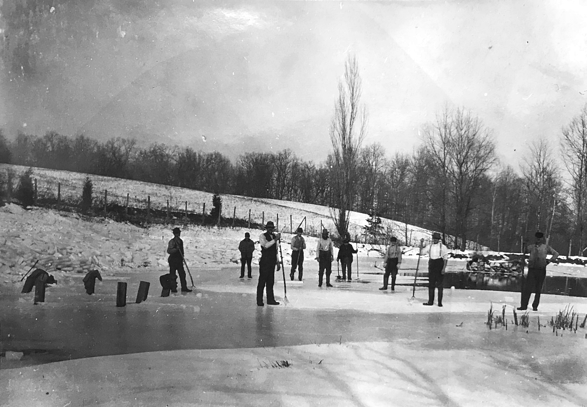
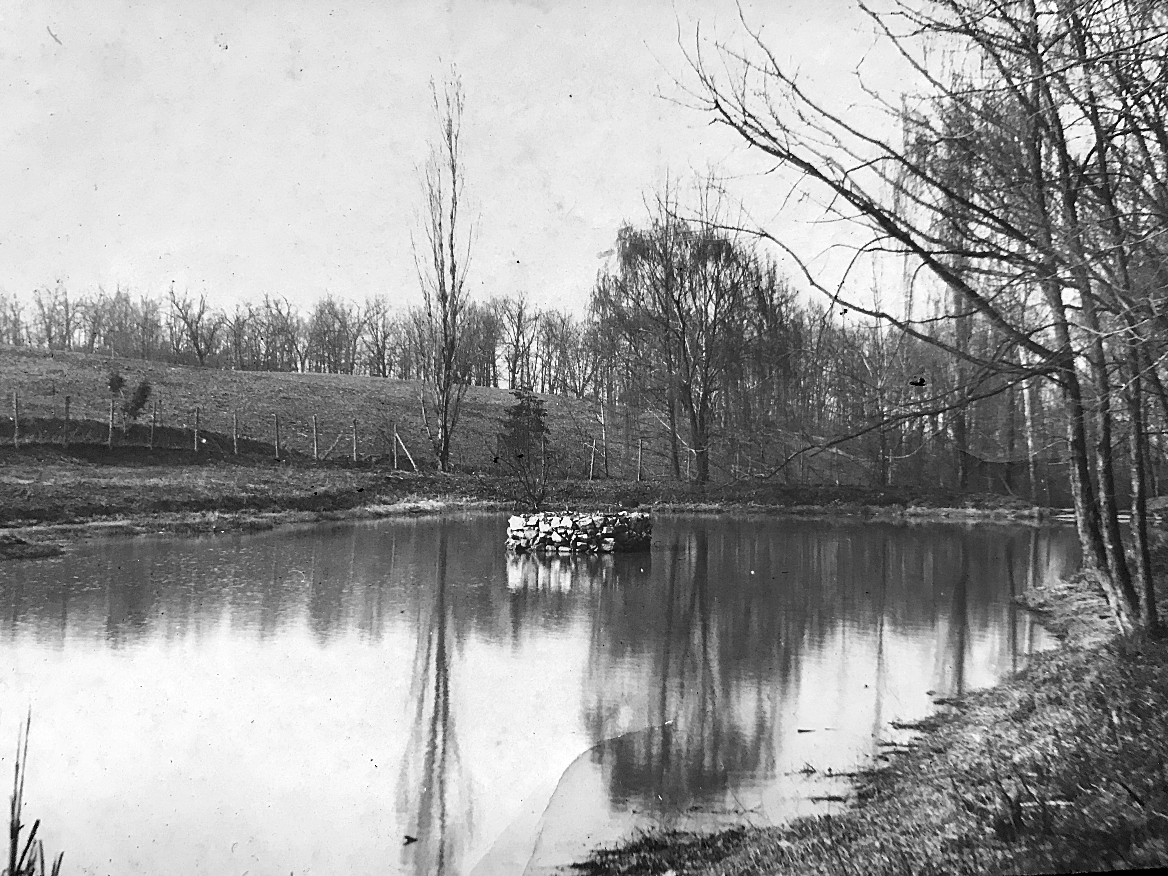
Men harvesting ice with pitchforks and hand saws in Darnestown, Maryland. Photo taken by Lewis Reed in 1910. Note the blocks of ice stacked up along the shoreline. The exact location of the pond is unknown.
Most people wouldn’t consider the months of January and February a season of harvest in Montgomery County. But in our not so distant past, this was harvest time for—ICE. Rivers, lakes and ponds were generally frozen and ice was harvested like a winter crop to keep food cold all summer long.
Before the first successful ice-making machines were built, ice for refrigeration was obtained through a process called “ice harvesting.” Ice cutters used to risk their lives by going out onto frozen ponds with saws, tongs, and pitchforks and methodically cut and dragged blocks of ice which would be stored in hay-packed ice houses. But people did not put ice in drinks as we do now. The possibility of debris having been in the water as it froze – even a bug now and then – discouraged the idea.
Ice houses were dug into the ground to keep the temperature low; double-thick walls were often filled with sawdust for further insulation, and the blocks themselves were packed in sawdust or straw. When you wanted some ice for drinks or to make ice cream, you wouldn’t pull out a whole block; ice picks, chisels, hatchets and shavers were used to get just what you needed.
Same pond in summertime without ice. Photo by Lewis Reed, 1910.
I’m not exactly sure what the stone structure is in the middle of the pond, but “google” said it could be an outlet structure to keep the water surface in the pond at its optimum level, which usually coincides with the maximum water level designed for the pond. It is connected to a pipe allows water to exit the water body. This pond must have been on a creek or stream and is very likely no longer in existence.
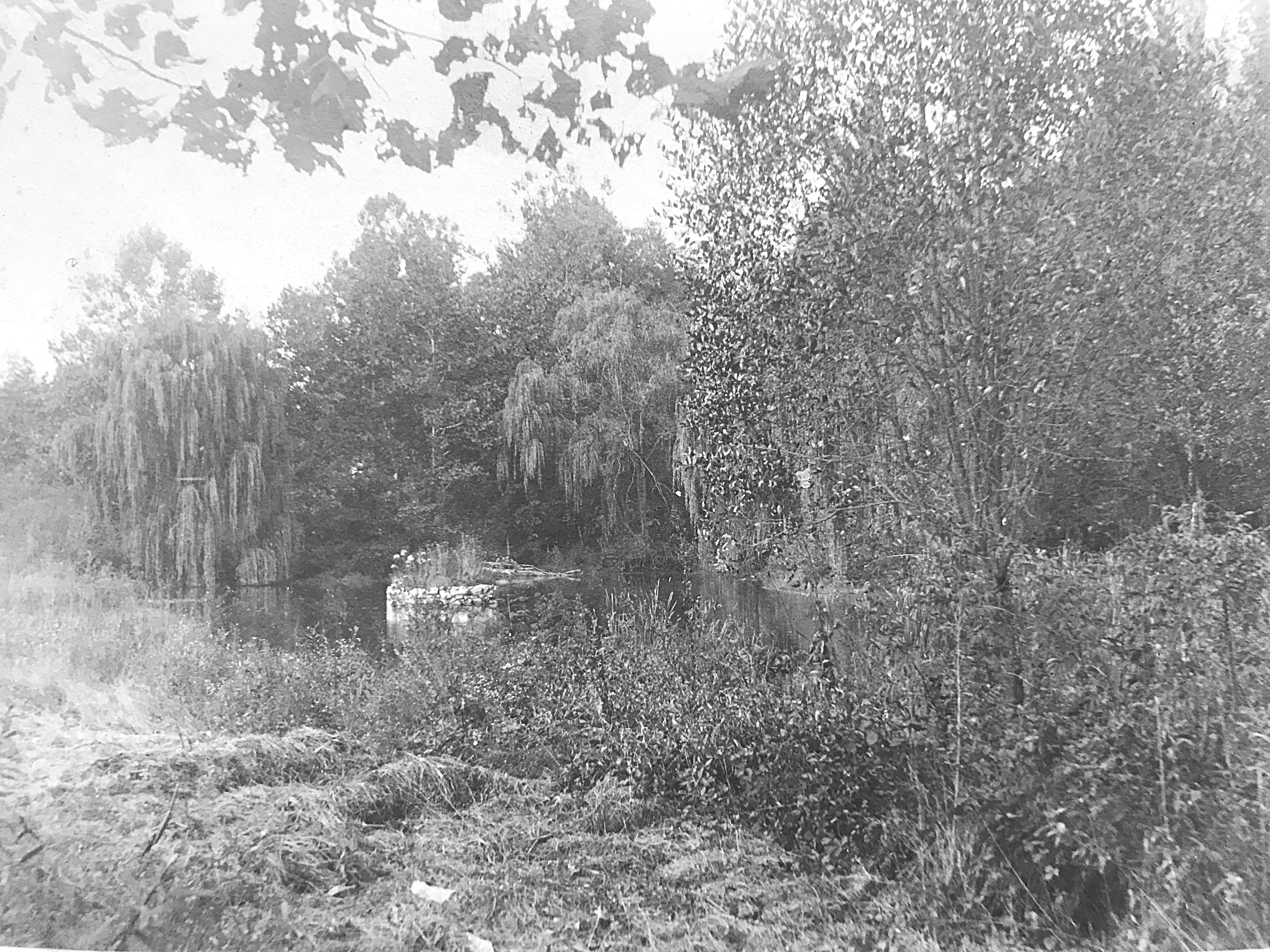
Same pond in summertime from a different perspective. Photo by Lewis Reed, 1910.
From The Evening Star, Washington, D.C. December 22, 1904
ROCKVILLE AND VICINITY GENERAL NEWS
The cold weather of the past ten days has frozen the ponds and creeks throughout this county to a thickness of six or seven inches, and the ice harvesting is now the order of the day. The quality of the ice is not regarded as first-class, however, and for this reason many persons will defer filling their houses until later in the winter.
Next time you drop a few ice cubes into a glass or take out a frozen piece of meat from the freezer, perhaps give a momentary thought to how much we take for granted the ability to have ice cold drinks, preserved foods that can be stored for months, ice cream, cold frothy beer, and so many perishable food products. Refrigeration is a modern convenience that we just can’t live without and certainly one that I took for granted until I wrote this!
Lewis Reed Photos Featured on WETA’s “If You Lived Here” Rockville
Several of Lewis Reed’s photos were featured on a historical segment of “If You Lived Here” series on Rockville that aired on December 4, 2023 on WETA. While in Rockville, viewers learn about the history of Rockville, Maryland and the town’s transformation after World War II. The post-war era brought about a wave of growth and change.
This video is part of WETA’s house-hunting “If You Lived Here” series, which spotlights a wide array of neighborhoods and properties throughout the national capital area while celebrating each area’s history, culture, notable places and flavor. Hosts, best friends and longtime Washingtonians Christine Louise and John Begeny tour homes and communities with local realtors, exploring the D.C. Metro region one neighborhood at a time.
The following photos are screenshots of Lewis Reed’s photographs that appeared in the video. (click any image to view photo gallery)

Lewis Reed (at left) using a tripod and five-by-four box camera to shoot photos of an arriving B&O train near Germantown in 1913

Rockville B&O Railroad Station pictured here at the turn of the century.

Rockville Trolley car #596, 1908

Tenallytown and Rockville Pike Trolley Line, 1910
The “If You Lived Here” series is now WETA PBS’ most popular local show ever produced. Follow the link to watch the video of Episode 16 of Season 3 on WETA/PBS series, “If You Lived Here” Rockville.
Books
![]()
Related Resources


Copyright Notice

Reed Brothers Dodge History (1915-2012) by Jeanne Gartner is licensed under a Creative Commons Attribution-NonCommercial 3.0 Unported License.

Recent Comments