
High Flying History: When the Goodyear Blimp Came to Rockville

")


A Night on the Mooring Mast
According to a 1938 report from The Montgomery County Sentinel, the visit was far more than a simple flyover; it was a full-scale community event that turned Rockville into a temporary hub of aeronautical wonder. Local residents, who had long wondered how such a massive airship could be anchored away from a permanent dock, were given the rare opportunity to see a mobile mooring mast in action as the Enterprise stayed overnight.
The spectacle wasn’t limited to the skies, as Reed Brothers also sponsored a “Life Guard” tire demonstration to prove the safety of Goodyear’s latest technology. In a display that had to be seen to be believed, a car traveling at upwards of 60 miles per hour underwent a deliberate blowout to demonstrate that it could maintain control without serious consequences. This high-speed event was conducted with the full cooperation of local police authorities, who assisted in managing the crowds that gathered to witness the future of automotive safety and aviation.
A Ride to Remember (From the Womb)
History is often best told through the personal stories of those who lived it. One of the most charming accounts of the Enterprise’s visit comes from Janice Beall Taylor, whose parents both worked at the dealership in the 1930s.
Her mother, Mary Anna Slater, was the bookkeeper at Reed Brothers and was eight and a half months pregnant at the time of the blimp’s arrival. Not wanting to miss the chance of a lifetime, Mary Anna called her physician, Dr. Hartley, to ask if it was safe to fly.
Only if I can go, too!” the doctor reportedly replied.
True to his word, the doctor and the expectant mother took to the skies. Janice often jokes with her children that she technically enjoyed her first blimp ride two weeks before she was even born!
Preserving the Legacy
The visit of the Goodyear Blimp was more than a marketing stunt; it was a moment that captured the imagination of a generation. Thanks to Lewis Reed’s foresight in bringing his camera into the cockpit, we have a permanent record of Rockville’s landscape from a time when “aerial photography” was a daring new frontier.
Today, these images serve as a bridge to the past, reminding us of the days when a silver giant in the sky could bring an entire city to a standstill.
104 Years Ago, Six Men and Five Motorcycles Launched Montgomery County’s First Police Department

The first Montgomery County Police Department Motor Unit, photographed outside Reed Brothers Dodge in Rockville on July 4, 1922. Chief Charles Cooley (center) stands with Officers Earl Burdine, Lawrence Clagett, Guy Jones, Leroy Rodgers, and Oscar Gaither beside their Harley-Davidson motorcycles on the day the department officially began operations. Photograph by Lewis Reed.
On the morning of July 4, 1922, a small group assembled outside Reed Brothers Dodge in Rockville to mark the beginning of a new era in Montgomery County’s history. Chief Charles Cooley and five motorcycle officers had been appointed to form the county’s first organized police department. Before they departed on their inaugural patrols, local photographer Lewis Reed preserved the moment with his camera.
The photograph captures Officers Earl Burdine, Lawrence Clagett, Guy Jones, Chief Charles Cooley, Leroy Rodgers, and Oscar Gaither standing beside their Harley-Davidson motorcycles. More than a century later, it remains one of the earliest surviving images of the Montgomery County Police Department and a remarkable record of law enforcement in its infancy.
New Police Force Installed
As reported in the Montgomery County Sentinel, July 7, 1922
The officers of the Montgomery County Police Department were installed in office at the Court House on Tuesday, July 4, 1922. A goodly number of persons were present to witness the ceremony. This new force is a novelty now upon trial, introduced by an Act of the last Legislature for Maryland, and it is the general impression that it will prove to be a worthy innovation in behalf of peaceful government.
The force is composed of six members: Chief Charles T. Cooley and Privates Oscar T. Gaither, Leroy Rodgers, Earl Burdine, Guy L. Jones, and Lawrence Clagett. They filed into the courtroom wearing their new uniforms of gray whipcord cloth and their weapons, taking their seats in a line facing the Judge’s bench.
The program began with the police officers taking their oaths, administered by Mr. Ray, followed by the presentation of certificates of appointment by President Benjamin Perry of the Board of County Commissioners.
The ceremony concluded with brief speeches by Judge E. C. Peter and State’s Attorney Thomas L. Dawson.
Judge Peter addressed the new force, congratulating them on their appointment but warning them sternly against bribery, petty jealousy, and “winking at crime.” He encouraged them to uphold order, peace, and dignity in the county by strictly enforcing police laws against all offenders without fear or favor. He emphasized that the State stood behind them in their work, and that their duty was to maintain their honor and make the laws “masters of this land”.
State’s Attorney Dawson advised the officers to keep detailed records of all dates and circumstances in cases they dealt with, which he noted would lead to the “economizing of time” and the “swift and indubitable conviction of offenders”.
It was established that the new police force would work in harmony with, rather than interfere with, the work of the Sheriff’s office. Regarding compensation, the Chief of the force was to receive $1,800 a year, while each private was set to receive $1,500. Additionally, each officer was allowed $300 a year for the upkeep of his motorcycle.
The Montgomery County these officers served was a rural community of fewer than 35,000 residents. Modern police communications did not yet exist. Officers relied on telephones at the courthouse and local firehouses, while a flashing signal light atop the Red Brick Courthouse summoned them when emergencies arose. It was a simple but effective system for an era before radios and patrol cars became standard equipment.
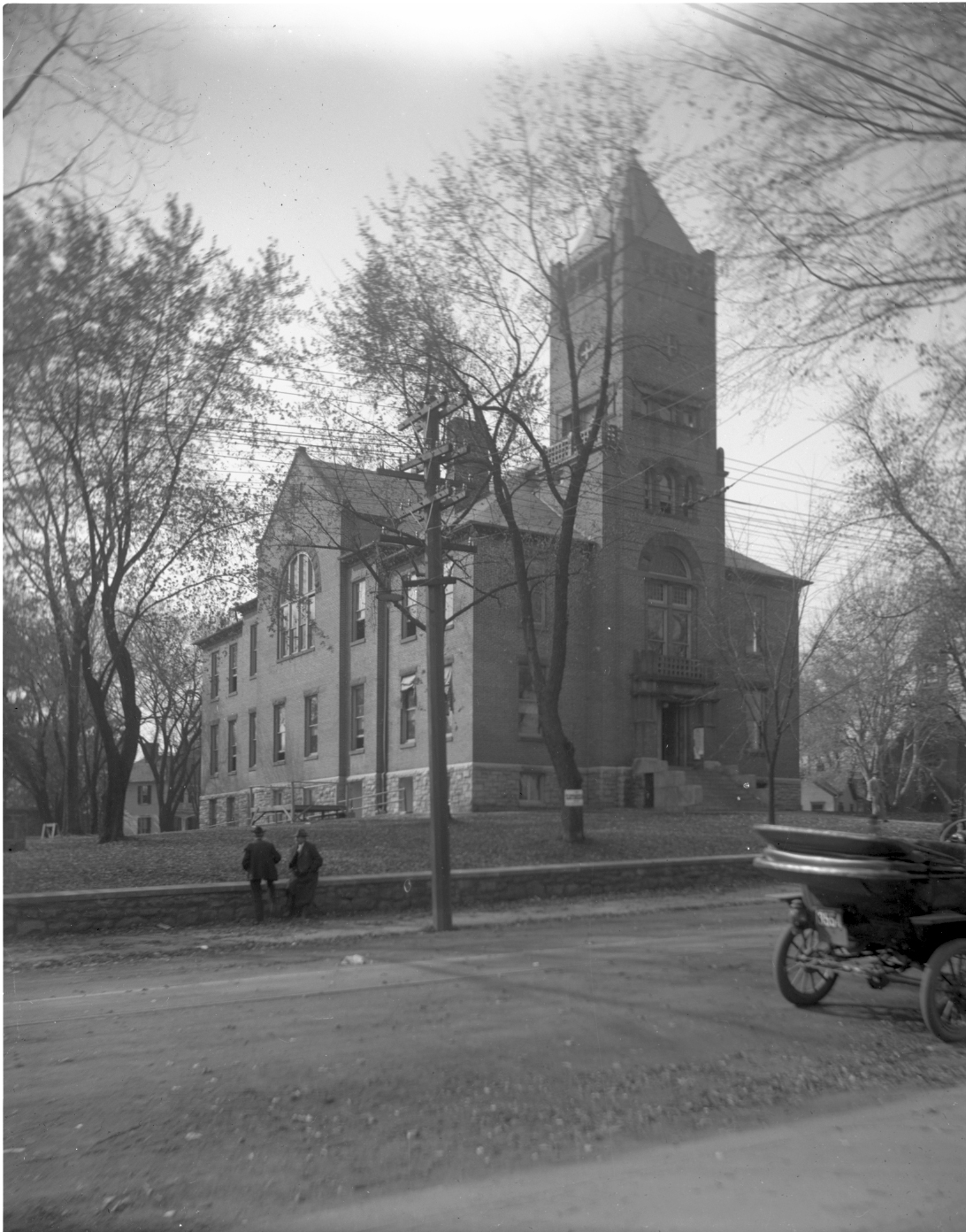
The Red Brick Courthouse in Rockville, photographed by Lewis Reed in 1914. Just eight years later, the courthouse became the headquarters of Montgomery County’s newly established Police Department, where officers reported for duty and received emergency calls before the era of police radios.
Lewis Reed’s 1922 image records the birth of Montgomery County’s Police Department at a time when motorcycles replaced horses, rural roads linked isolated communities, and professional law enforcement was becoming an essential public service.
Today, this remarkable photograph remains an enduring testament to both the officers who answered the county’s first call to duty and the photographer whose work continues to preserve Montgomery County’s rich history.
Inventing the Scene: Lewis Reed’s Composite Experiment

Not everything in the Reed Collection is what it seems. This early composite by Lewis Reed shows how he experimented with illusion long before Photoshop.
This unusual photograph offers a rare glimpse into the experimental side of early 20th-century photography. Created by Lewis Reed at a time when cameras relied on glass plate negatives and hand-mixed chemicals, the image reflects a period when photographers were not only documentarians, but also inventors; pushing the boundaries of what the medium could achieve.
At first glance, the scene appears to show a peaceful gathering along a wooded stream. Yet the composition quickly reveals signs of careful manipulation. The curved form across the top of the image, resembling the back of a chair or decorative arch, does not belong to the natural landscape. Its texture and sharp edge cut through the sky and treetops, suggesting it was introduced from a separate negative.
The figures also feel slightly detached from their surroundings. Their contrast is stronger, their edges more defined, and the lighting on each does not quite match. Most intriguingly, the woman seated on the ground appears to be the same woman standing between the two men. This repetition is a clear sign that Reed reused the same subject in different positions, further revealing the layered nature of the image and his playful approach to composition.
Such composite images were created through a painstaking darkroom process. Photographers used masking techniques, layered glass plate negatives, and contact printing to merge multiple exposures into a single print. These “trick photographs,” as they were often called, were popular between the late 1890s and the 1920s and were meant to entertain, surprise, and demonstrate technical skill.
This photograph stands as evidence of Lewis Reed’s curiosity and craftsmanship. While he is best known for documenting everyday life and early automotive history, this image reveals another side of his work–one rooted in imagination, experimentation, and the early artistry of the photographic medium.
Rare 1924 Photos Capture the First Shenandoah Apple Blossom Festival in Winchester, Virginia
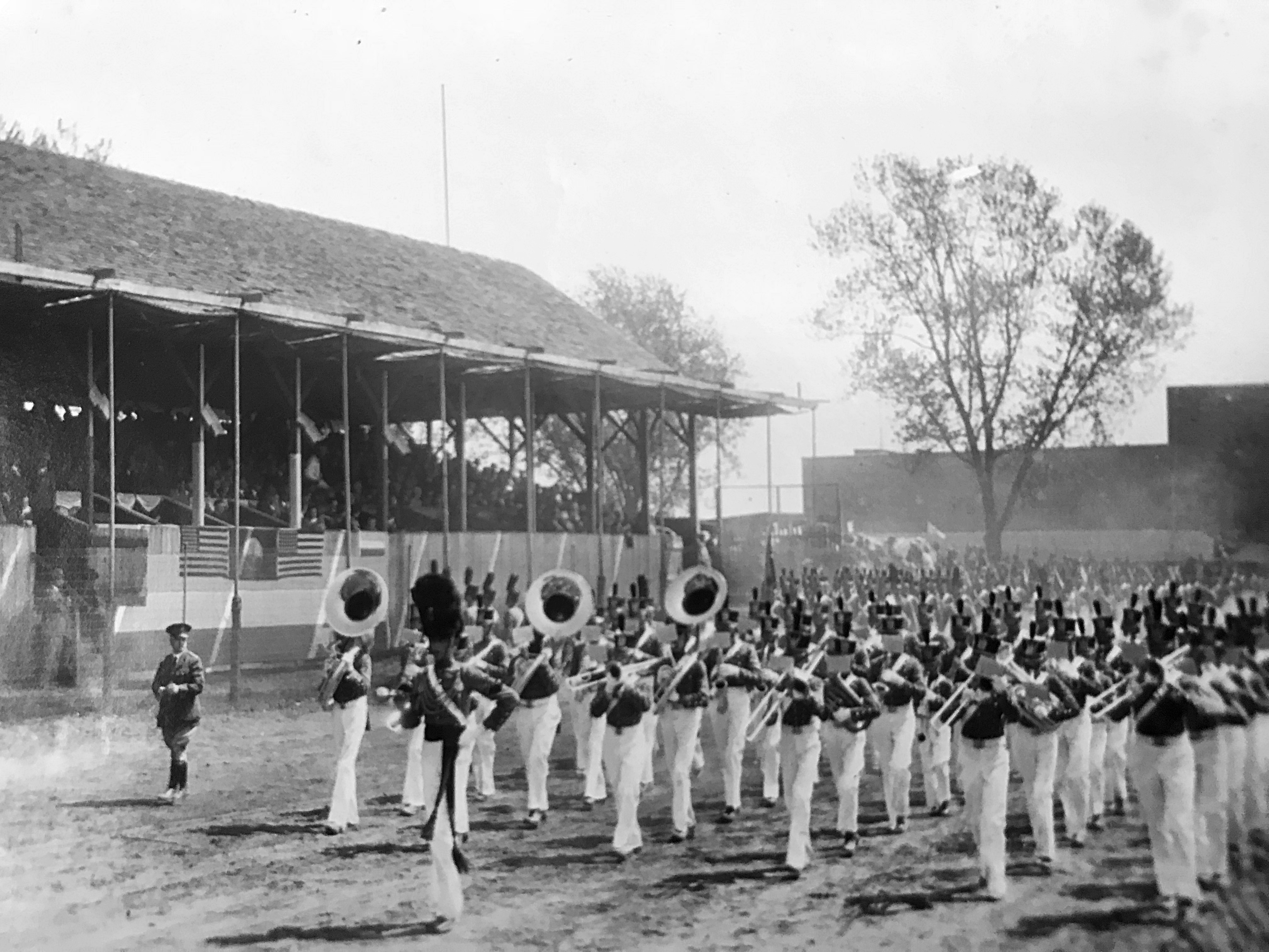
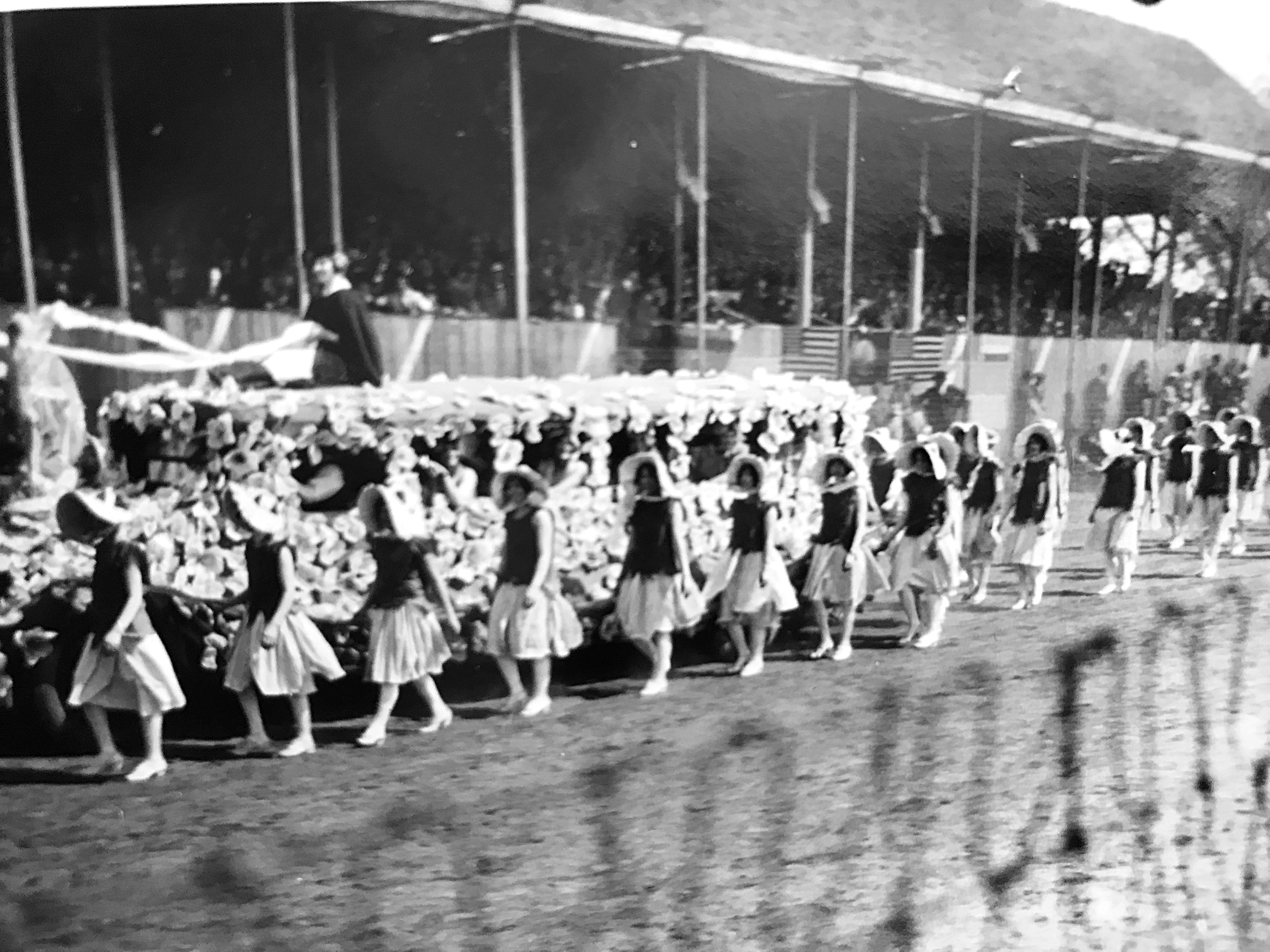
Parade participants circle the racetrack as spectators view the parade from a grandstand. There was no caption on this photo, but I’m guessing it might possibly be the VMI Regimental Band. Photo by Lewis Reed, 1924
On May 3, 1924, a new tradition began in Winchester with the very first Shenandoah Apple Blossom Festival– an event that would grow into one of the region’s most celebrated annual traditions.
At the time, however, it was simply a one-day community gathering. Its lasting visual record exists largely because of one person: Lewis Reed.
His photographs captured the festival as it happened, unrehearsed and unrefined. Parade units circle the fairgrounds track, spectators fill wooden grandstands, and marching bands move through the grounds with a mix of ceremony and curiosity. There is a sense of immediacy in these images, reflecting a community participating in something entirely new, without yet knowing its future significance.
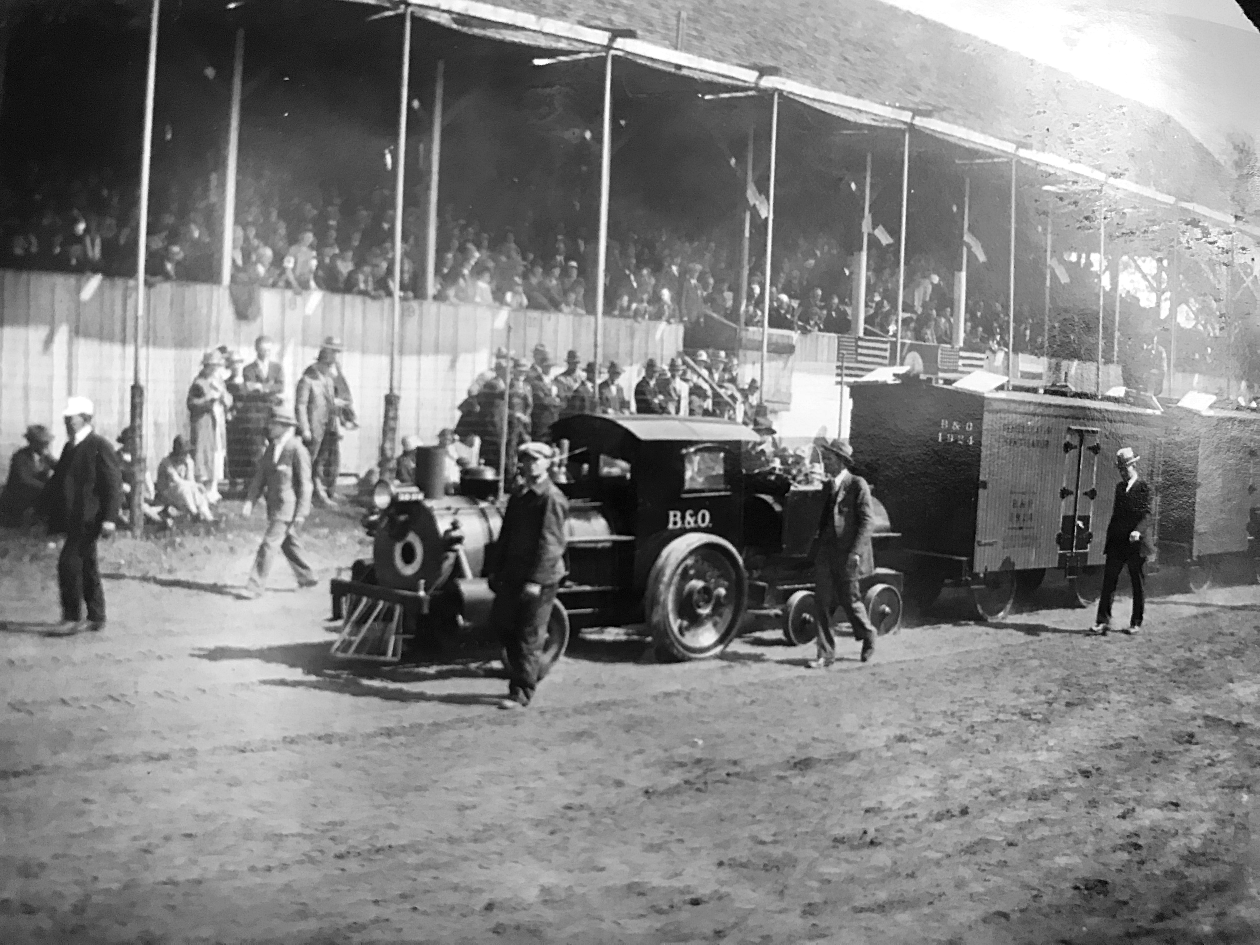
The B&O Railroad had a float in the Apple Blossom Parade. Photo by Lewis Reed, 1924
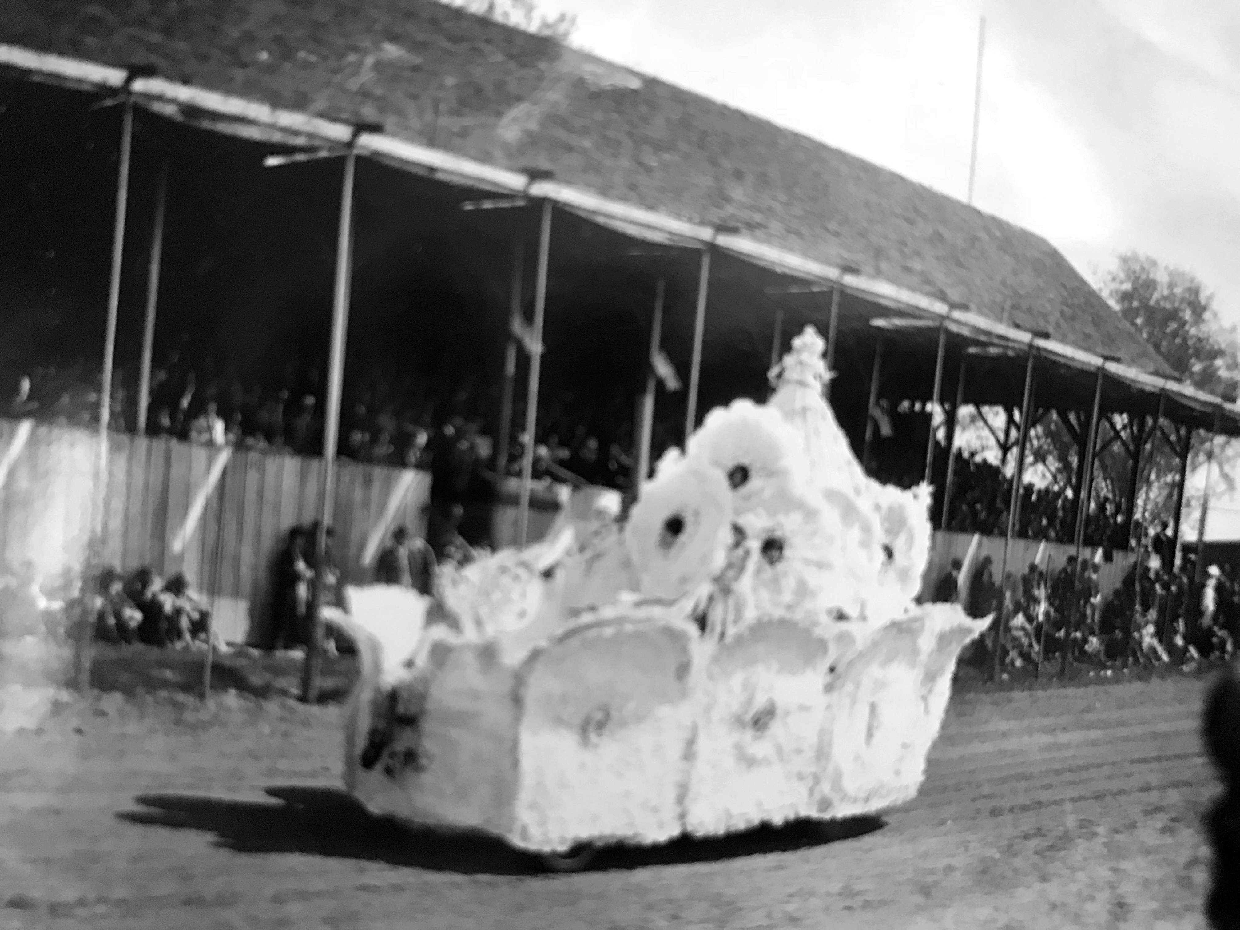
A flower-laden parade float glides past the grandstand at the Winchester fairgrounds during the first Shenandoah Apple Blossom Festival, captured through the lens of Lewis Reed as spectators look on from the shaded pavilion.
Unlike later years, when the festival would be widely promoted and carefully documented, the 1924 celebration left behind only limited records. Reed’s photographs now stand as one of the few surviving firsthand visual accounts. Parade units circle the fairgrounds track, spectators fill the wooden grandstands, and marching bands move through the space with a sense of purpose that suggests both ceremony and curiosity. There is an immediacy to these images, an unpolished authenticity that reflects a community participating in something entirely new, without yet knowing its future significance.
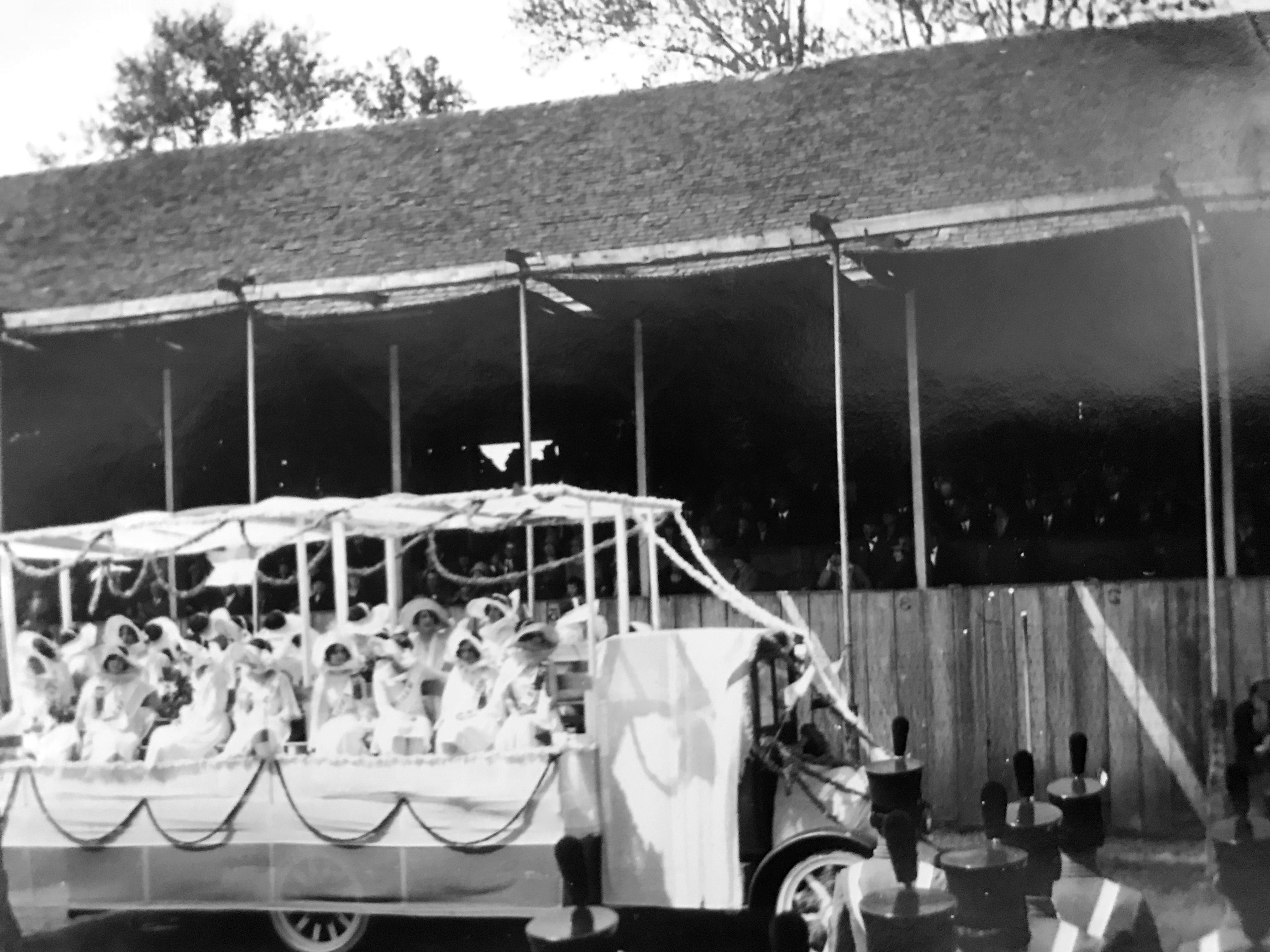
Taken by Lewis Reed, this image features a grand parade float adorned with white drapery and floral garlands, carrying a court of young women in classic 1920s white gowns and wide-brimmed hats.

This photo is believed to show the inaugural Queen, Elizabeth Steck, atop her floral-draped float. This historic moment during the first Shenandoah Apple Blossom Festival set the stage for a century of tradition in Winchester, Virginia.
What gives these photographs their enduring value is not simply their age, but their perspective. Lewis Reed approached photography as both a practical necessity and a form of documentation. While his work often centered on automobiles, business life, and everyday scenes, it also captured moments that would later take on deeper historical meaning.
His images of the 1924 festival preserve a fleeting beginning. They offer context for early 20th century civic celebrations and document the material culture of the time, from clothing and transportation to public gathering spaces. Without these photographs, the first Apple Blossom Festival would exist largely as a written account. With them, it becomes something far more tangible; a moment that can still be seen and experienced.
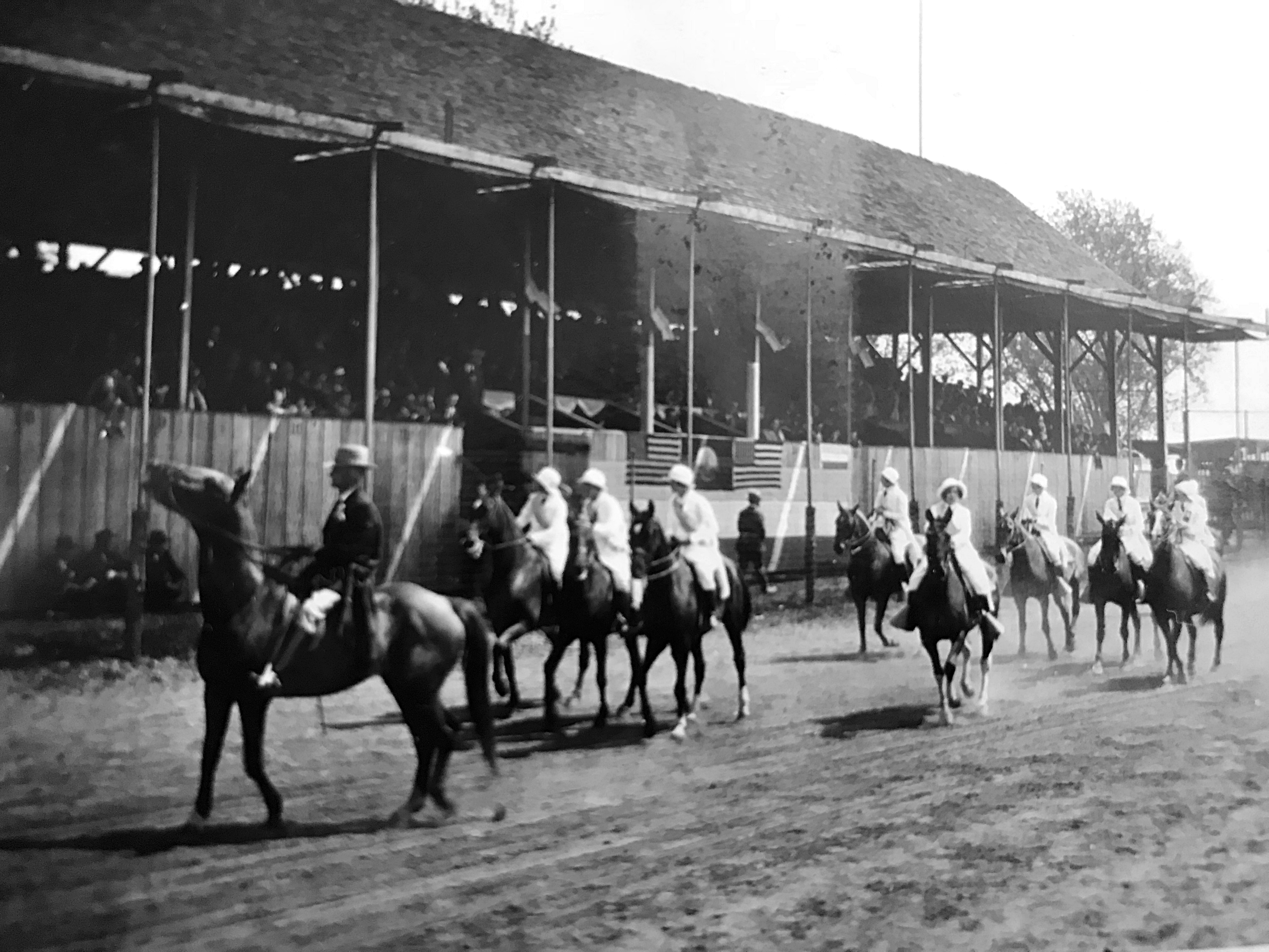
This photograph highlights the equestrian spirit of the event. A group of riders, dressed in formal white attire and matching caps, parades past the grandstands on horseback. Photo taken by Lewis Reed, 1924
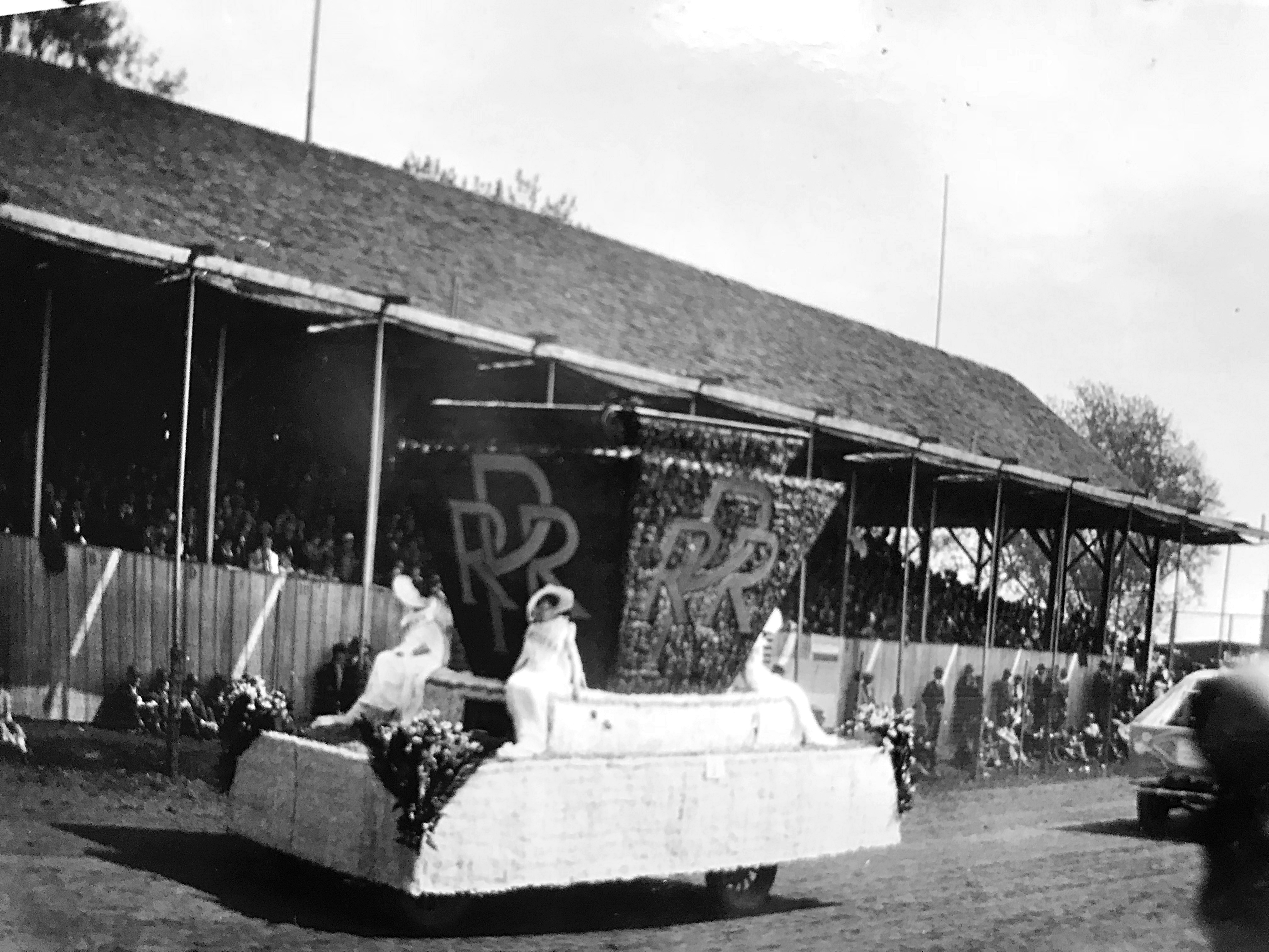
This photograph captures the Pennsylvania Railroad float as it passes the grandstands. The float features a large keystone, the railroad’s iconic symbol, emblazoned with the interlocking “RR” logo. Photo by Lewis Reed.
The same rustic grandstands seen in the other photos are visible, filled with spectators watching the pageant unfold on the dirt track. Photo by Lewis Reed
Through Lewis Reed’s photography, the 1924 festival is immortalized in its most foundational form. These images do more than just record a date; they preserve the material culture of the early 20th century, documenting the precise moment when the motorized elegance of the era began to define community life. By capturing the formal attire, the rustic grandstands, and the civic pride of Winchester’s inaugural celebration, Lewis Reed ensured that the festival’s origins were not lost to the fog of memory.
Today, the Shenandoah Apple Blossom Festival draws thousands each year, but in 1924, it all began right here.
The Devastation of May 2, 1929: Montgomery County’s Deadliest Tornado in Historic Photographs
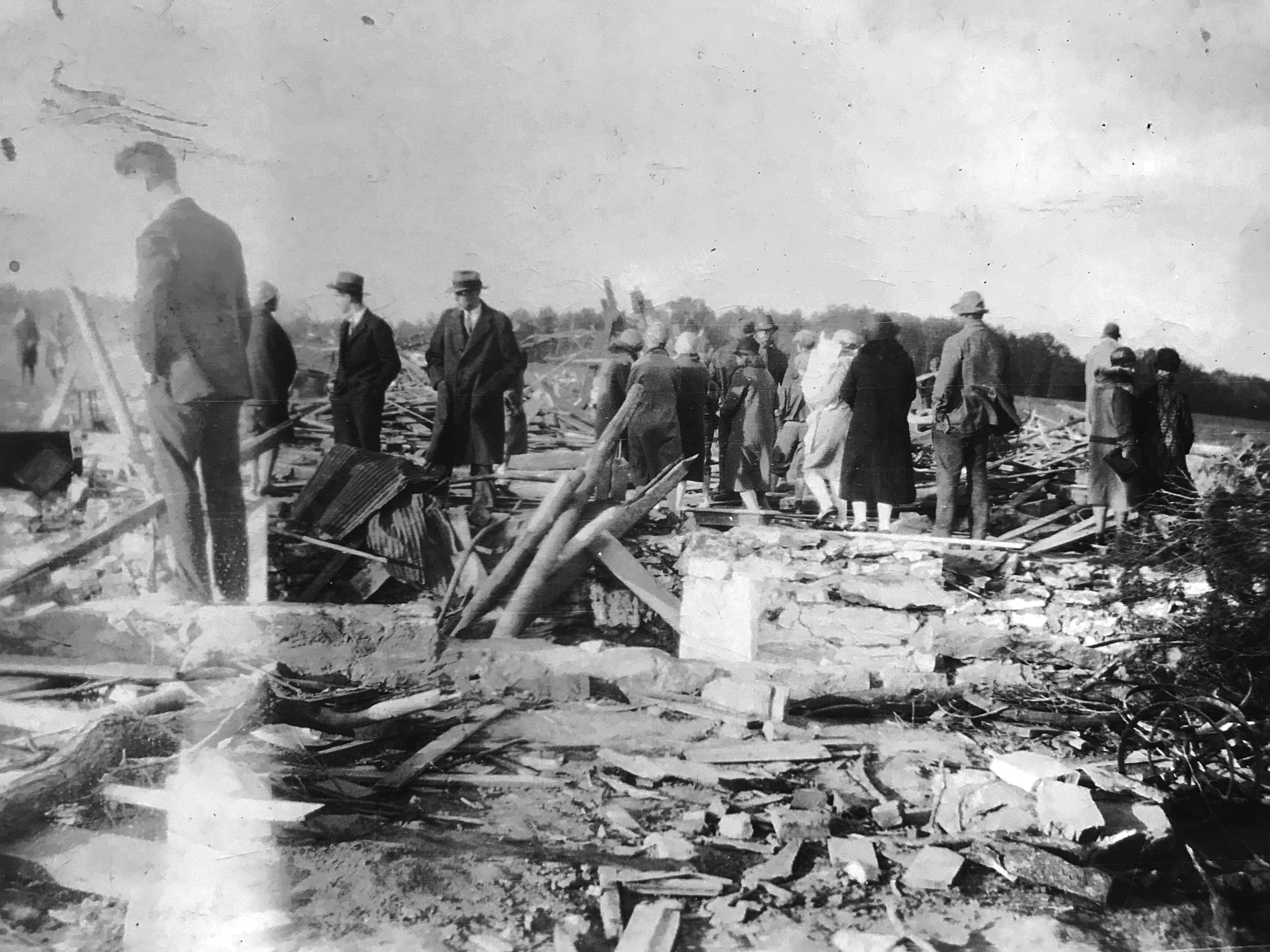
Spectators view the destruction at the Benson farm, May 1929. Photo by Lewis Reed
Ninety-seven years ago today, one of the worst tornado outbreaks in area history devastated a part of Montgomery County Maryland. At about 9 p.m. on Thursday, May 2, 1929, northeastern Montgomery County was struck by an F3 tornado, part of a large storm system that caused devastation from Florida to Ohio. The weekly Montgomery County Sentinel reported on May 10th that the “wind storm of cyclonic power… was of limited width and serpentine on its course. Everything in its path met with destruction.” These photographs were taken by Lewis Reed “after the tornado of May 2, 1929”.
Among the hardest hit was the farm of J. William Benson, where every structure, including the house, a massive barn, and multiple outbuildings, was completely obliterated. Even the surrounding landscape was reshaped. Trees from the orchard were reportedly lifted into the air and carried miles away, a testament to the storm’s incredible force.
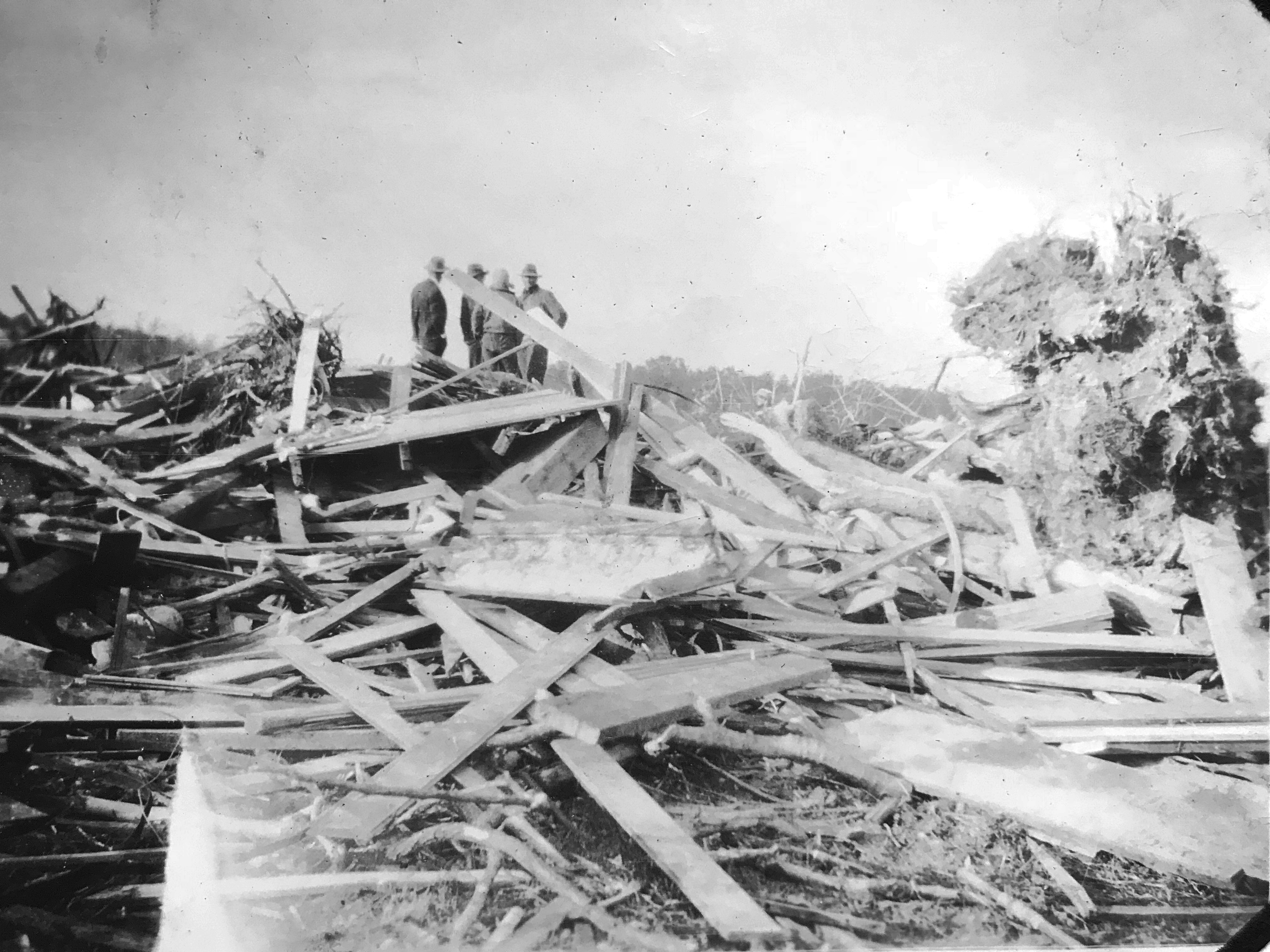
Surveying the wreckage: Local men stand atop the splintered remains of a farmstead, where the 1929 tornado reduced buildings to a tangled mass of lumber. Photo by Lewis Reed
In the days following the disaster, Lewis Reed traveled to the scene to document the devastation. His photographs, now a haunting window into the past, capture the sheer force of a storm that could lift entire orchards into the air and reduce sturdy farmsteads to splinters. For days, thousands of people traveled to the area to witness the devastation firsthand. What they encountered was described as “indescribable wreckage,” a scene that defied easy explanation and lingered in memory long after the debris was cleared.
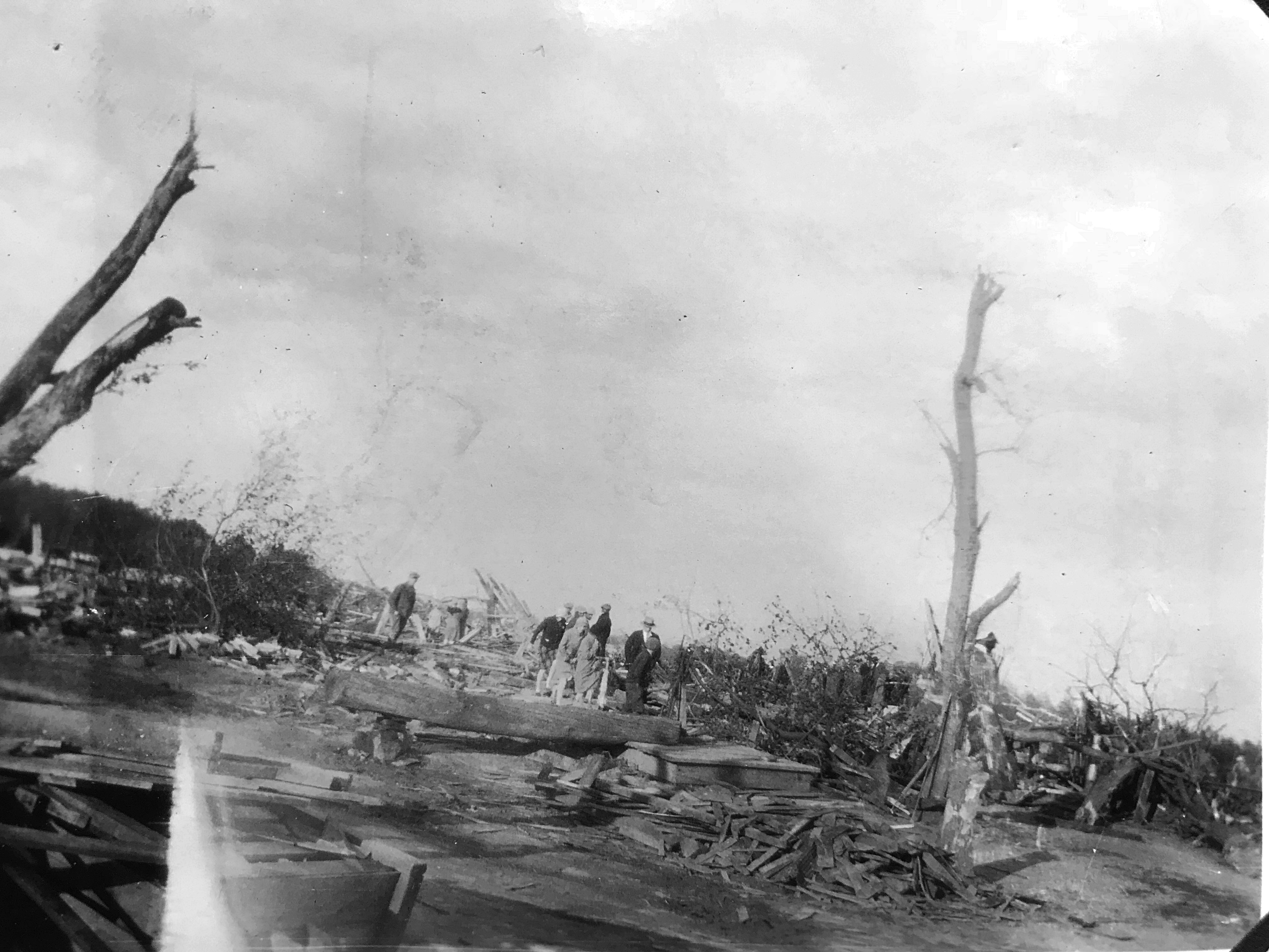
In the tornado’s aftermath, residents pick their way through a flattened landscape, where shattered timber, uprooted trees, and scattered debris mark the storm’s destructive path across the countryside. Photo by Lewis Reed
Amid this chaos, help arrived quickly. Local fire departments from Rockville, Gaithersburg, and Sandy Spring responded after a farm worker, having freed himself from the wreckage, ran to summon aid. Relief efforts soon followed, including support organized by the local Red Cross to assist those who had lost homes, livelihoods, and stability in a single night.
While Montgomery County was spared the worst loss of life, the broader storm system proved deadly. Reports at the time indicated that 28 people were killed across Maryland and Virginia, with the most tragic losses occurring in Virginia when a school was struck directly.
One particularly meaningful photograph includes Reed’s young daughter, Mary Jane, standing amid the aftermath. Decades later, she would help identify the locations of these images, connecting memory with history in a way few archival collections can. This personal link transforms the photographs from simple documentation into living history.
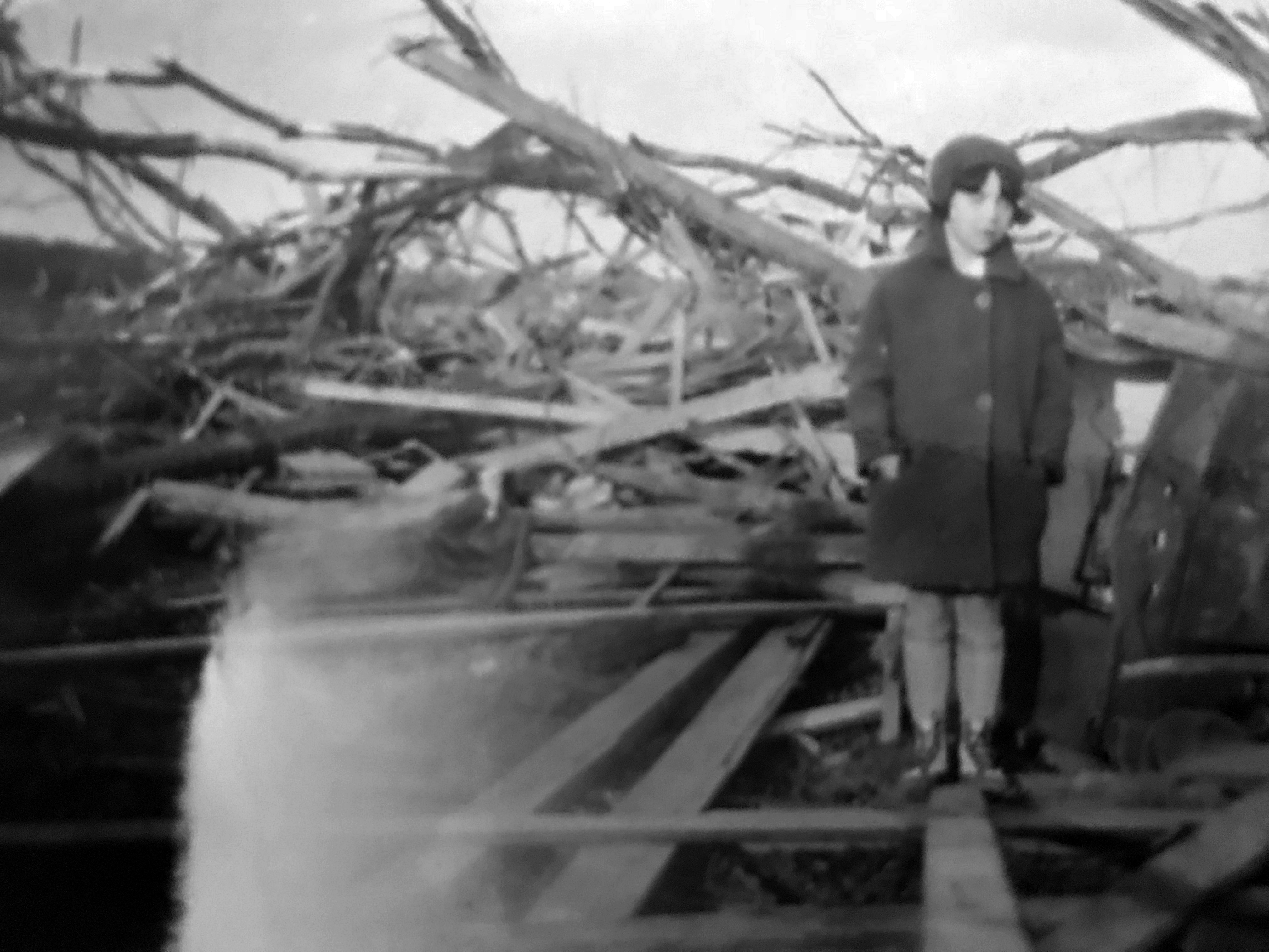
Seven-year-old Mary Jane Reed surveys the aftermath of the F3 tornado that decimated the J. William Benson farm in Unity, Maryland. Captured by her father, Lewis Reed, this image highlights the complete destruction of the 117-foot barn and the surrounding landscape following the deadliest storm in Montgomery County history.
Originally undated and unlabeled, these images might have remained anonymous fragments of the past. Instead, through family recognition and preservation, they now serve as vital historical evidence, offering a rare glimpse into one of the most destructive storms ever to strike Montgomery County.
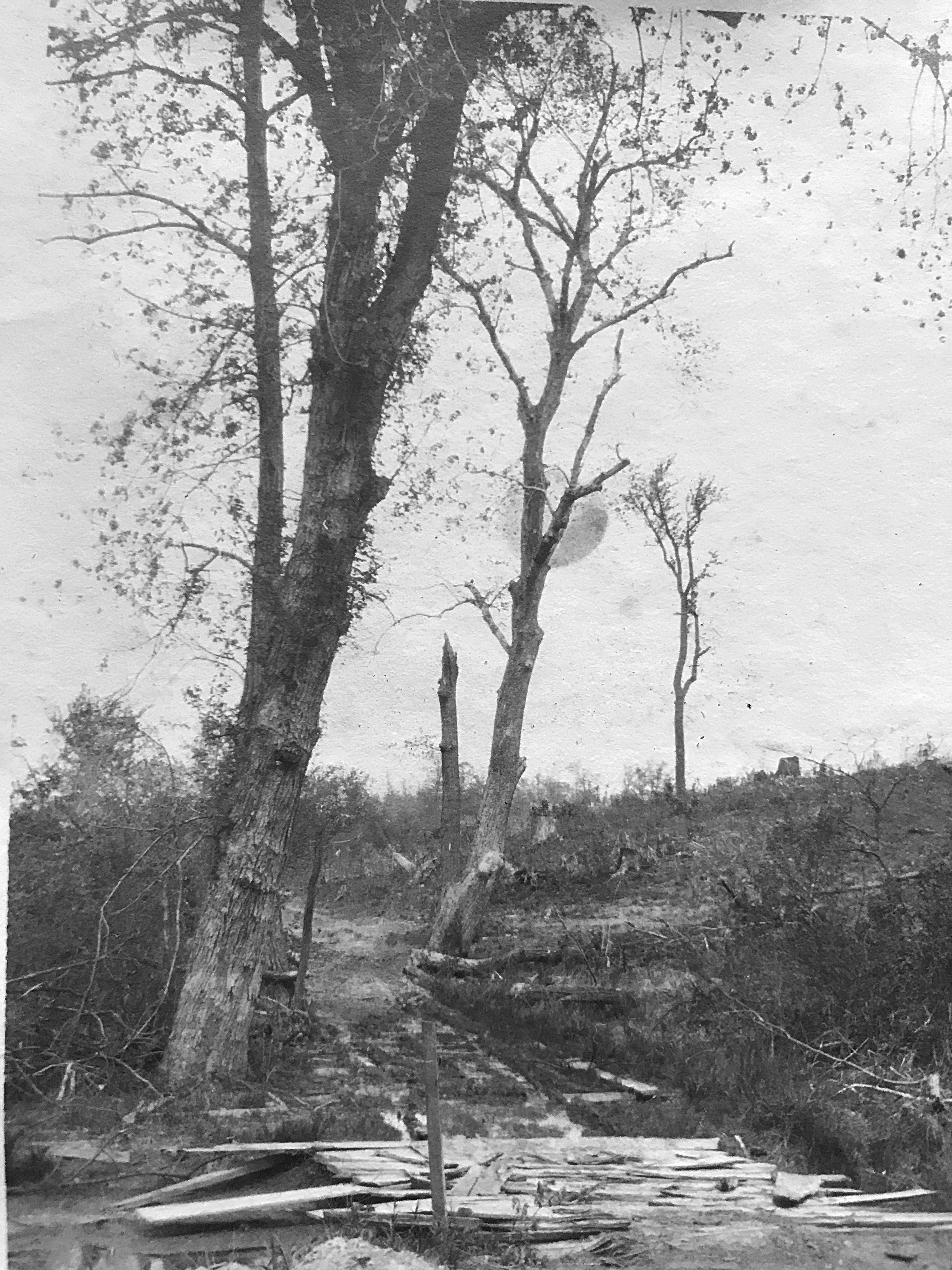
The skeletal remains in this photo stand as a silent testament to the F3 twister that devastated northeastern Montgomery County. Photo by Lewis Reed
Today, nearly a century later, the 1929 tornado is remembered not only for its level of destruction, but for the resilience of those who endured it. And for the photographs that ensure their story is never lost.
Sources of Information:
A Fine Collection
The Montgomery County Sentinel, May 10, 1929
Books
![]()
Related Resources


Copyright Notice

Reed Brothers Dodge History (1915-2012) by Jeanne Gartner is licensed under a Creative Commons Attribution-NonCommercial 3.0 Unported License.

Recent Comments