
Then and Now: Hotel Cape May, 1919
People have been visiting Cape May, “the nation’s oldest seashore resort,” for longer than America has been a country. That makes Cape May the perfect place to look back on over 100 years ago and from today — then and now.
A bit of Hotel Cape May history: The Christian Admiral, formerly Admiral Hotel and Hotel Cape May, was a luxury beachfront hotel located in Cape May, New Jersey. Opened in 1908, as the Hotel Cape May, the ornate hotel was abandoned five years later due to bankruptcy. It was then sold at a Sheriff’s sale. The hotel was leased by the War Department as a hospital from 1918-1919 during WWI. Afterwards, it was again abandoned. In 1932, the Admiral Hotel company purchased it and renamed it the Admiral Hotel. They too went bankrupt in 1940. The military returned for WWII from 1941 to 1945 and afterwards it was once more sold at Sheriff’s sale. It opened and closed multiple times before being abandoned again in the 1950s. Reverend McIntire saved it from demolition in 1963, and operated it until his organization too, went bankrupt. The Christian Admiral never made a profit for any of its owners and was the cause of six bankruptcies. Nonetheless, it was a gorgeous hotel and one of the most recognizable and beloved buildings in Cape May. The people who liquidated McIntire’s organization shopped the hotel around, but it was deemed too far gone to save. Engineer estimates were $20 million and above, just to make it structurally sound and from $60-$80 million to restore it. The hotel was razed in 1996.
Hotel Cape May (THEN): The Christian Admiral Hotel, originally known as the Hotel Cape May, was erected in the Beaux-Arts style between 1905 and 1908. When opened on April 11, 1908, it was the world’s largest hotel. Completed behind schedule and over budget, Hotel Cape May was part of a development project intended to bring wealthy visitors to the city and rival East Coast resorts such as Newport, Rhode Island. During its existence it would undergo five bankruptcies and ownership changes.
Edgar was a partner with his brother Lewis Reed, in Reed Brothers Dodge. During WWI, Edgar served as a Sergeant in the U.S. Army Medical Corps from February 1918 to August 1919 and had been posted to GENERAL HOSPITAL NO. 11 in CAPE MAY, NEW JERSEY. The spirit of patriotic service which swept the country prompted many persons to offer their properties to the War Department for hospital purposes. These offers included buildings of every conceivable kind, such as department stores, private establishments, hospitals, and properties in large cities. It was found that many of these could be obtained and converted into hospitals much more expeditiously than barrack hospitals could be constructed, and at less cost.
The Surgeon General recommended that the War Department authorize the leasing of the Hotel Cape May for use as a general hospital on December 18, 1917. The Hotel Cape May was located on the Ocean Drive, at the eastern end of the city, and within 100 feet of the beach of the Atlantic Ocean. Opened first as GENERAL HOSPITAL NO. 16, the designation was changed to GENERAL HOSPITAL NO. 11, March 14, 1918. The enlisted personnel were quartered in tents which were located to the rear of the building.
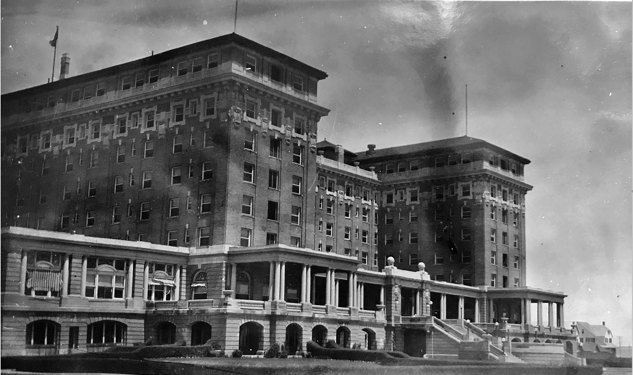
Hotel Cape May as it looked in 1919. Photo by Lewis Reed.
The Christian Admiral Hotel (NOW): In 1991, the hotel was closed by Cape May City officials. The hotel was demolished in 1996 and the site was reused for a development of single family homes. The demolition of the hotel placed the city’s National Historic Landmark status at risk.
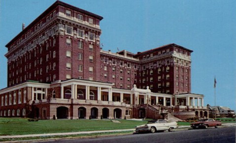
The Christian Admiral Hotel, late 1970s. Closed by Cape May City Officials, 1991 for want of tens of millions of dollars to bring up to modern codes. Destroyed: Feb, 1996.
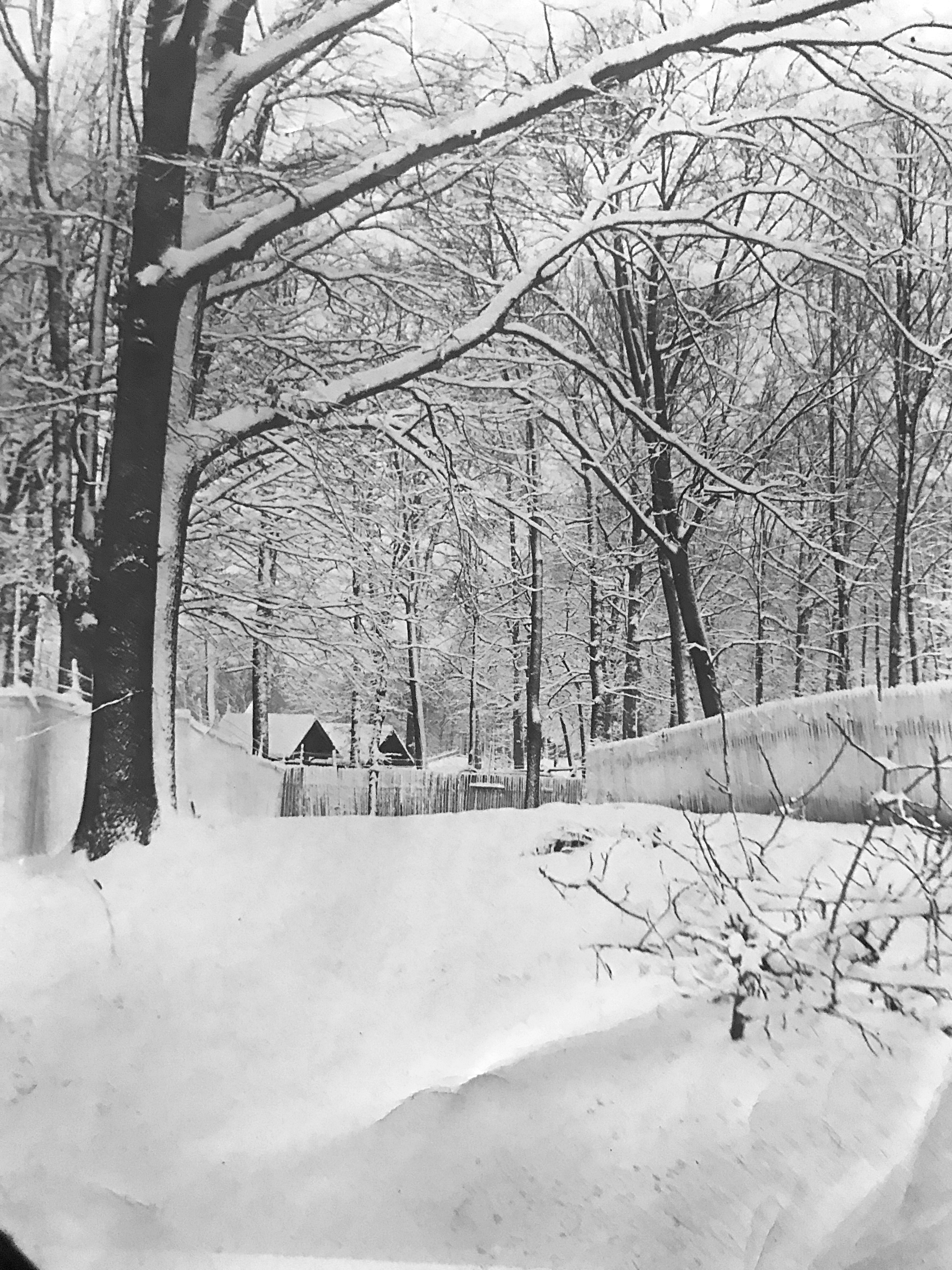
Off-Season at the Montgomery County Fairgrounds, 1910
These winter photographs, taken around 1910 by Lewis Reed, offer a rare glimpse of the Montgomery County Fairgrounds during its off-season; long before crowds, exhibitions, and midway sounds returned each year. Covered in snow and largely still, the fairgrounds appear almost contemplative, preserving a moment in time that contrasts sharply with the bustle normally associated with the annual fair.
The Montgomery County Fair was held in Rockville from 1846 until 1932, serving as one of the county’s most important agricultural and social gatherings. Farmers, merchants, families, and visitors from across the region—including Washington, D.C.—came together to celebrate livestock, crops, craftsmanship, and community. Yet photographs of the fairgrounds outside the fair season are uncommon, making these images particularly significant.
Lewis Reed’s photographs show the grounds at rest. Snow blankets the open spaces, softening the outlines of fences and walkways. Buildings stand closed for the winter, including the Poultry House, which would have been a hive of activity during fair time. In these images, the structures themselves take center stage, revealing their form and placement without the distraction of crowds.
Snow blankets the fairgrounds in this early 20th-century photograph by Lewis Reed. Images such as this offer a rare view of the fairgrounds outside the fair season, documenting the site as it appeared in everyday use.
Reed’s work is notable not only for its subject matter, but for its documentary value. At a time when photography was still a deliberate and technical process, his images captured everyday scenes that might otherwise have gone unrecorded. Today, they provide visual evidence of how the fairgrounds looked and functioned in the early twentieth century, as well as a reminder of the role photography played in preserving local history.
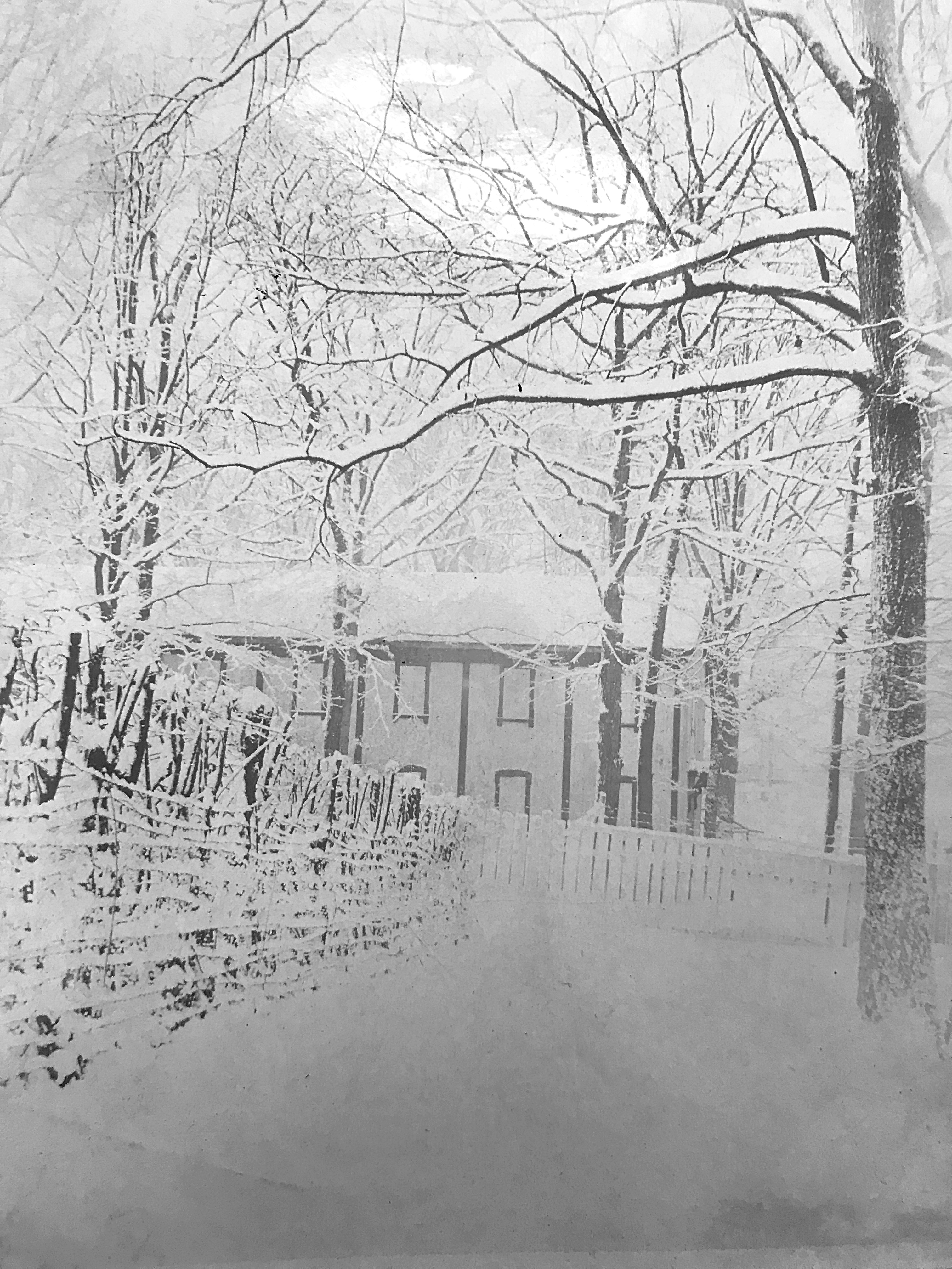
The Poultry House at the Montgomery County Fairgrounds, photographed by Lewis Reed during the winter of 1910. Closed for the season, the building would later host livestock exhibits during the annual Montgomery County Fair.
Viewed more than a century later, these snowy scenes connect us to a slower pace of life and to a Montgomery County that was still largely rural. Thanks to Lewis Reed’s careful eye and willingness to document the ordinary as well as the celebrated, these winter moments at the old fairgrounds endure.
Snow, Tinsel, and Memories: A Century of Christmas at the Reed Family Home
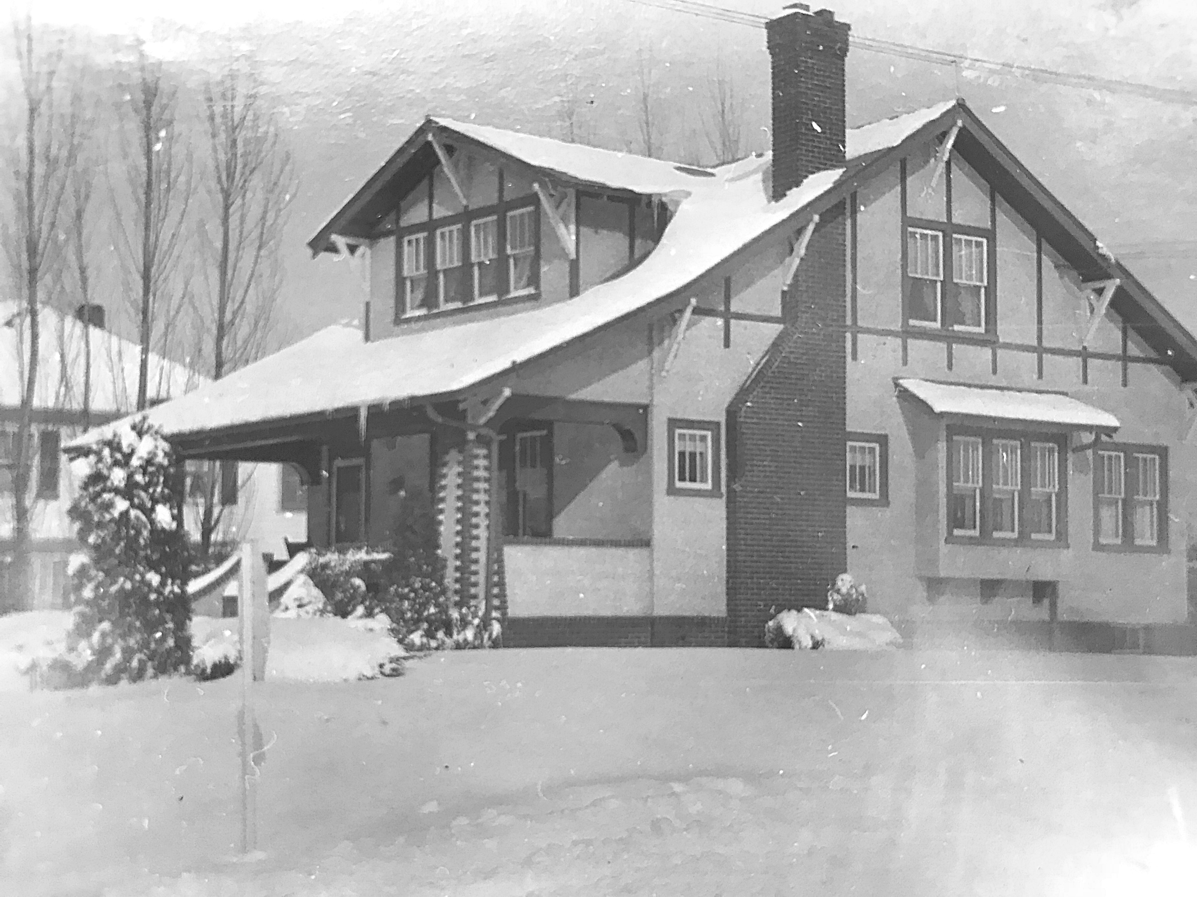
Lewis Reed’s craftsman-style home, looking rather solitary on a snowy day. Photo by Lewis Reed.
With only a few days left until Christmas, I thought it might be fun to take a look at some photos from Lewis Reed’s collection that show us what Christmas trees used to look like 100 years ago. In those days, there was not wide-spread agreement on exactly what a tree should look like, which made for a lot of creativity. Not surprisingly, they were very different than the perfectly shaped tress we have on display today.
The trees were big back then and always fresh. They went right to the ceiling and were very wide. Early Christmas trees were generally fastened onto a flat board surrounded with fence-rails, snow villages and carpeted with cotton blankets of snow. The tree in the photo below has an abundance of tinsel, which grew in popularity to the point that, by the 1920s, it was common to nearly cover the tree in the decorative material.
So, what is tinsel (aka icicles) exactly? Originally made from strands of silver alloy, tinsel was in fact first used to decorate sculptures. It was only later that it became a Christmas tree decoration, employed to enhance the flickering of the candle flames. In the 1950s, tinsel became so popular that it was often used as a substitute for Christmas lights.
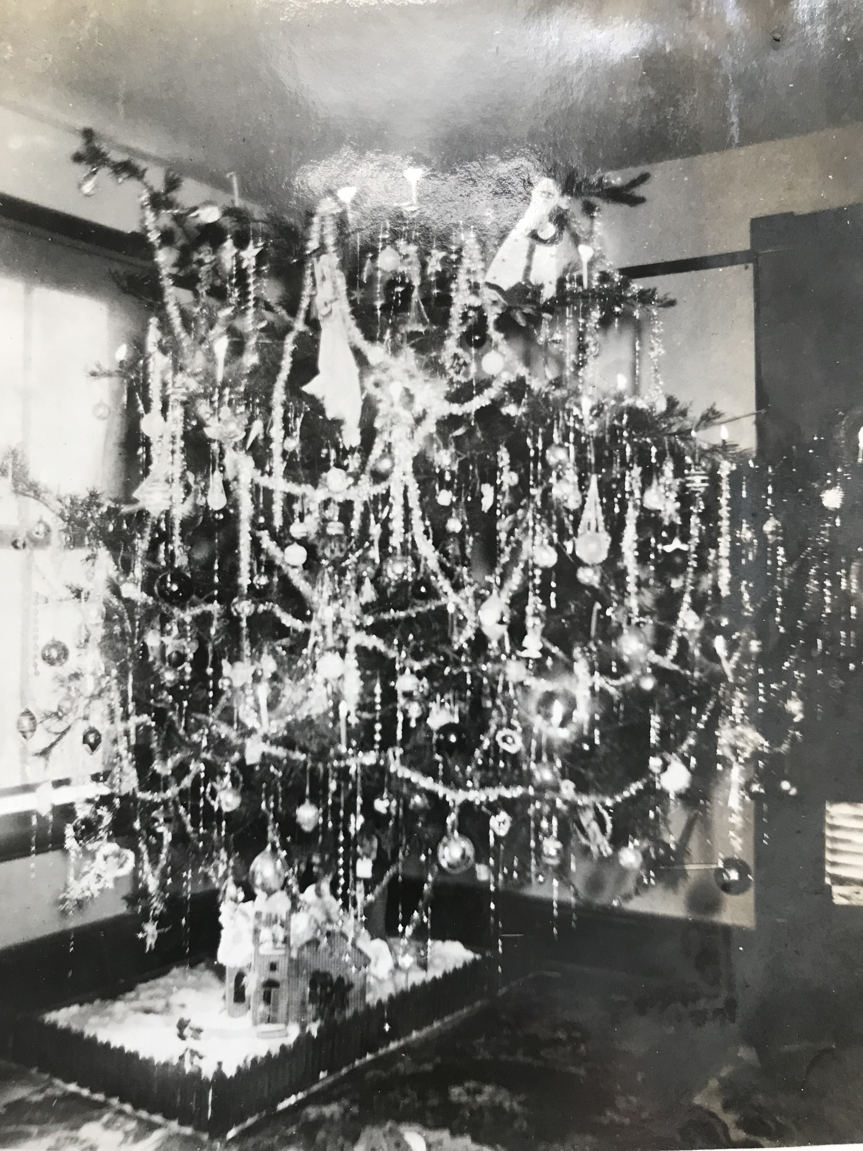
A small snow scene with what appears to be a miniature church is arranged at the foot of the Christmas tree. A popcorn garland adorns the tree. Photo by Lewis Reed
So, where did Washingtonians get their trees?
From The Evening Star, Washington, DC 23 December 1923:
Conduit Road on the long stretch between Glen Echo and Great Falls for many years has been a favorite hunting ground where hundreds and hundreds of families have customarily obtained scrub pine trees for Christmas week. Usually there is plenty of holly and some mistletoe to be found in the rugged and rolling hill lands which are the gateway to Great Falls.
In the early 1900s, Christmas trees weren’t the uniform, perfectly trimmed evergreens we see today. They were large, often reaching the ceiling, and proudly displayed their natural, sometimes misshapen forms. Families fastened them to flat boards, surrounded them with fence rails, and carpeted the ground with cotton blankets to mimic snow. Tinsel, originally made from strands of silver alloy, became a staple used to catch the flicker of candlelight and later, as a substitute for electric lights by the 1950s.
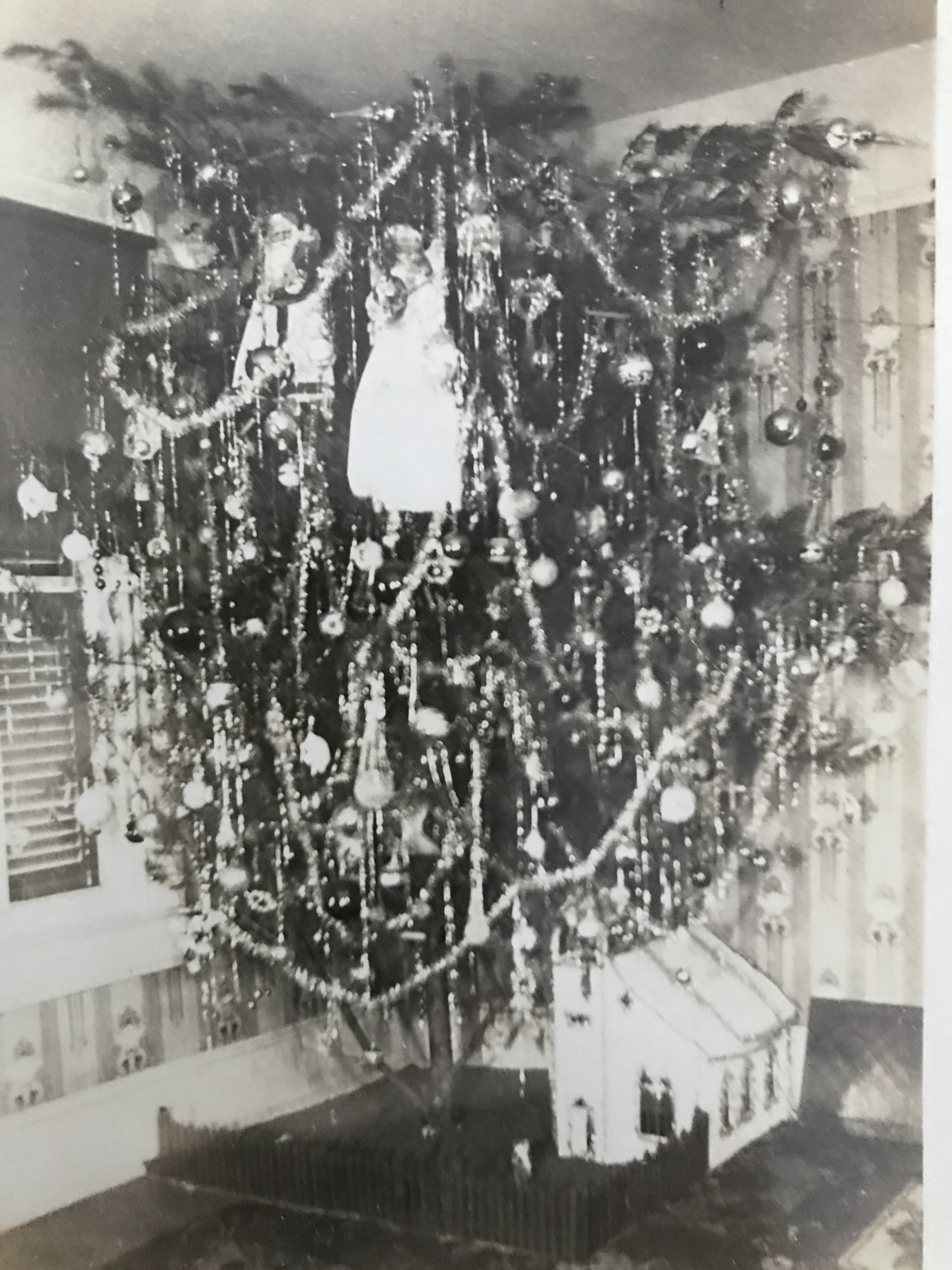
No room for a star on the top of this tree! And just look at those big Santa and Angel dolls. Other fun little details are notable, including a miniature church with picket fence is arranged at the base of the tree. Photo by Lewis Reed
There’s a fine art to decorating Christmas trees that’s been developing since over 100 years ago. People consider lights, garland, ornaments, skirt, and more. But one thing that’s hard to resist sometimes is just filling every available space with decorations. Clearly, that was the case years ago, too. What I like about these trees is that they are so randomly shaped and even misshapen. Folks back then didn’t trim them down to a more aesthetically pleasing symmetry like we do today.
The tradition of building miniature Christmas village landscapes, including houses, animals, and other hand-crafted wooden figures, began with the Pennsylvania Dutch in the late 1800s. Mass-produced cardboard houses, sold in dimestores, became popular in the mid-20th century. Today, these villages in good condition can be highly collectible.
Below are photos of Lewis Reed’s snow village set up under the Christmas tree decorated with vintage ornaments, tinsel, and lights. I don’t remember the odd-shaped Christmas trees, but I do remember having a lot of fun helping my grandfather set up the miniature landscapes with the varied figures, little houses, and trees at Christmastime each year. It seemed like a holiday village right out of a storybook.
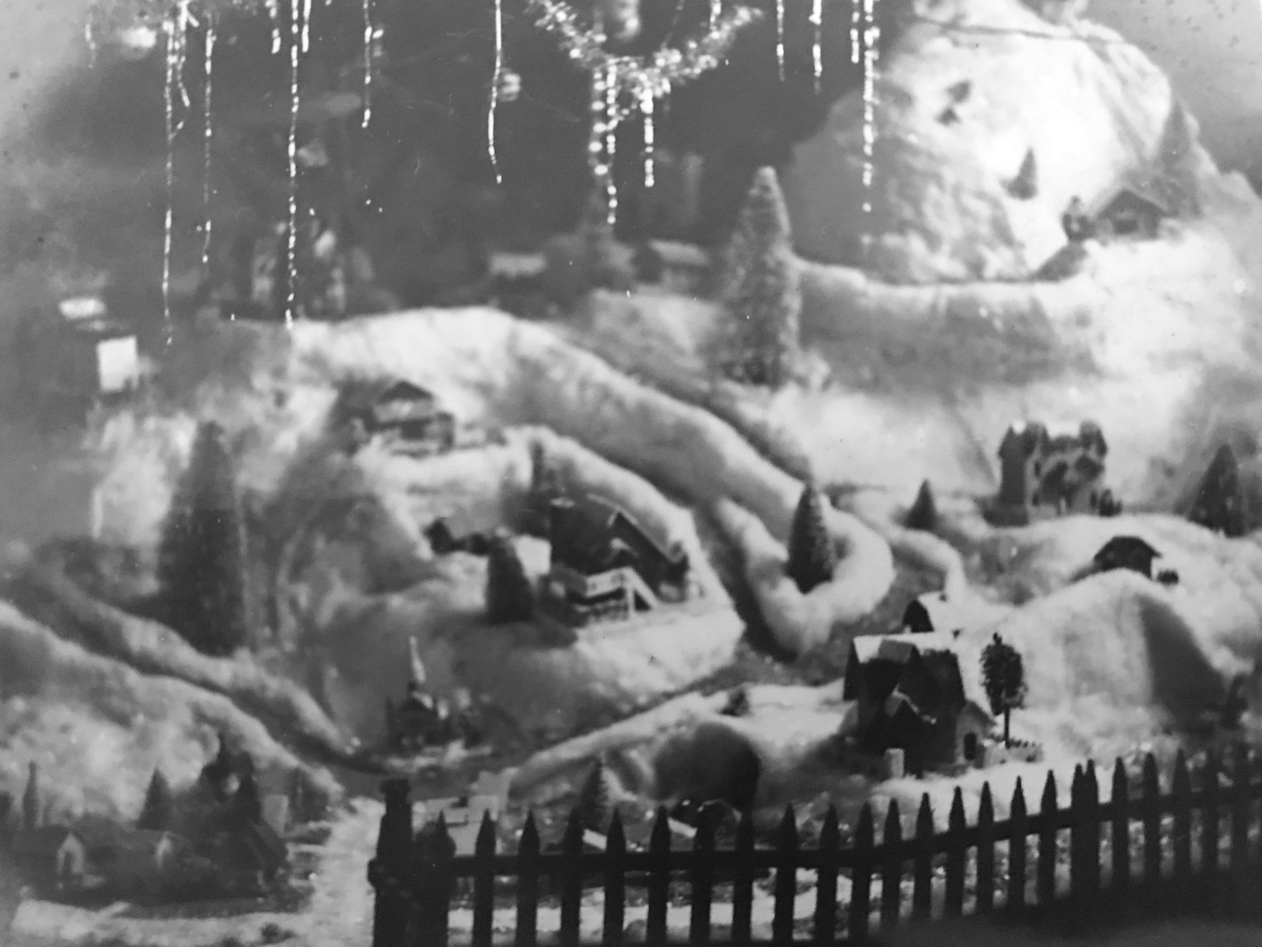
A rustic picket fence is used to set off the village display. Dangling strands of tinsel hang below the tree. Photo by Lewis Reed
The snow villages were set up in Lewis Reed’s basement on top of a big table beneath a small Christmas tree. He made the snow scenes entirely by hand using wire-covered cardboard and balled up paper to make hills and pathways. The little houses and figurines would fit into the landscape with cotton ‘snow’ all around; and lights would be wired underneath.
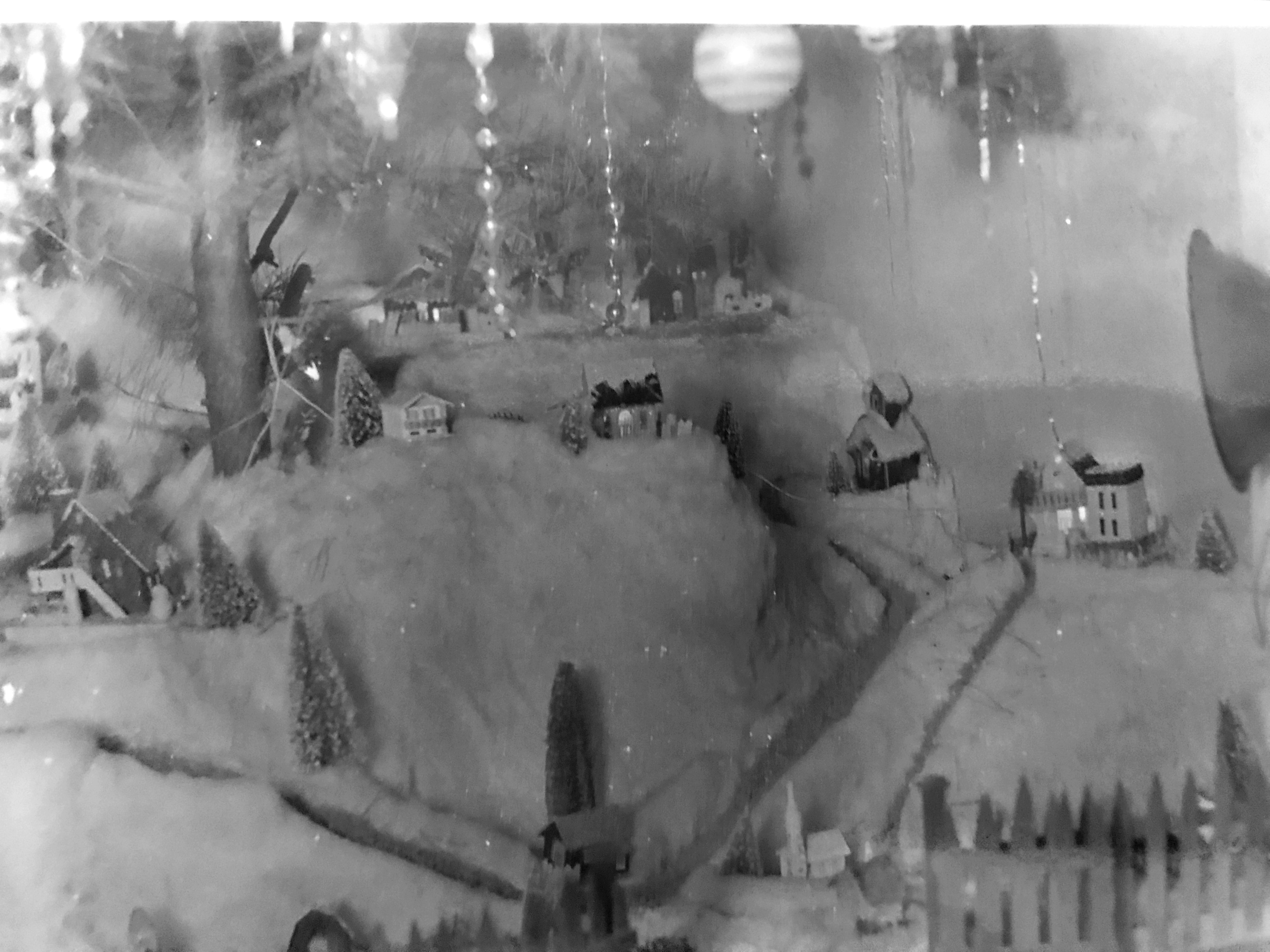
Little houses, churches, fences, trees, and pathways were added to the scene. Some of the houses have charming light effects in the windows. The roofs of the houses were decorated with fake snow. Photo by Lewis Reed
These early Christmas villages were the forerunners of today’s elaborate holiday displays, most famously popularized by Department 56. What began as simple, handmade scenes beneath family Christmas trees eventually evolved into the collectible ceramic villages that fill shelves and mantels during the holidays today.
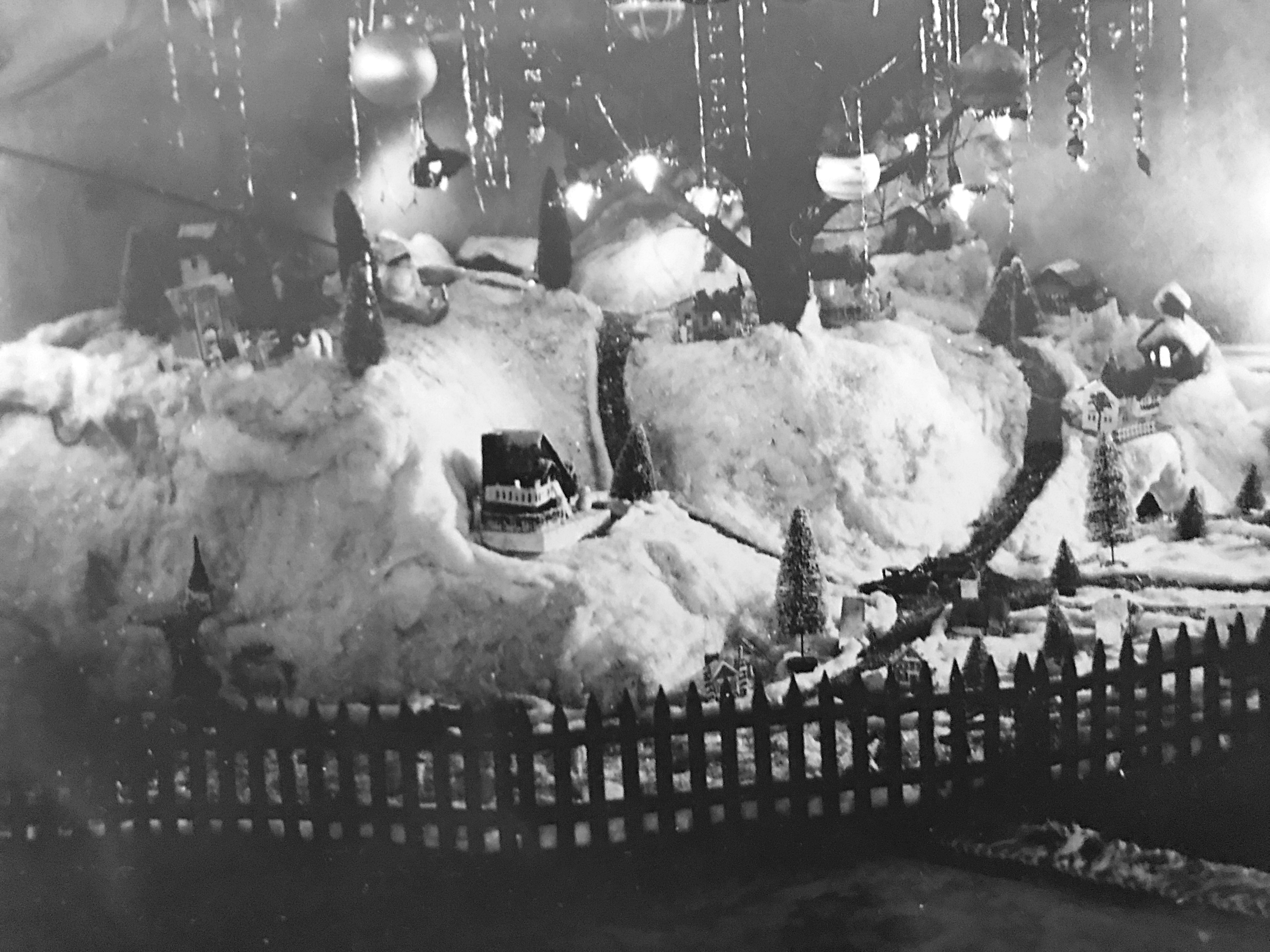
Old-fashioned lights can be seen on the tree, along with lit windows in the houses. The miniature houses usually had holes in the back or the bottom through which tiny lights were placed to provide illumination. Photo by Lewis Reed
Thanks for taking the time to visit. May your Christmas be merry, your New Year bright, and your holidays filled with everything that brings you joy. Stay safe and enjoy the season with family and friends!

Winter’s Harvest: Ice-Cutting in 1910 Montgomery County
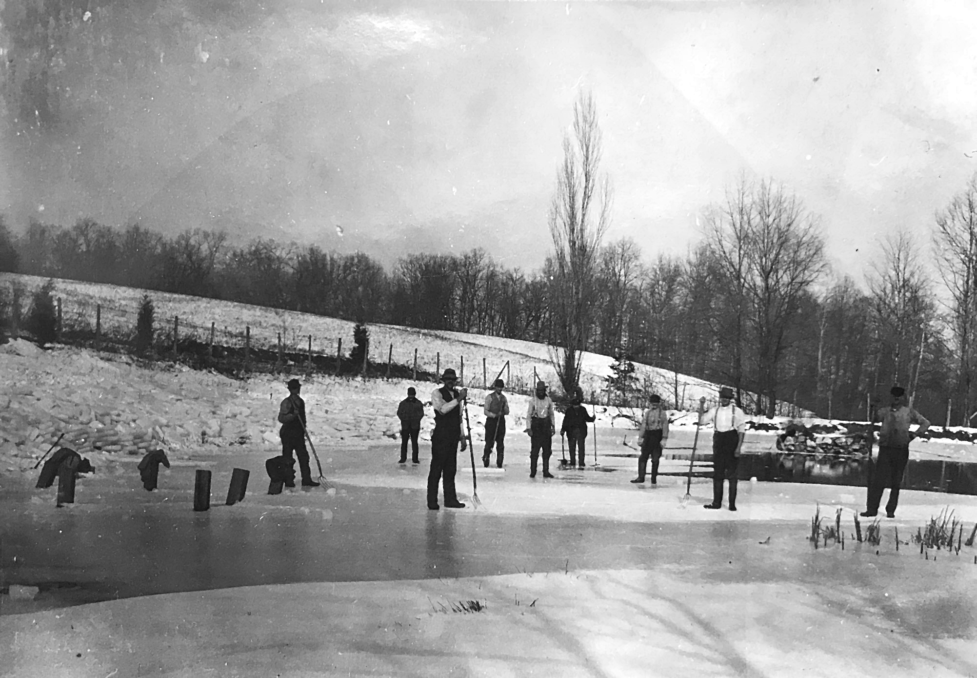
Men harvest ice with pitchforks and hand saws on a frozen pond in Darnestown, circa 1910. Stacked blocks line the shoreline, ready for storage in nearby ice houses. Photo by Lewis Reed.
Most people wouldn’t consider the winter months of December through February a season of harvest in Montgomery County. But in our not so distant past, this was harvest time for—ICE. Rivers, lakes and ponds were generally frozen and ice was harvested like a winter crop to keep food cold all summer long.
Much of what we know visually about this era survives thanks to Lewis Reed, founder of Reed Brothers Dodge, and one of the county’s most prolific early photographers. Among his many surviving images is a striking photograph of men harvesting ice on a Darnestown pond around 1910. In it, workers stand poised with their tools, the frozen surface carved into neat glistening blocks ready for transport.
Ice harvesting wasn’t merely a winter job; it was a community effort that tied households, farms, and businesses together. Timing was everything. Too early in the season, the ice was fragile and dangerous; too late, and the freezing window had passed. Because the work involved standing on frozen water with sharp tools and heavy loads, it carried genuine risk. Yet despite the hazards, these annual harvests were essential to community well-being. The ice collected in the winter months might be keeping milk or meat cold on farms well into August.
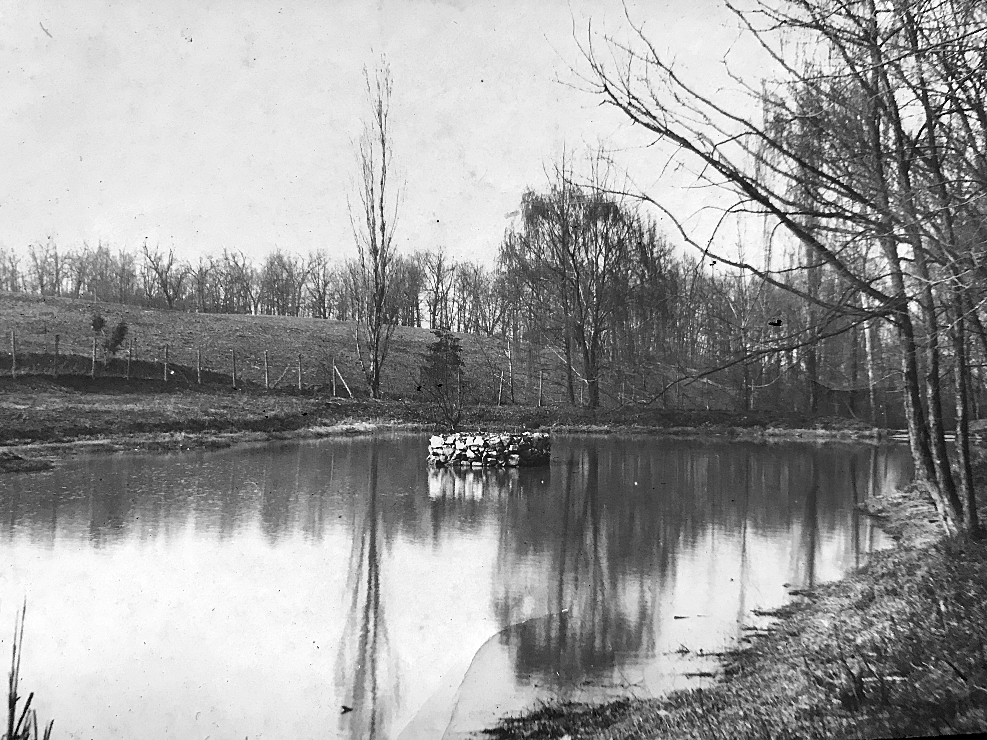
The same pond once used for ice harvesting, seen here ice-free. Photo by Lewis Reed, 1910.
From The Evening Star, Washington, D.C. December 22, 1904
ROCKVILLE AND VICINITY GENERAL NEWS
The cold weather of the past ten days has frozen the ponds and creeks throughout this county to a thickness of six or seven inches, and the ice harvesting is now the order of the day. The quality of the ice is not regarded as first-class, however, and for this reason many persons will defer filling their houses until later in the winter.
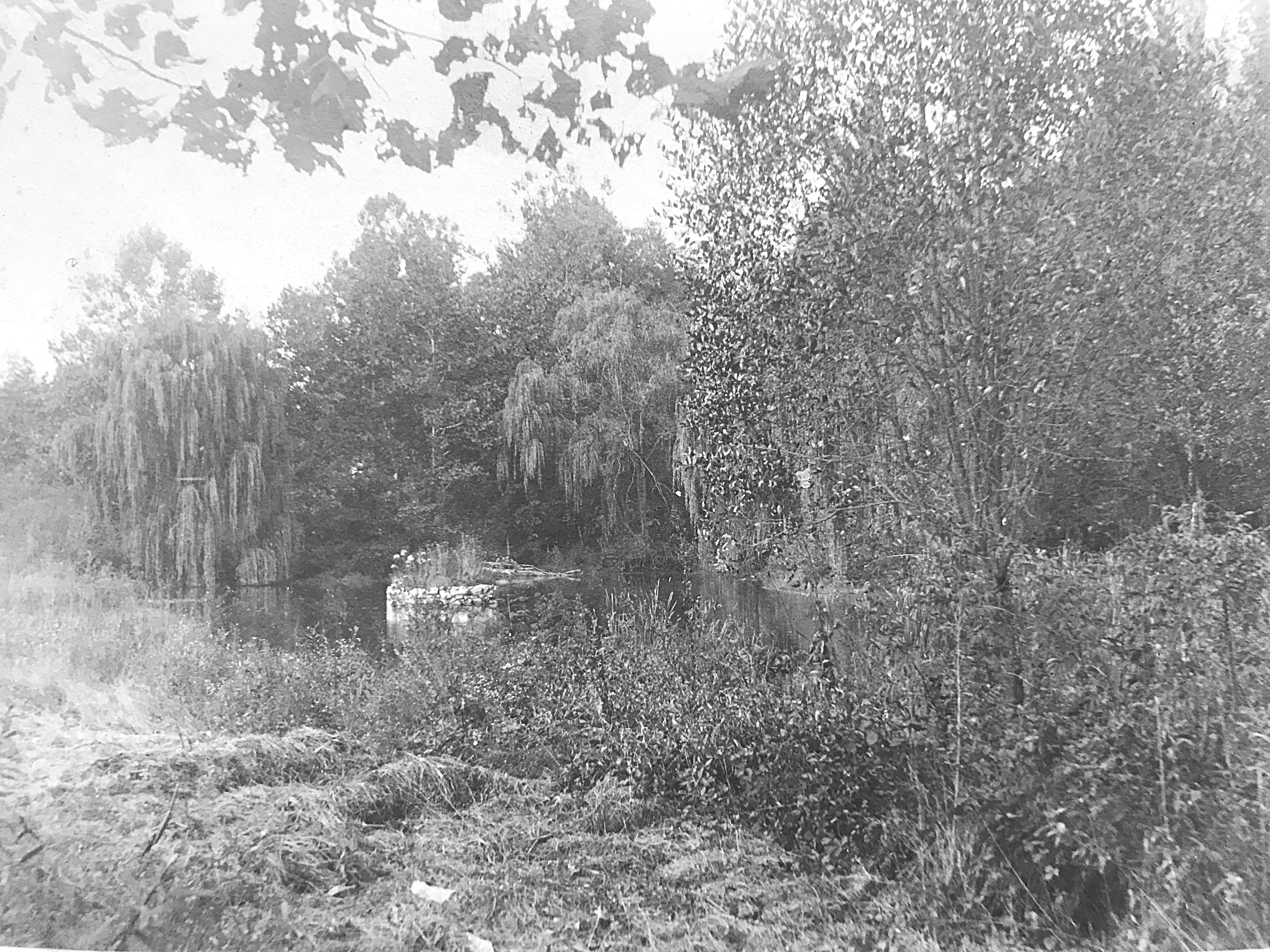
Summertime view of the same pond, seen from a different vantage point. Photo by Lewis Reed, 1910.
As we look back more than a century later, these images invite us to appreciate not only the hard labor that made year-round food storage possible, but also the photographers like Lewis Reed who understood the importance of documenting everyday life. Thanks to his lens, we can still witness this fleeting moment of Montgomery County’s past; a time when winter’s cold was not an inconvenience, but a resource to be harvested, stored, and relied upon long after the ice had melted.
The Reed Sisters and the Spirit of Early Motorcycling
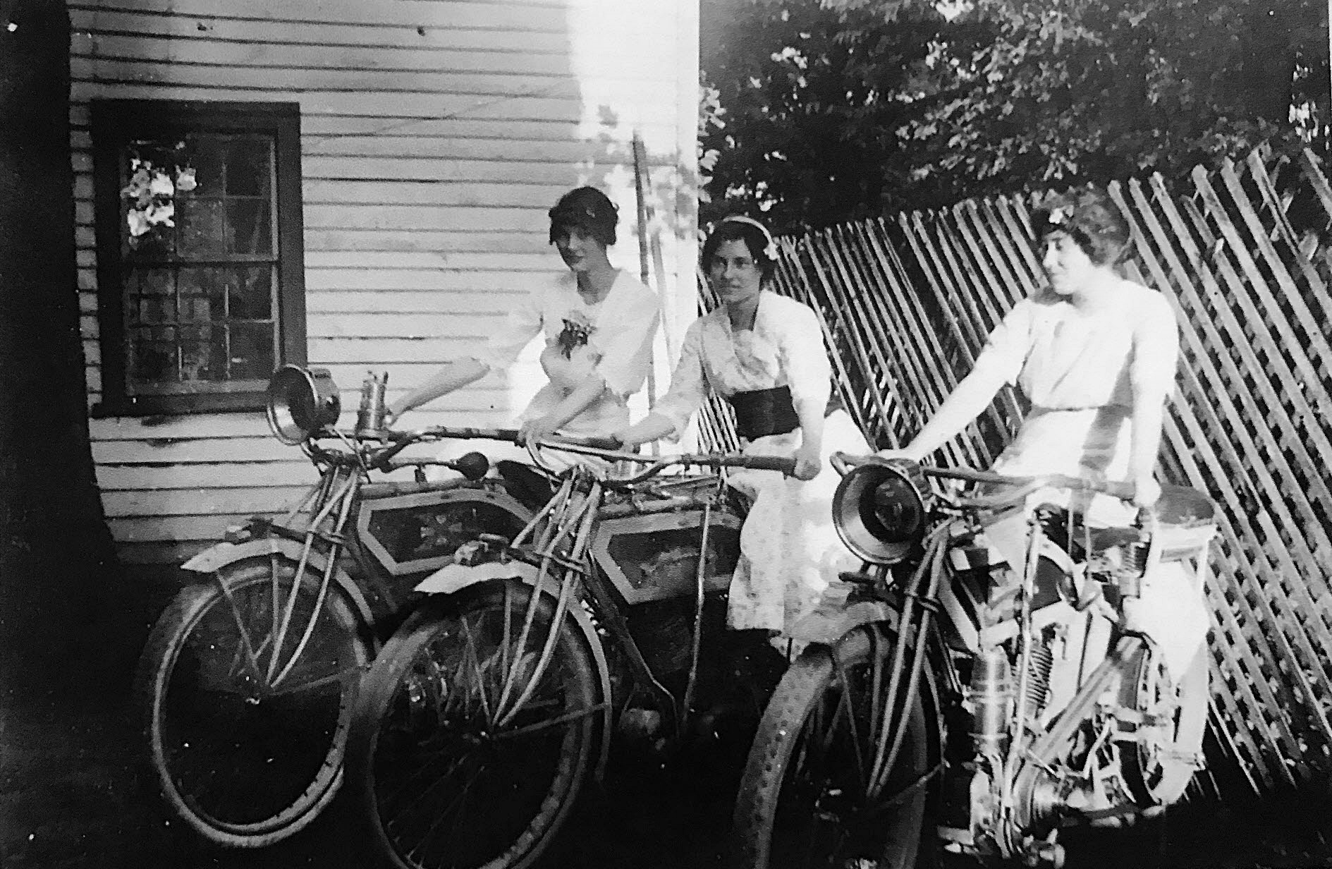
Eleanora Reed with Lewis Reed’s sisters, Geneva and Eva, posing on Excelsior motorcycles. Photo by Lewis Reed, ca. 1912.
At the dawn of the 20th century, motorcycles symbolized the spirit of innovation sweeping the modern age. Adapted from bicycles and powered by the new internal combustion engine, these machines represented freedom, ingenuity, and progress. Before cars dominated the roads, motorcycles often outnumbered automobiles, and it wasn’t uncommon to see riders as young as fourteen traveling the open road.
Photographer Lewis Reed captured this transformative era through his lens, preserving scenes of both relatives and acquaintances astride their machines between the 1900s and early 1920s. His collection offers a rare glimpse into an age when motorcycling was as much a bold adventure as it was a social pastime. Among his most memorable subjects were sisters Eleanora, Geneva, and Eva Reed, who embodied the daring enthusiasm of the time, embracing both the excitement and modernity that early motorcycling so vividly represented.
In the photograph below, a woman and a young child are seated on an Excelsior motorcycle, one of America’s premier machines of the early twentieth century. The child’s cap and goggles, likely intended as playful props rather than functional equipment, evoke the novelty and adventure associated with motorcycling during this era. The woman’s practical riding skirt, tailored jacket, and matching cap and goggles, however, suggest that she was an experienced rider with a genuine familiarity with the motorcycle.
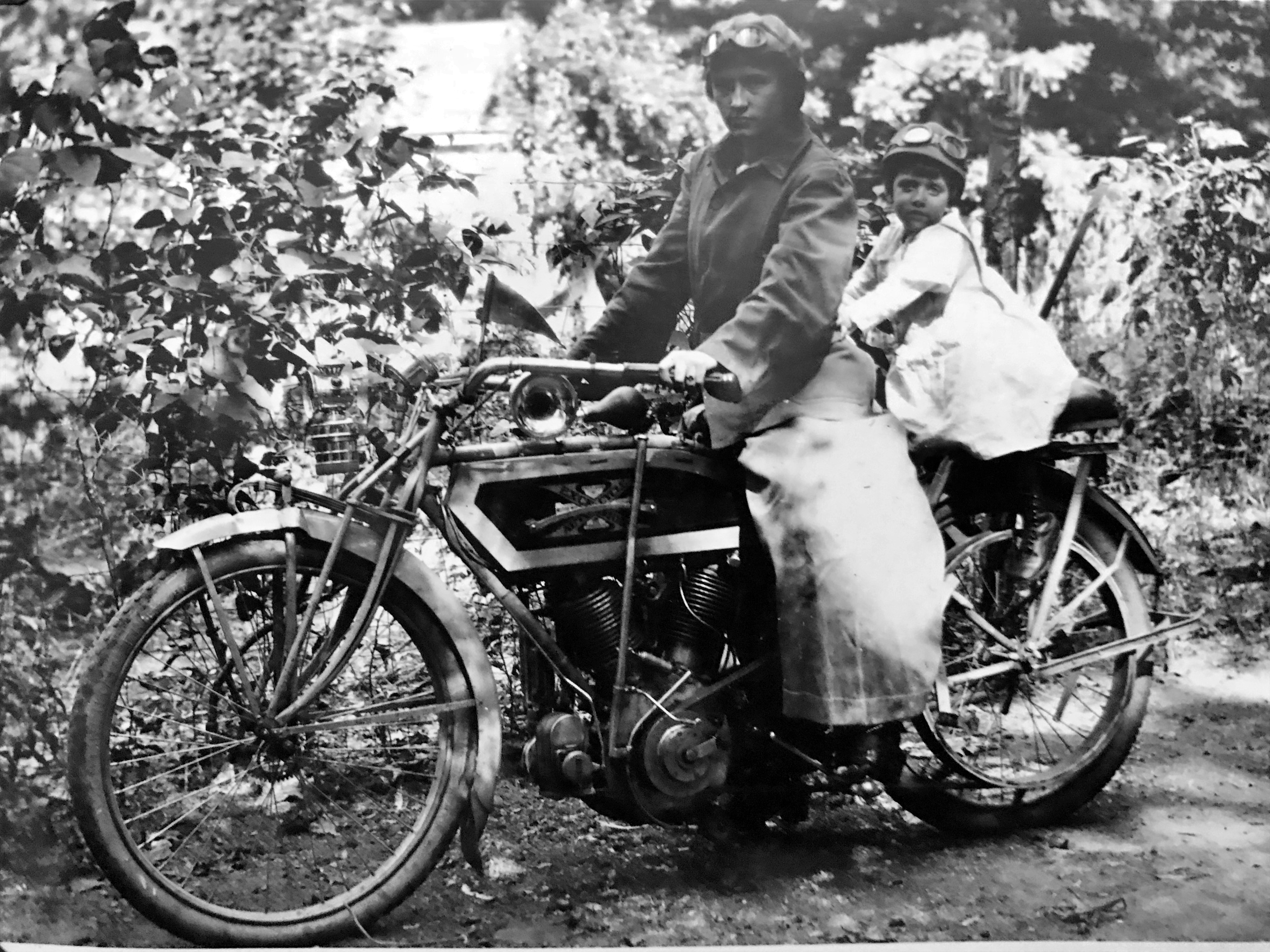
Woman and toddler on an Excelsior motorcycle. Photo by Lewis Reed.
The Excelsior itself showcased early 20th-century innovation, featuring a headlamp for night riding, a handlebar-mounted Klaxon horn with its famous “Ahoo-ga!” sound, and a padded passenger seat for a brave companion. In the early 1900s, many women rode motorcycles before they were even widely allowed to drive cars… while wearing military-style riding gear that shocked more than a few bystanders along the way.
Adding to this story of early American motorcycling is another remarkable photograph below; one featuring a woman and toddler posed on a Harley-Davidson motorcycle. Images like this one remind us how quickly motorcycles captured the public imagination in the years before World War I. They were not only practical for travel over rough roads but also symbols of progress and personal freedom. For women, especially, posing on, or even simply near, a motorcycle was a subtle act of empowerment at a time when societal expectations were still very traditional.
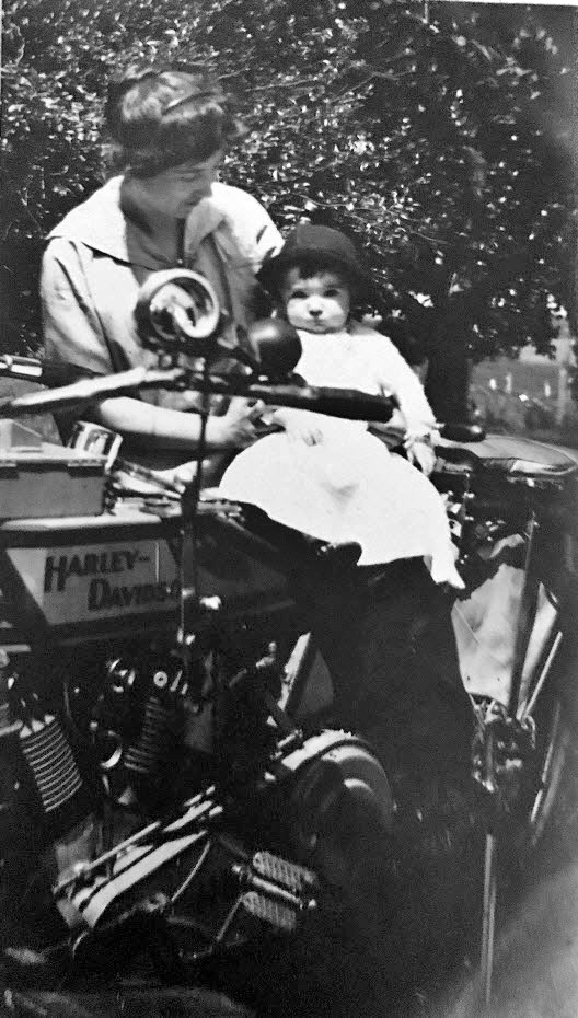
Woman and toddler on Harley Davidson motorcycle, ca. 1912. That slightly timid look says it all; not quite ready to ride, but definitely ready for her close-up! Photo by Lewis Reed.
Preserved through Lewis Reed’s remarkable photography collection, these images remain both a family heirloom and a glimpse into a transformative era. Through his lens, we see not only the evolution of transportation but also the growing independence and confidence of women at the dawn of modern motorcycling.
Books
![]()
Related Resources


Copyright Notice

Reed Brothers Dodge History (1915-2012) by Jeanne Gartner is licensed under a Creative Commons Attribution-NonCommercial 3.0 Unported License.

Recent Comments