
Front-of-the-House Photography of the Early 20th Century
Get the kids, the horses, the cats and dogs, buggies and tractors. Lewis Reed is here, and it’s time to gather in front of the house for a family picture!
Front-of-the-house family photographs were popular from the 1880s through the first decade of the 20th century. Until the early 1900s, people went to the photographer’s studio in town to get a picture, a “likeness” as they sometimes called it. But soon after, the reverse was possible: the photographer sometimes came to the family house to take a picture (and yes, a single picture!).
In the early 1900s, families rarely took their own photographs. Most people would never even consider owning a camera, which then was an expensive and complicated piece of equipment. If they wanted a picture of their family or their home, they called on a photographer like Lewis Reed to take it for them.
Below are some houses on which Lewis Reed trained his lens in the first decade of the 1900s–some identified, some not–but all a fascinating glimpse into the everyday world as it was back then. As always, click on the photos to get a better look.
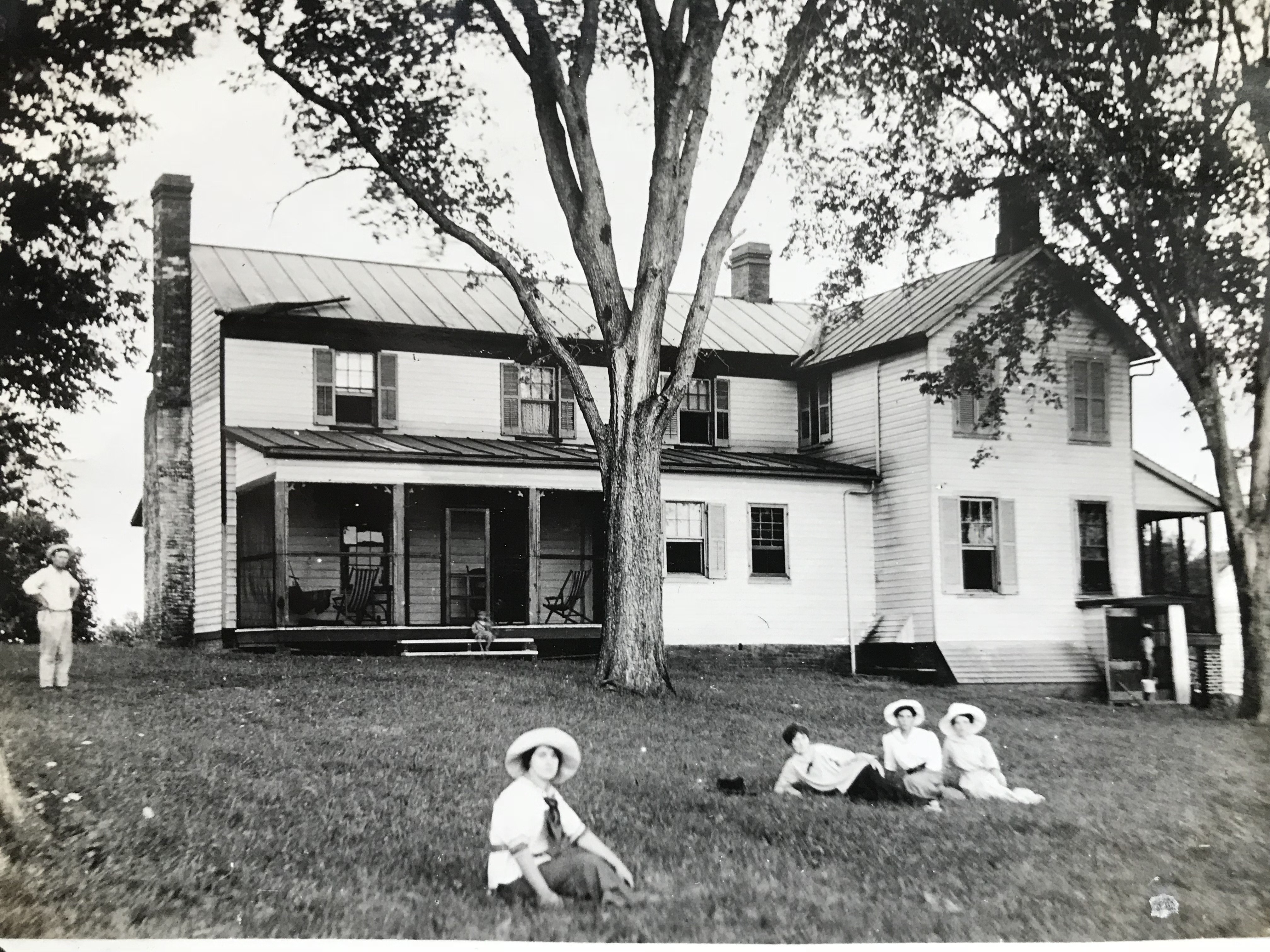
An unusual view of the backyard of a house, with its screened-in porch and children relaxing in big floppy hats.

This photo and the one below it, are very interesting in that they depict a small child posing with likely her nursemaid or a house servant who is African American, and still a child herself. Above, a view of the front porch…

…and the same house as above with the girls now playing in the side yard. The smaller child is in a buggy styled to look like a sleigh.

Here, the women of the family pose for the camera (while a young man photo-bombs from behind a bush).
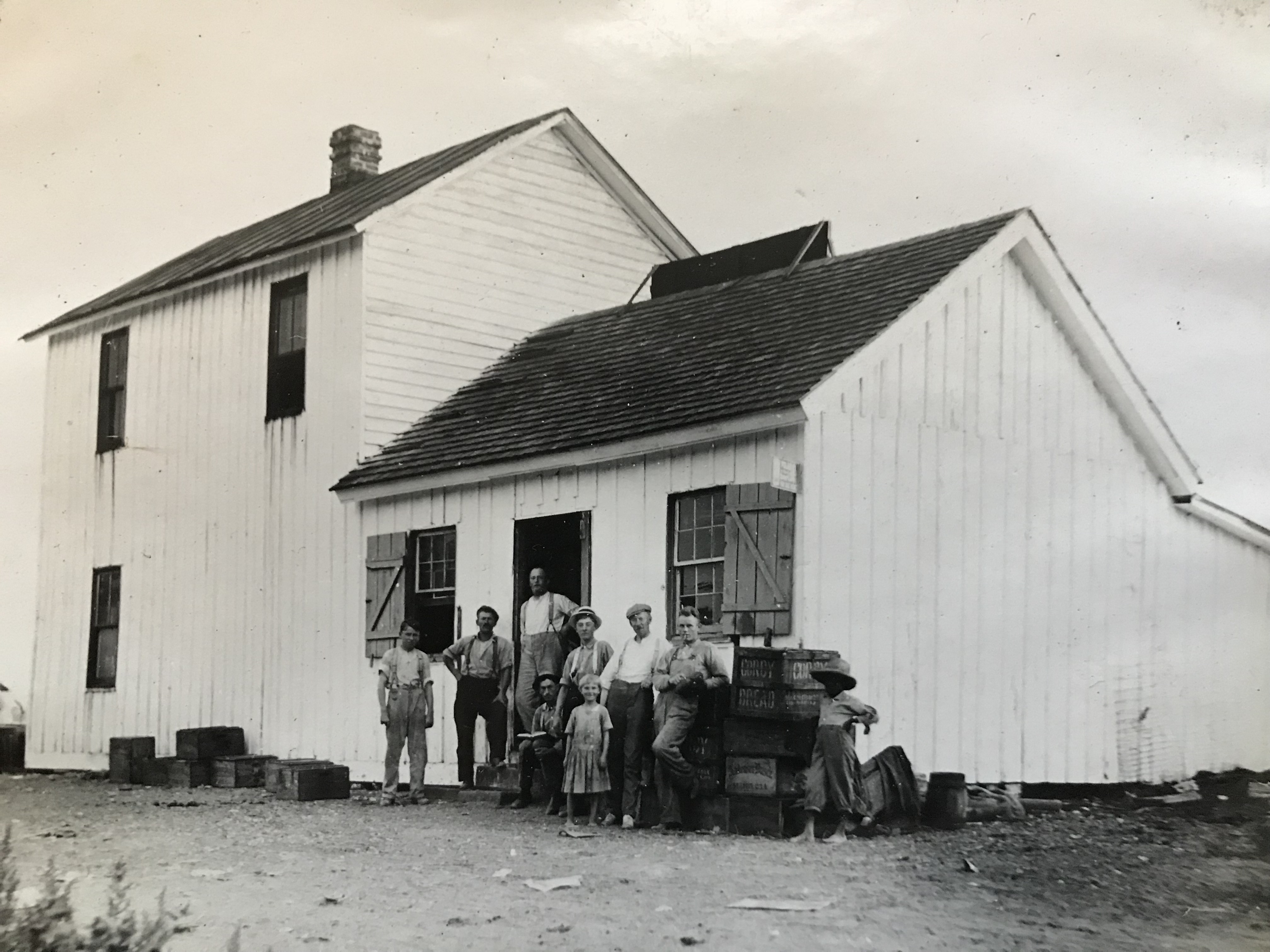
This unusual group of people posing at the back door of an unidentified building may be running a store. The crates and debris on the ground, and the back side of a possible sign on the roof indicate a mercantile rather than a home.

This family is clearly dressed in their Sunday best on a winter day. The sidewalk in front of their house is made of wooden planking.

Several women can be seen on this house’s front porch, with its flowering vines strung from trellis to rail.
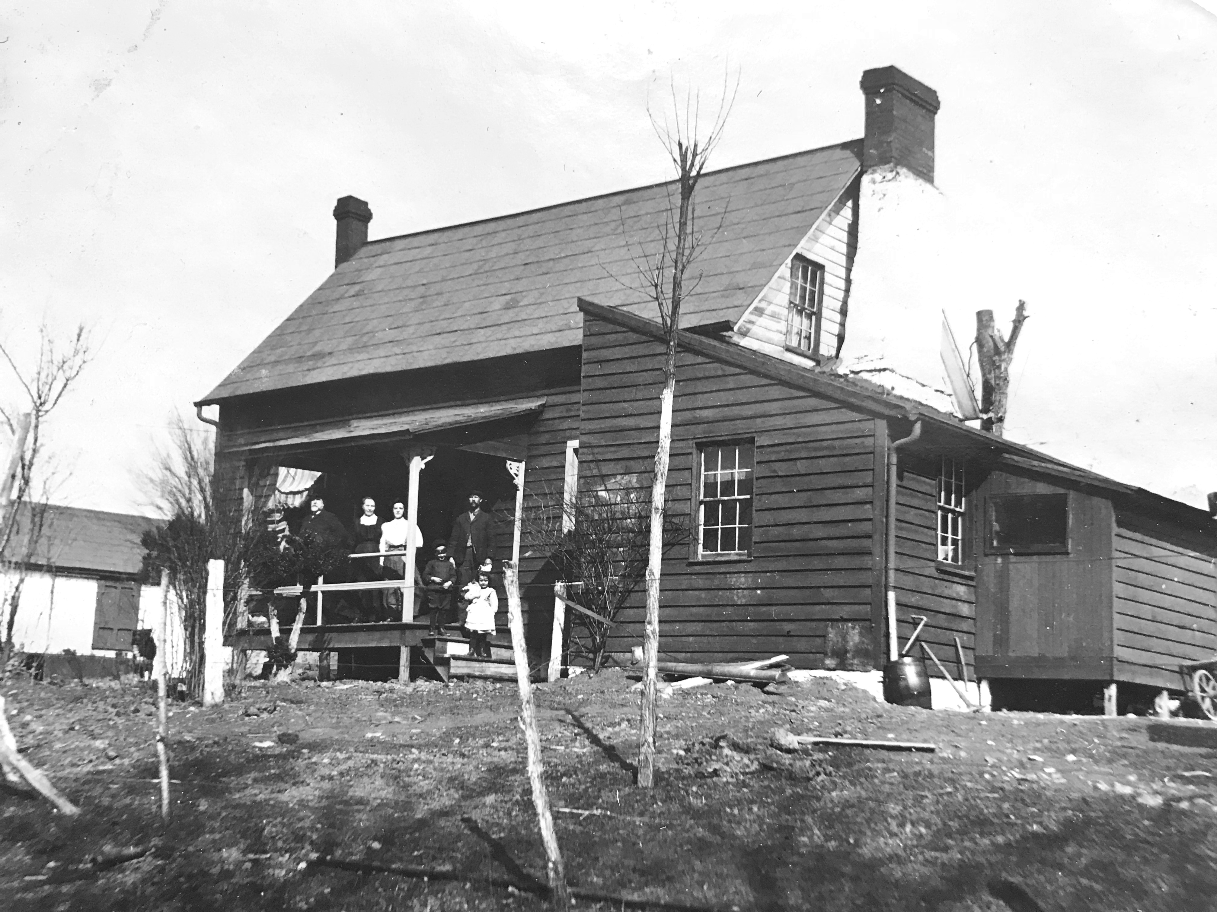
This modest house has had an addition put on–it looks rather new and perhaps Father wished to show it off. Here, a portion of the family poses on the front porch (possibly with a set of in-laws)…
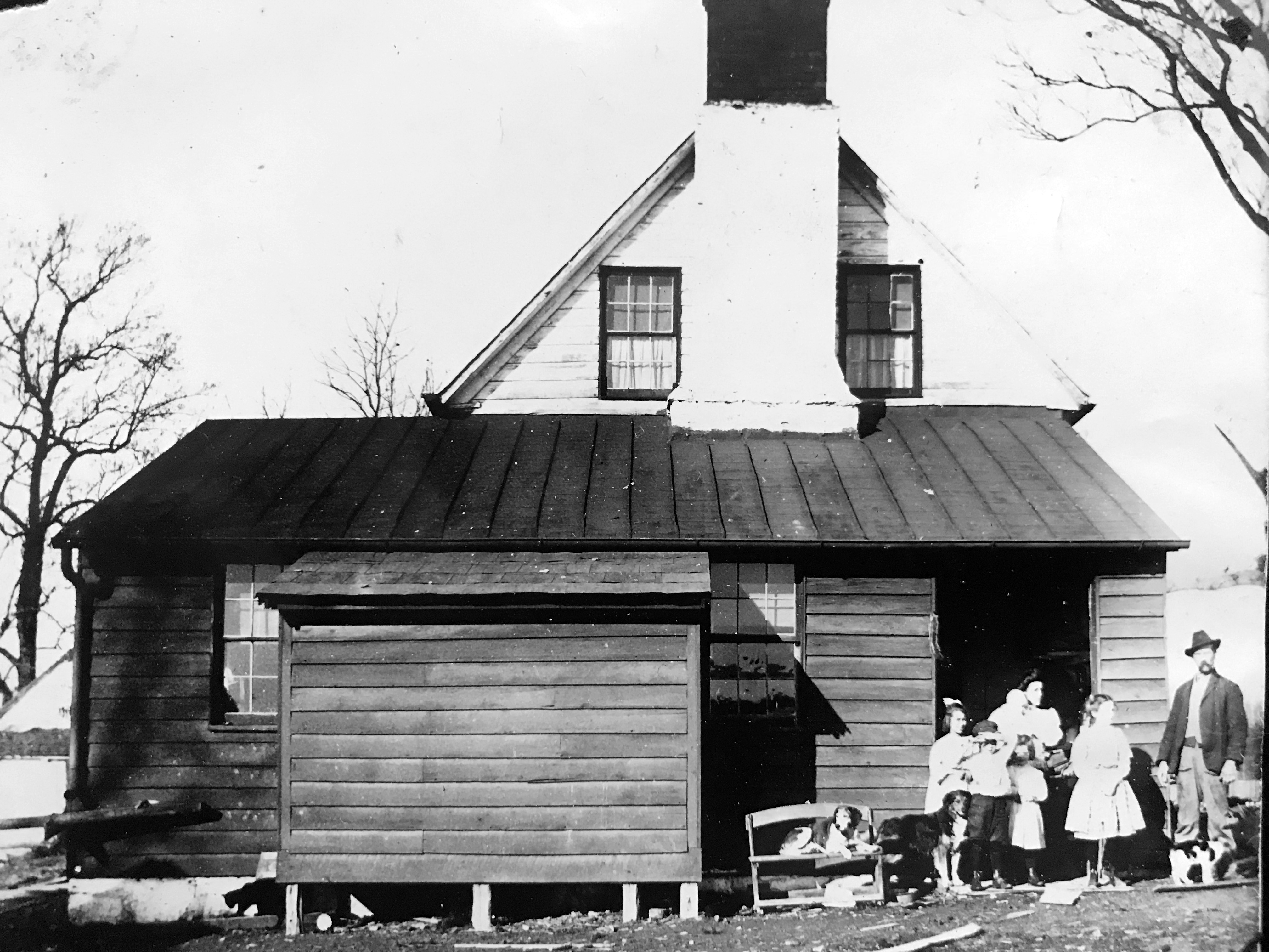
…and here a different grouping are at the side door. In this less formal shot, there are far more children, as well as two dogs and a cat in the picture.

One downside to photographing an entire house is you lose the detail of each family member. The families in this photo and the one below, clearly cared more about seeing their faces than their houses. Notice the youngest girl above couldn’t keep still long enough, so her face is blurred.
Modern observers of these photographs are often drawn to the poverty, or at least the relative poverty of the people in the images. In reality, however, the front-of-home family photograph was a sign of wealth. It’s function was to record a moment in which a family was prosperous enough to have their own homes, their own horses or tractor.

There is a chicken near the steps in the photo.
Around the turn of the century, middle class Americans could start to afford their own personal cameras.
100 Years Ago Today: First Ever Auto Races Held at Rockville Fair
Interestingly, horses made the first automobile speed races possible. Harness racing was one of the main attractions at the Rockville Fair race track before the introduction of the automobile and the subsequent popularity of racing cars. The race track was a half-mile dirt racing oval with wide, sweeping curves and a grandstand for spectators, and was easily adapted for bicycles, harness racing, and the sport of car racing.
The use of horse tracks for racing brought another change – the switch from amateur drivers to professionals. Cars were getting bigger and faster, and racing was becoming too dangerous for “gentlemen.” What had begun as entertainment for wealthy car owners had become a professional sport.
From The Evening Star (Washington, DC) 24 August 1923
ROCKVILLE AUTO RACES LISTED FOR TOMORROW
Speed records will be placed in jeopardy at Rockville Fair tomorrow afternoon when a half score of professional drivers will compete in a seven-event program.
Featuring the program is the record trials in which Frank Ripple, Canadian speed star and dirt track champion will drive his 140 horsepower aeroplane motor in an effort to hang up some new marks. Every driver on the track will be eligible to enter the time events, but speed fans look to Ripple.
Two foreign machine and six American-built cars are listed to start.
Early action shots like the ones below are rare, however, Lewis Reed was there to capture six epic moments of race history through the lens of his camera that day.
THE FIRST RACE
From The Baltimore Sun, August 27, 1923:
This is the first year that a Rockville Fair has continued through Saturday. The extra day was added this time as an experiment, the management believing that by substituting new features the additional day could be made a success. Automobile races, the first ever held at Rockville, were the day’s principal attraction and they attracted a good-sized crowd.
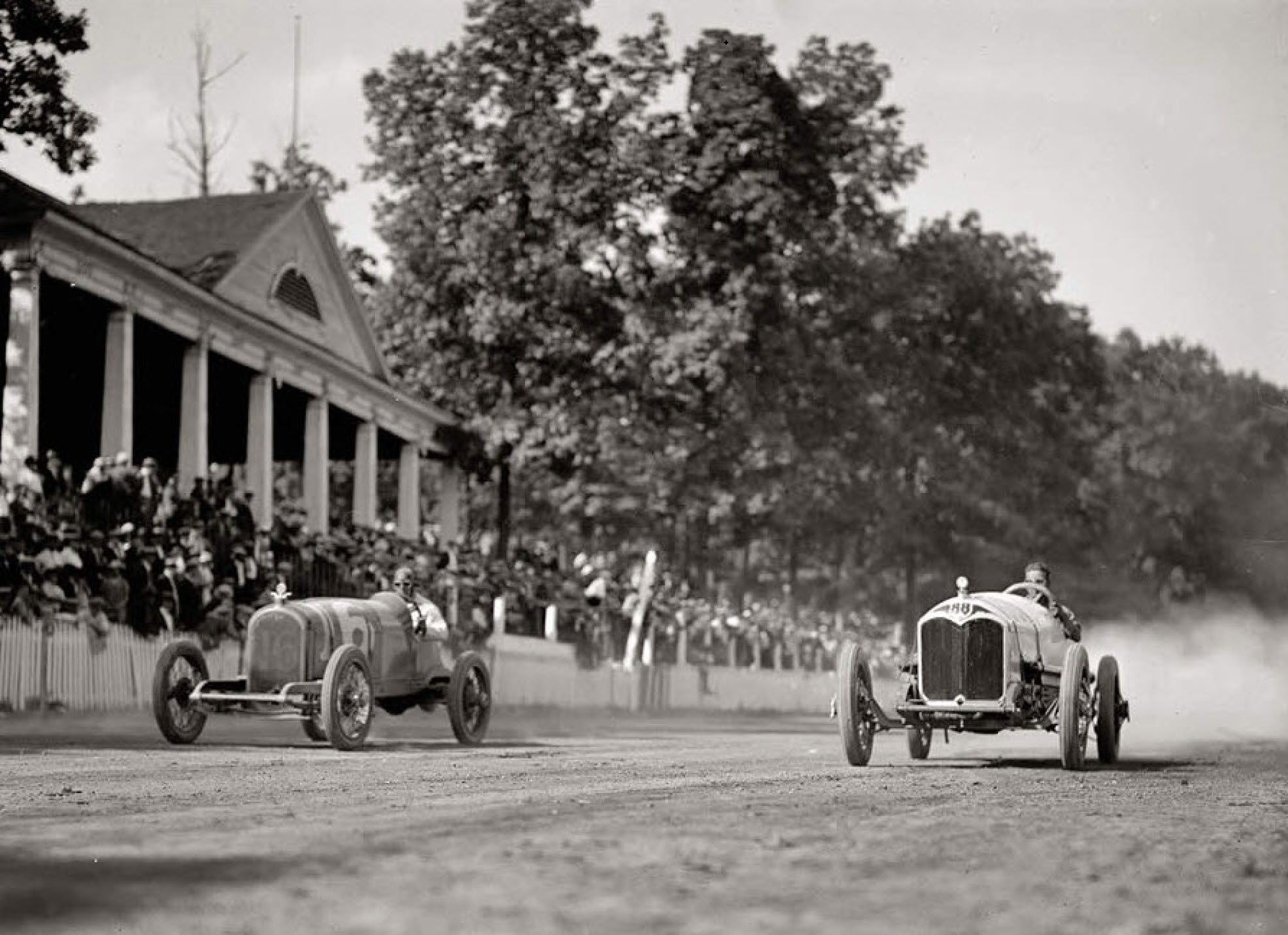
Rockville drew huge crowds for auto races. Rockville Fair, August 25, 1923. Photo by Lewis Reed

Dusty Action – 1923 photo of the exciting auto races at Rockville Fair. Five racers are just coming around the bend on this dirt track with their tires spinning up dust in their wake. Photo by Lewis Reed

Race car drivers deep in dust round a turn at the Rockville Fair auto races. Print made from a Lewis Reed glass negative.
High-powered race cars rounding a wide, sweeping curve at the Rockville Fair auto races, August 25, 1923. Print made from a Lewis Reed glass negative

Two-man race car. Some early race cars included both a driver and a ‘riding mechanic’. One of the key jobs of the second man in a race car was to look backward and alert the driver to what was going on behind him. Photo by Lewis Reed
Early race car drivers were required to have a riding mechanic, otherwise it was voluntary. Riding mechanics, who in addition to being lookouts, kept an eye on tire wear and would even hop out of the car and run back through the infield to get fuel.
This photograph was featured as a part of the ‘London Array’ Series of Impossible Engineering that was broadcast on January 24, 2019 on Discovery’s Science Channel. The photograph was used on the program that featured a segment on the development of the race car.

More dirt track action. Skinny tires make for slippery turns. Photo by Lewis Reed.
ALONG WITH AUTO RACES, AUTO POLO DEBUTED AT THE ROCKVILLE FAIR

From The Washington Post, August 25, 1923
Note in the program above, that in addition to racing, there were two auto polo events.
WHAT ON EARTH IS AUTO POLO?

Given that early automobiles were marketed as replacement horses, it was inevitable that the game of auto-polo would be invented. The idea of playing polo with cars had been tossed around starting in about 1900. It took 10 years, and the Ford Model T, to make it practical.
In 1912, some people thought it would be a good idea to strip the bodies off Model Ts, and put together some two-car teams to whack a ball around with mallets. On July 12, they did just that, playing with oversized croquet mallets and a two-pound, basketball-sized ball. Two cars took the field, and two more tended their respective goals.
From The Daily News, Frederick, Maryland, August 24, 1923:
Thousands of people attended the Fair on Thursday, which was the biggest day of the week, at least from the attendance standpoint. By two-o’clock the grandstand was so crowded that even standing room was at a premium. The racing events of the afternoon were unusually good. As special grandstand features there were auto polo and stunt riding.
Any form of safety was completely absent, unless you count the occasional presence of a hat. The cars were protected with roll bars in back and around the radiator, but the drivers, not so much. The game consisted of five 10-minute periods. It was hard on drivers, cars, and the field. There was no limit on car substitutions, and as many as a half-a-dozen per team might be demolished during the game, along with the stands, goalposts, referees (on foot on the field) and anything else that got in their way.

1922 auto polo match in Los Angeles. The referees job is very dangerous as the cars careen about the field and smash into each other. Google stock image.
All we hope is that this lunatic game will not spread.Automobile Topics, Nov. 16, 1912
AUTO RACES MARK END OF 5-DAY ROCKVILLE FAIR
From The Sunday Star, Washington, DC, August 26, 1923:
Thrilling automobile races brought the annual Rockville Fair to a close this afternoon. The sport was as innovation so far as Rockville was concerned.
Seven high-powered cars, operated by some of the crack drivers of the country, participated. The events ranged from one to ten miles in distance, and some fast time was made. Excepting that of Thursday, the largest crowd of the five days was on hand.
Auto Polo Credit: May 2010 issue of Hemmings Motor News
Origins of the Montgomery County Agricultural Society & Fair (1846-1932)
The Washington Times., August 20, 1922
It’s August, which means the Montgomery County Fair is coming soon! (The Agricultural Center’s website is literally counting down the seconds until opening day.) Since the fair will be here in just a couple of days, I thought it would be fun and interesting to look back at some rare, historical photographs taken by Lewis Reed at the fair, whose origins stretch back 177 years.
Montgomery County Fair History
In 1846, James K. Polk was President of the United States, the U.S. flag had only 28 stars on it, and less than 1,500 people lived in Rockville. It also was the year that the Montgomery County Agricultural Society was organized, that began the tradition of the Montgomery County Fair in Rockville. A 12-member board of directors was chosen, headed by John P. C. Peter, President. The Montgomery County Fair opened two years later on the Pike in 1848, about where Richard Montgomery High School is today.
Discussions about farm improvements led to organized agricultural efforts. In 1846, Rockville farmers helped to establish the Montgomery County Agricultural Society. Two years later, Court House Square overflowed with displays of agricultural implements at the first county fair. The register of will opened his office for exhibits of household manufacturers. and the county clerk’s place teemed with fruits and vegetables. Women competed for cash prizes in the categories of homespun fabrics, fancy handwork, pickles, preserves, butter, cheese, and honey. Men exhibited livestock on the grounds of the Beall-Dawson House.
In a few years, the fair moved to Samuel T. Stonestreet’s woodlot adjacent to Saint Mary’s Church. The annual fair became a week-long gathering to showcase innovation, compete, and socialize. The property on the Rockville Pike was used until 1932, after which much of the land became Richard Montgomery High School.
From The Baltimore Sun Newspaper on September 20, 1848:
The Montgomery County Agricultural Fair held at Rockville, Maryland on Thursday and Friday last, the Journal of that place says, fully met the most sanguine expectation of its friends. The concourse of people was very large, and the stock, implements, and other articles exhibited, were the most perfect and beautiful. The Journal designs to publish the various reports of the committee—and the very able and interesting address of R. J. Bowie, Esq., and the other appropriate remarks submitted on the occasion, and says:
The exhibition was highly credible to the officers and members of the club, and to our country. We must reserve, for a more lengthy notice, the beautiful stock and implements of agriculture sent by gentlemen residing out of our county. We are gratified, indeed, that every thing went off gloriously, and the occasion will be long remembered by all who were present.
The Baltimore Sun, Sunday 31 August 1909
All the latest improved machinery in farm and garden implements were there, together with wagons, carriages, automobiles, trucks, and tractors. The display of cattle, sheep and hogs had long been one of the leading features at the Rockville Fair. Many fine herds of cattle, including Jerseys, Guernseys and other varieties were on exhibition. Two hundred of the finest horses in Montgomery County, along with many from the District of Columbia, nearby Virginia, and elsewhere were on exhibition.
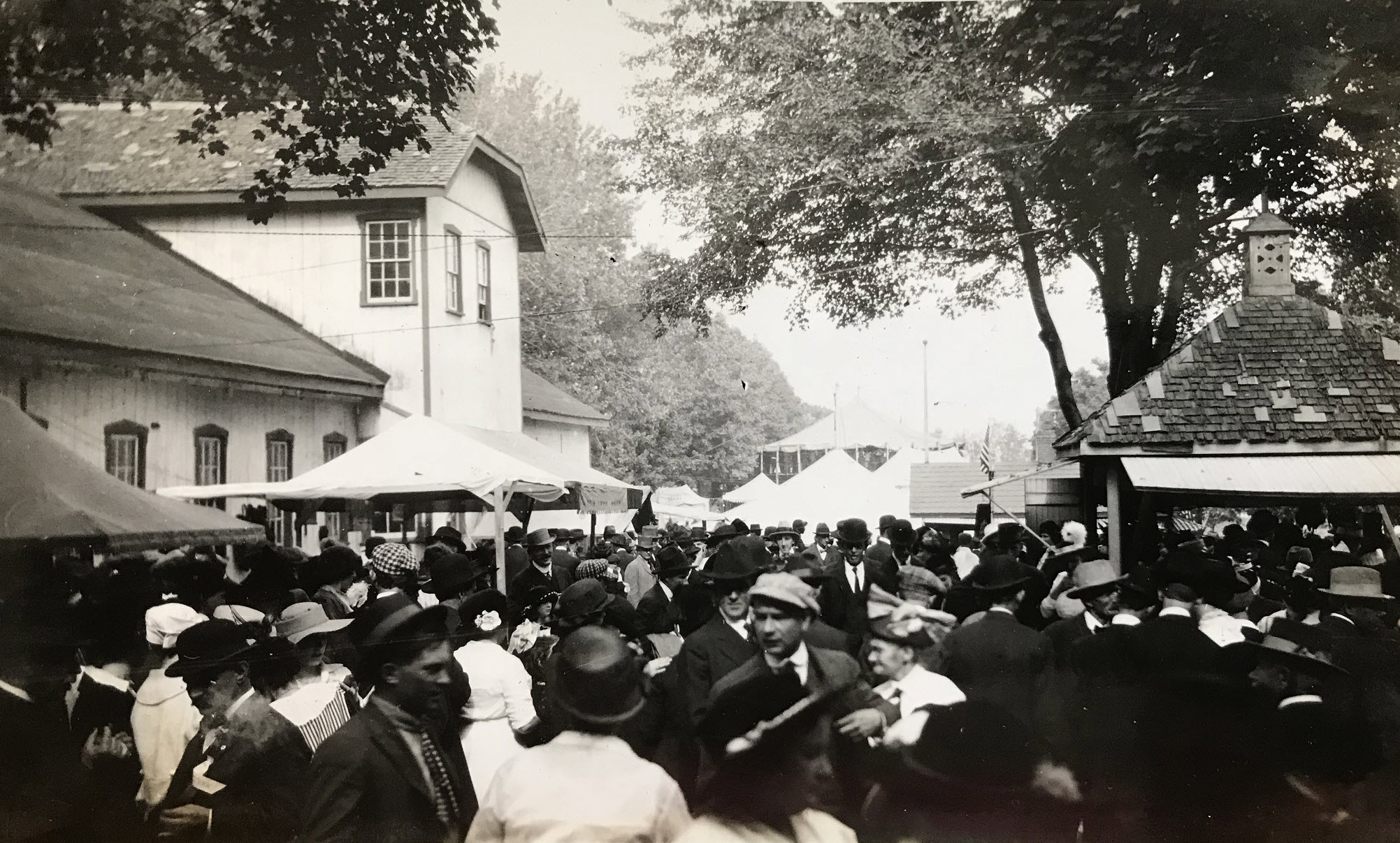
Fair-goers in their finest stroll along the midway. Hats were a fashion requirement at the time, as were long flowing dresses and suits. Photo by Lewis Reed, ca. 1910
Many other attractions were provided, including the midway, merry-go-round, Ferris wheel, side shows, free exhibitions in front of the grandstand, horse racing, pony races, mule races, automobile contests, a parade of stock, horse show, dog show, poultry show, an automobile show, and clay pigeon shoots. The clay-pigeon shoot was one of the biggest events of its kind ever held in Maryland.
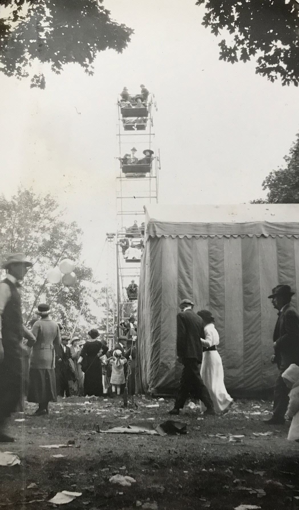
Ferris Wheel at the Rockville Fair. Photo by Lewis Reed, ca. 1910

Agricultural and various farm equipment exhibits. Photo by Lewis Reed, ca. 1910
The various departments were filled to overflowing with high-class exhibits. The main exhibition hall was devoted to farm products and garden products, household displays, flowers, fruits, etc. The household department had an endless array of preserves, jellies, canned fruits, bread, cakes, candles, pies, fancy articles, and works of art. Sanders & Stayman and E. F. Droop & Co. of Washington, had excellent displays of musical instruments in this hall. Examples of locally grown produce were abundant in the main hall. Peaches, apples, plums, damsons, cantaloupes and watermelons were piled up in tempting array. The poultry show was also a place of interest. Many fine chickens, turkeys, geese, ducks and pigeons were being shown.
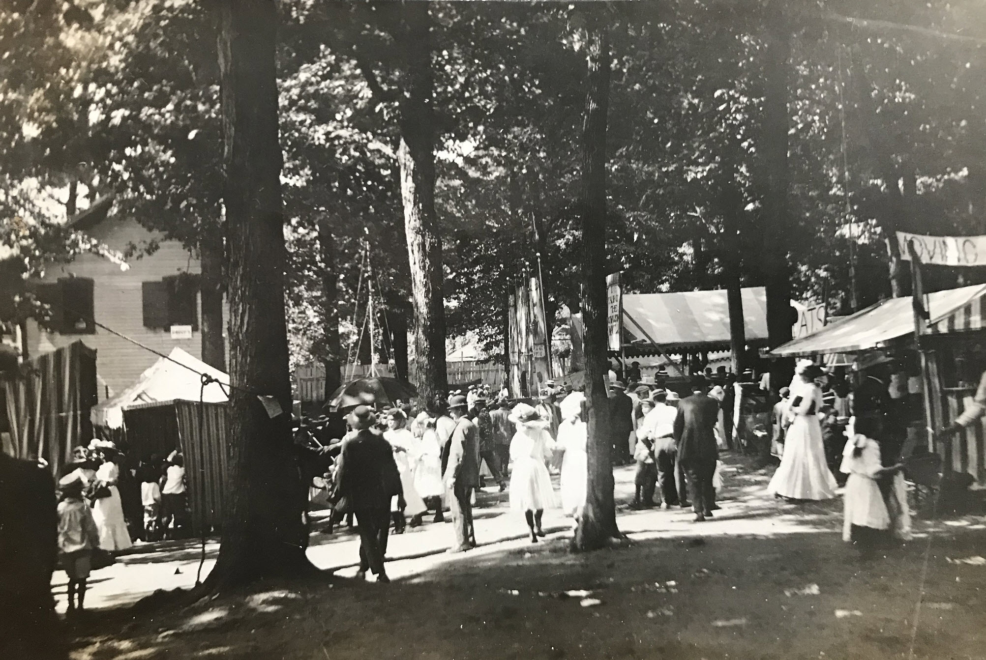
Fair-goers meander through exhibits. Photo by Lewis Reed, ca. 1910
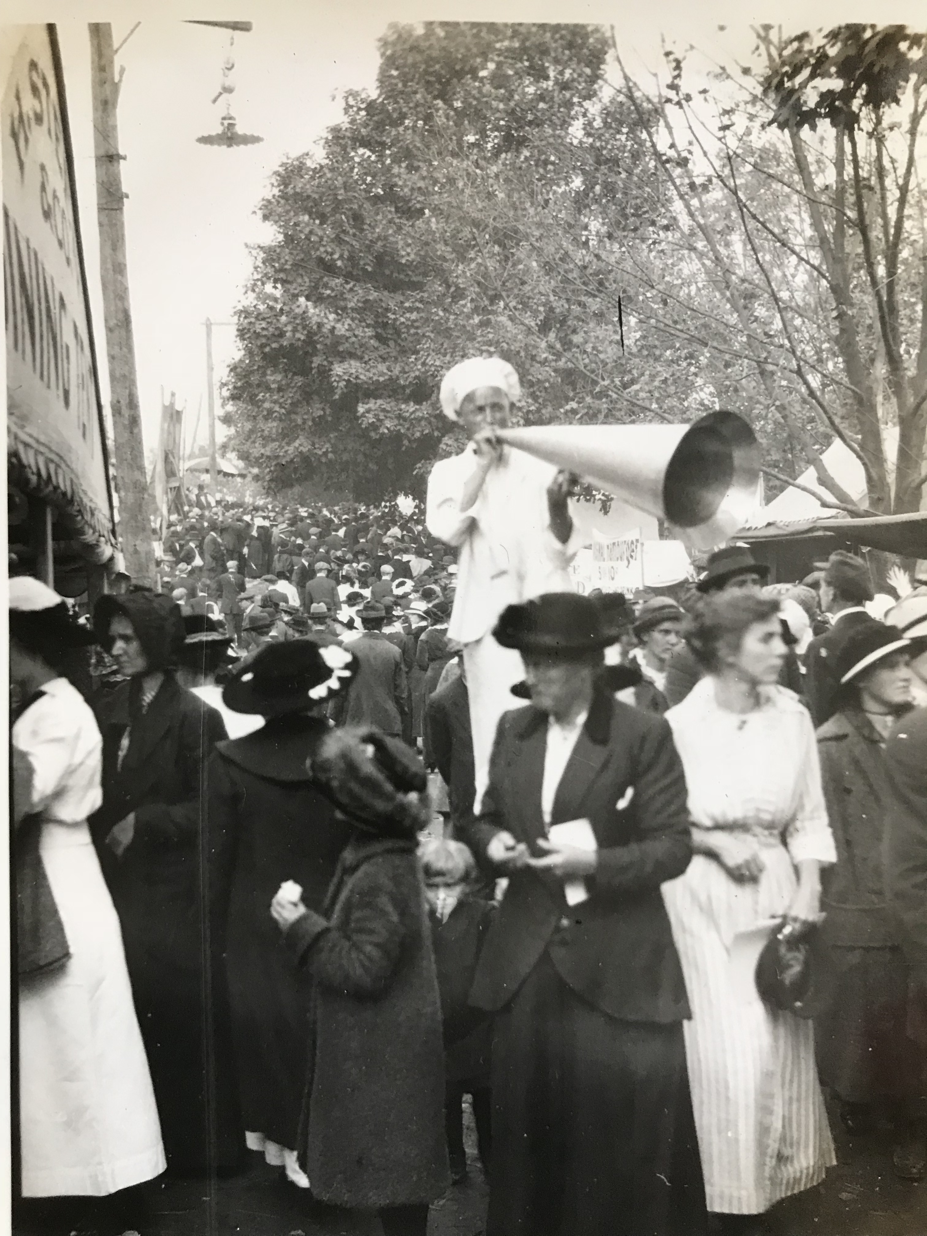
Can you hear me now? Photo by Lewis Reed, ca. 1910

Hundreds of cars parked in the fair parking lot. Photo by Lewis Reed, ca. 1910.
The Fair was always attended by large numbers of out-of-town visitors from other Maryland counties like Frederick, Howard, and Carroll counties, as well as attracting out-of-state fair-goers from the District of Columbia and neighboring counties in Virginia. Vehicles were assigned places all around the fairgrounds, and the park was completely surrounded. What is fascinating to me is, with all of these early cars painted in black, how on earth would you find your car?
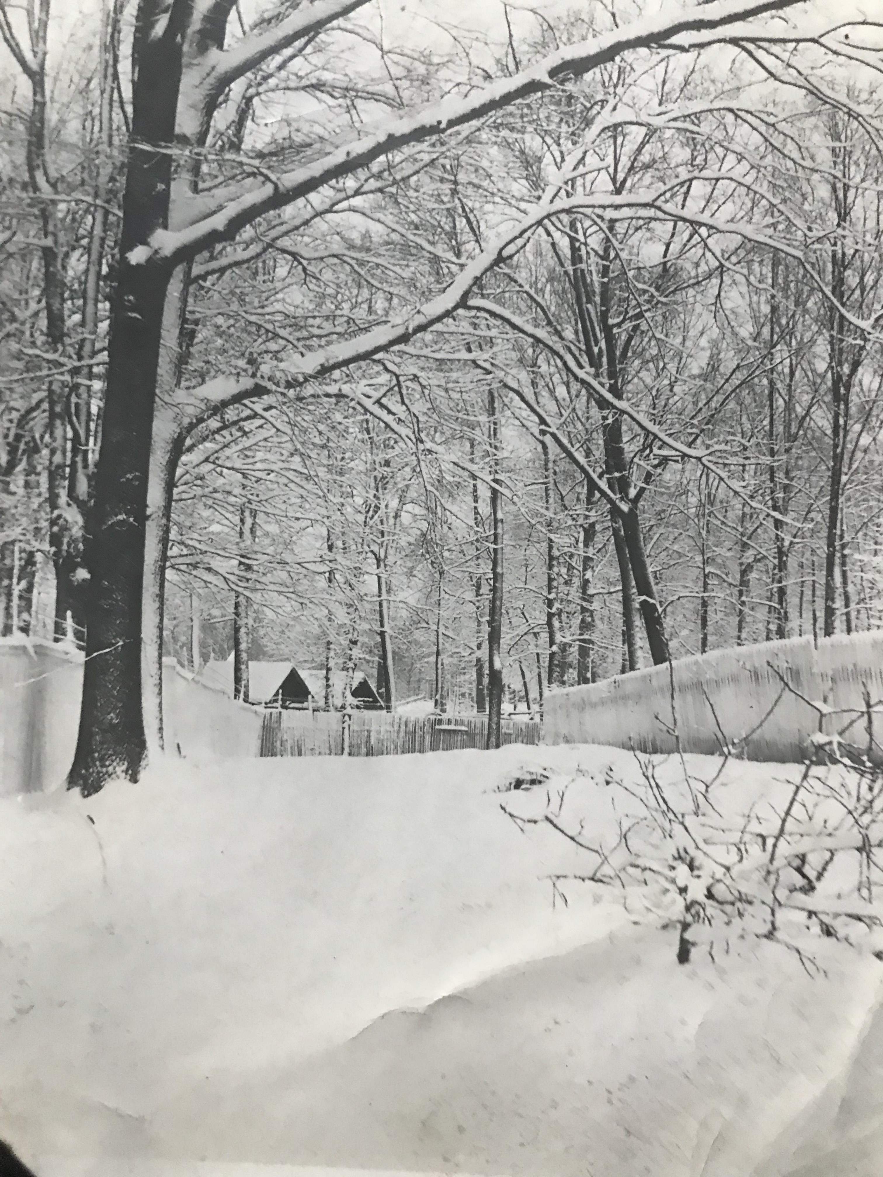
Montgomery County Fairgrounds in the snow. Photo by Lewis Reed, ca. 1910

Montgomery County Fairgrounds Poultry House boarded up for the winter. Photo by Lewis Reed, ca. 1910
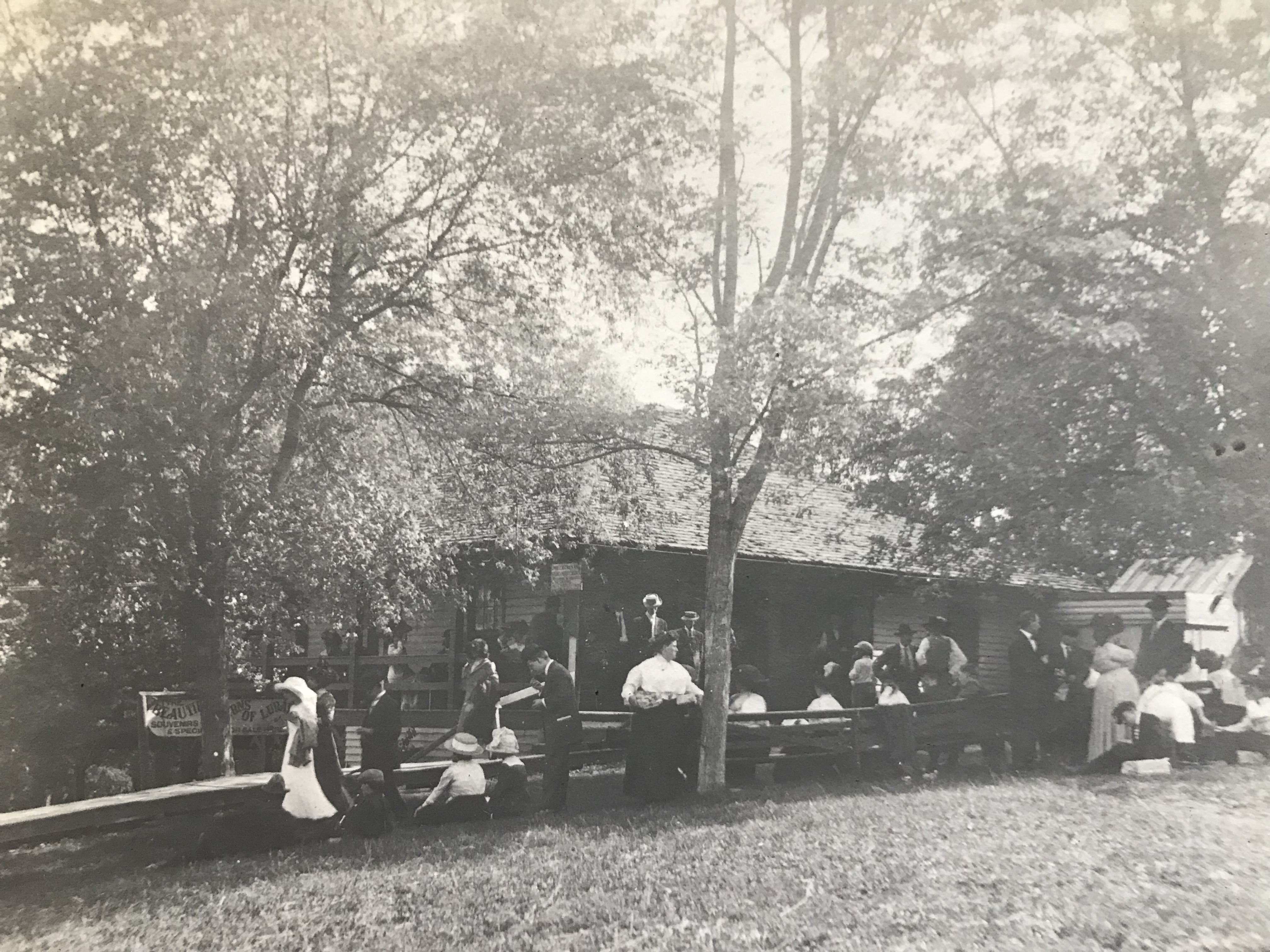
Sign on the left side of the building reads, “The Beautiful Caverns of Luray Souvenirs”. Photo by Lewis Reed, ca. 1910
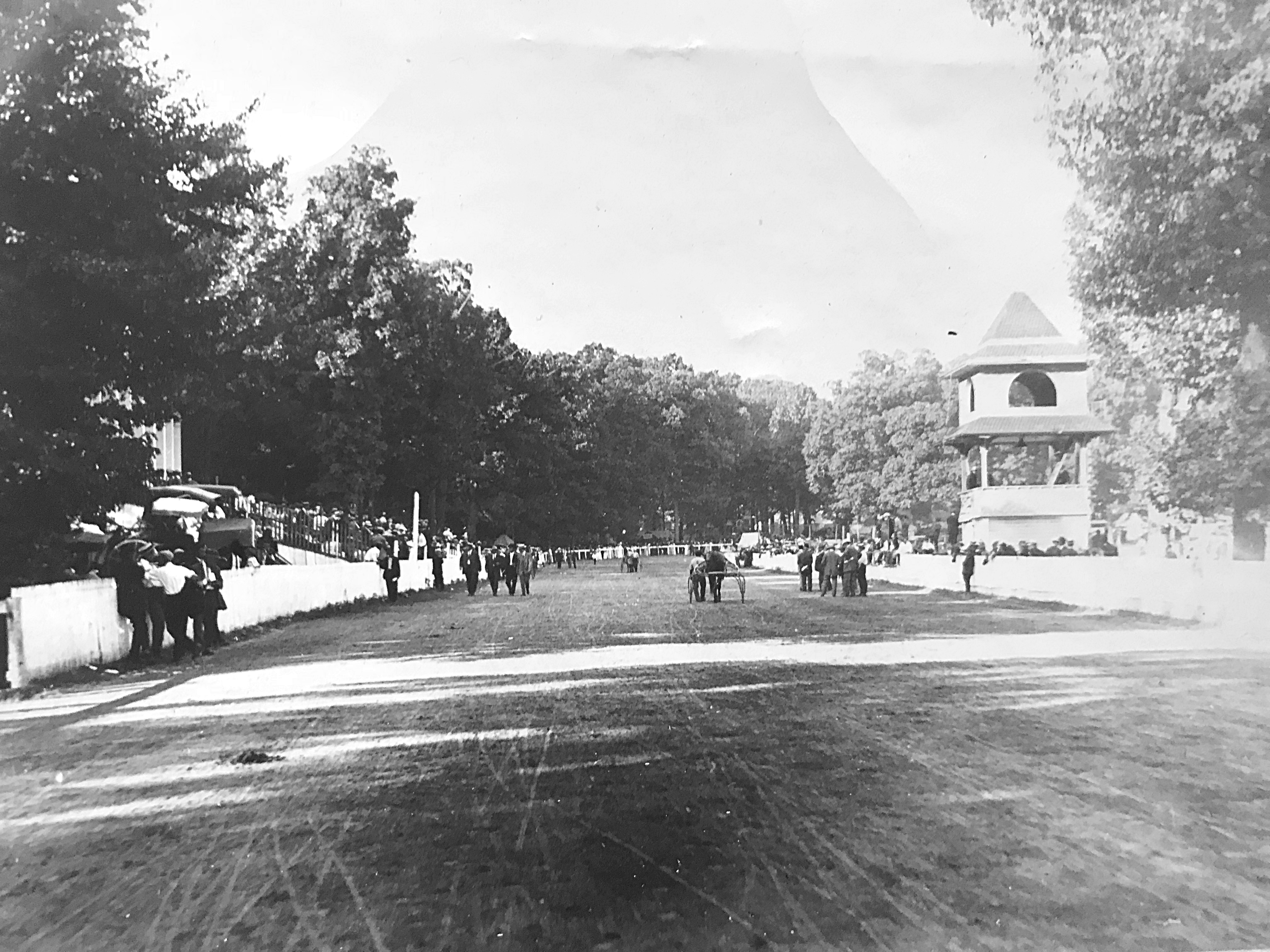
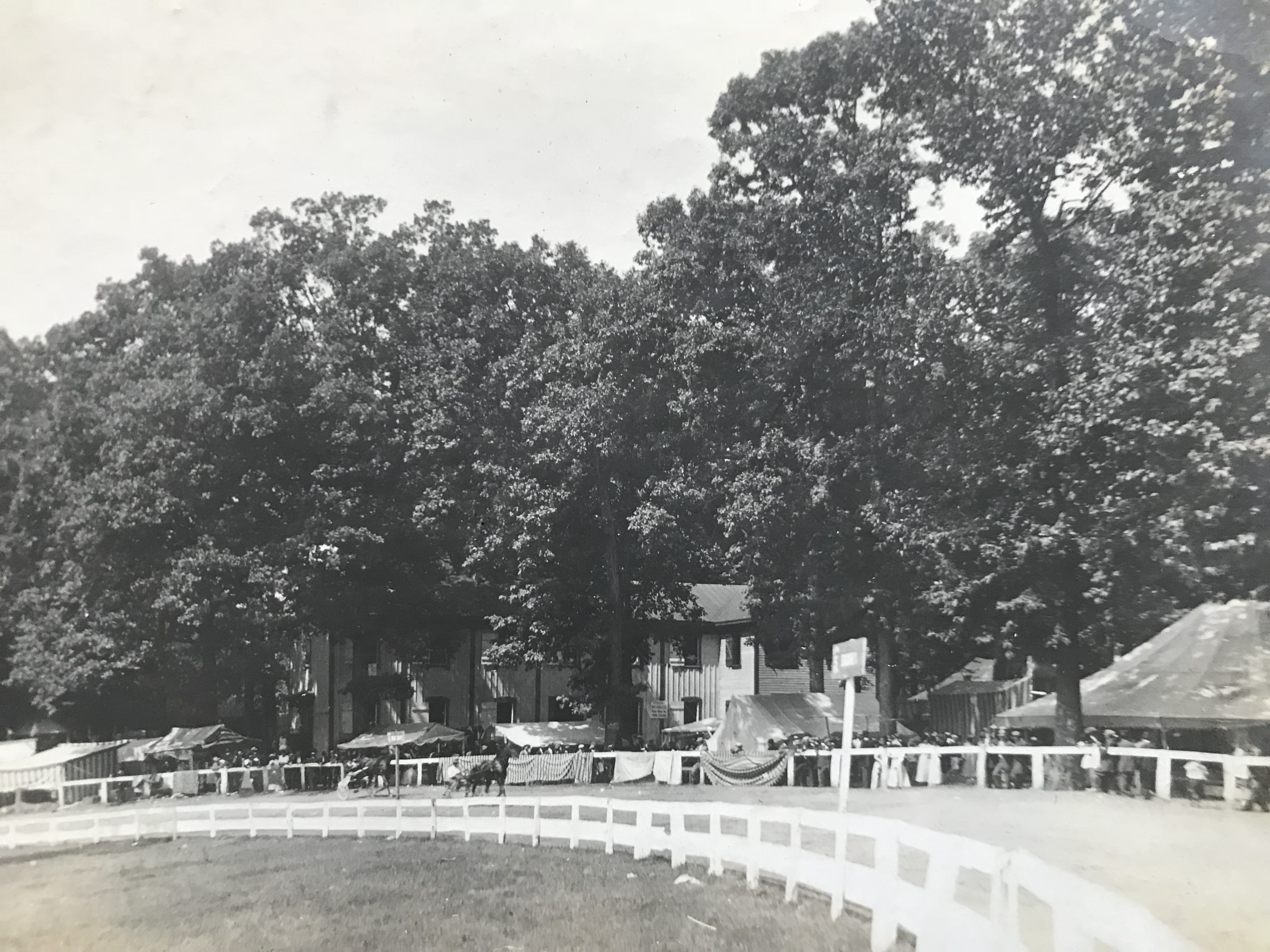
The Race Track
If only the grandstands at the Rockville Fairgrounds could talk. The stories it could tell – it would tell stories of great racing – first on horses, bicycles and motorcycles, and then in cars. This grandstand could talk about the rich history of racing that took place on the one-third of a mile long dirt track which attracted high-power cars operated by some of the most noted speed kings of the country.
When Lewis Reed took these photographs in the early 1900s, the Rockville fairgrounds had undergone a significant upgrade. The grounds were enlarged by the addition of about five acres, allowing for the construction of a one-third of a mile race course along with a new grandstand, and improvements were made to the buildings and grounds, bringing them up-to-date in every respect. Montgomery County could well boast one of the nicest fairgrounds in the state.
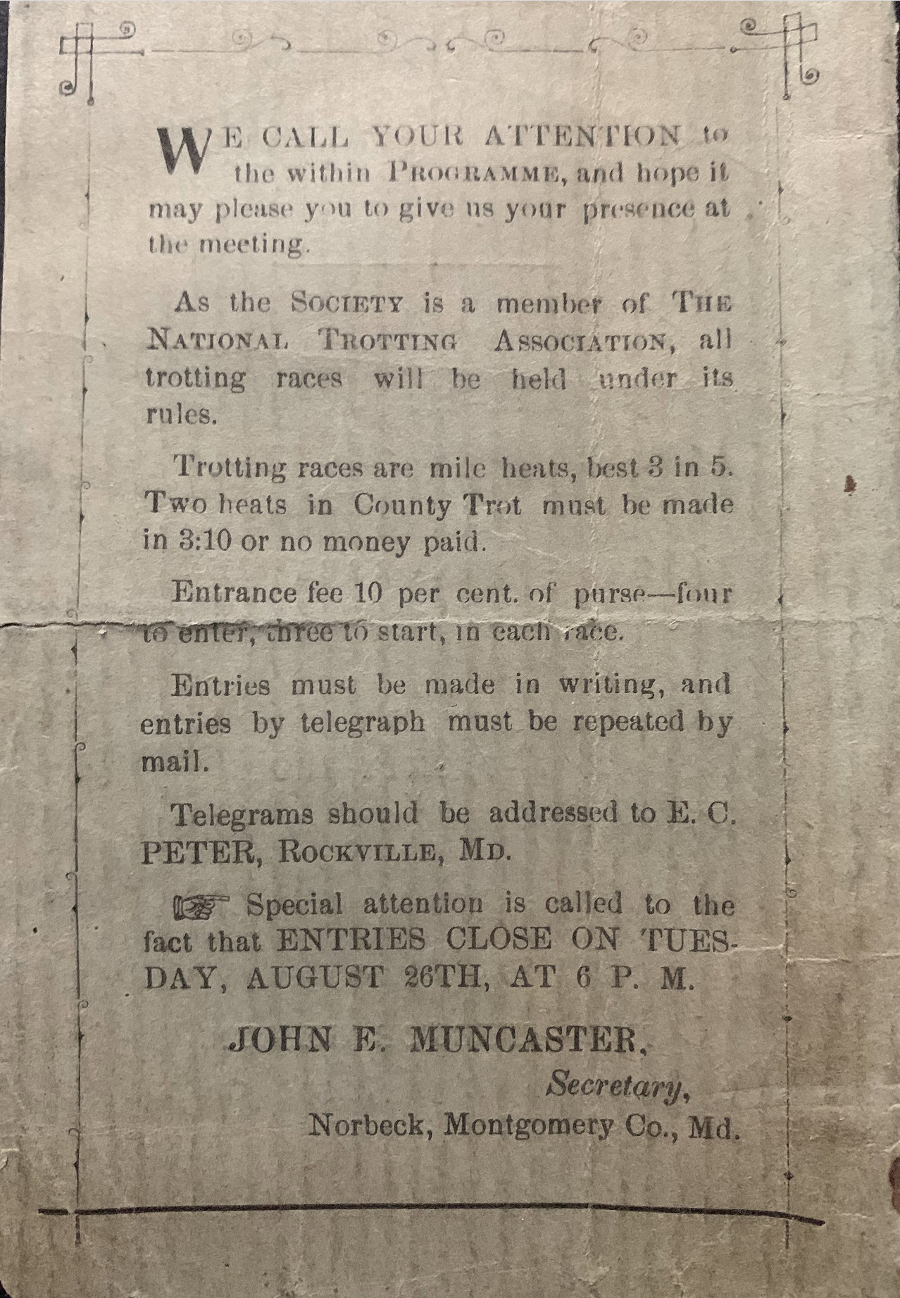
Below is a previously unpublished Program of Speed Contests held in Rockville, Maryland, dated September 4 and 5, 1890. The program is from Lewis Reed’s collection. (click on photos for larger images)
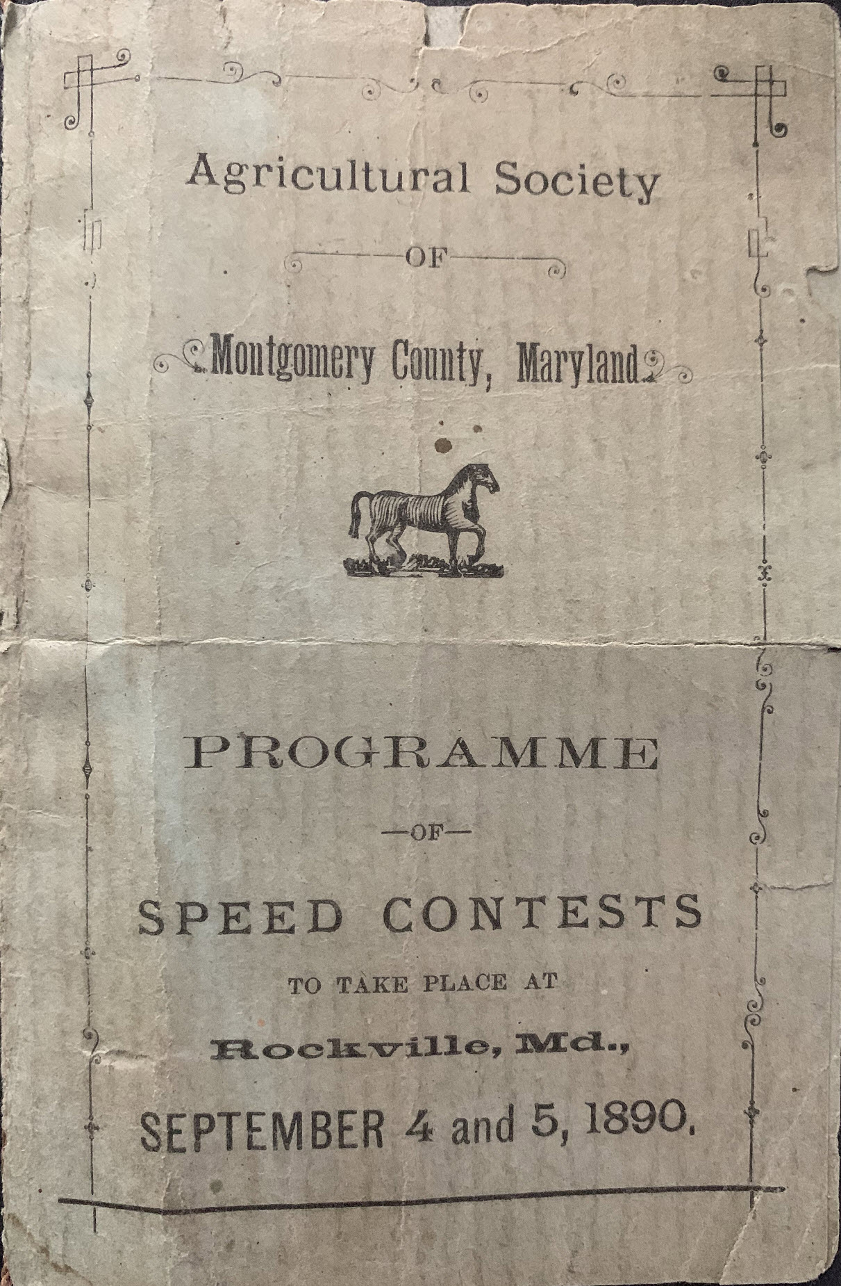
Front cover of a racing program from the 1890 Montgomery County Agricultural Society Fair. From Lewis Reed’s Collection.

Racing program from the 1890 Montgomery County Agricultural Society Fair. From Lewis Reed’s Collection.
Back cover of racing program from the 1890 Montgomery County Agricultural Society Fair. From Lewis Reed’s Collection.
Bicycle Races
Bicycle races became very popular throughout the country and were a novel event at the Rockville Fairgrounds as early as 1915. The track was a one-third of a mile dirt racing oval with wide, sweeping curves and a grandstand for spectators, which made for clear views. Notice the riders are in shirts and ties. In the background: according to the 1903 Sanborn Fire Insurance Atlas of the fairgrounds, these structures near the track were used as cattle pens.

This circa 1915 photo of an early bicycle race at the Rockville Fairgrounds gives a sense of just how popular the sport was at the time. Photo by Lewis Reed
Harness Races
Harness racing was one of the main attractions at the new race track before the introduction of the automobile and the subsequent popularity of racing cars. Horses were harnessed to lightweight one-seater buggies called sulkies, and would race around the track at a trot, as opposed to the galloping gait of horses ridden by jockeys.

Rockville drew huge crowds for harness races. Photo by Lewis Reed, circa 1910
Harness race at the Rockville Fair, circa 1910. All those throngs of people had plenty to see. Photo by Lewis Reed
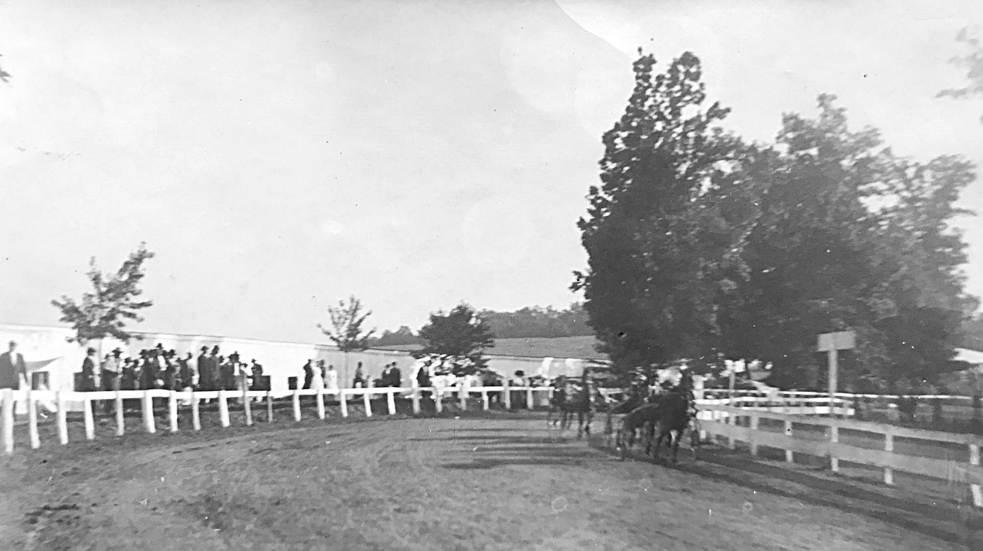
Harness racers rounding the bend on the racetrack, Rockville Fairground circa 1910. Photo by Lewis Reed
Bend on the harness racetrack, Rockville Fairground circa 1910. Photo by Lewis Reed
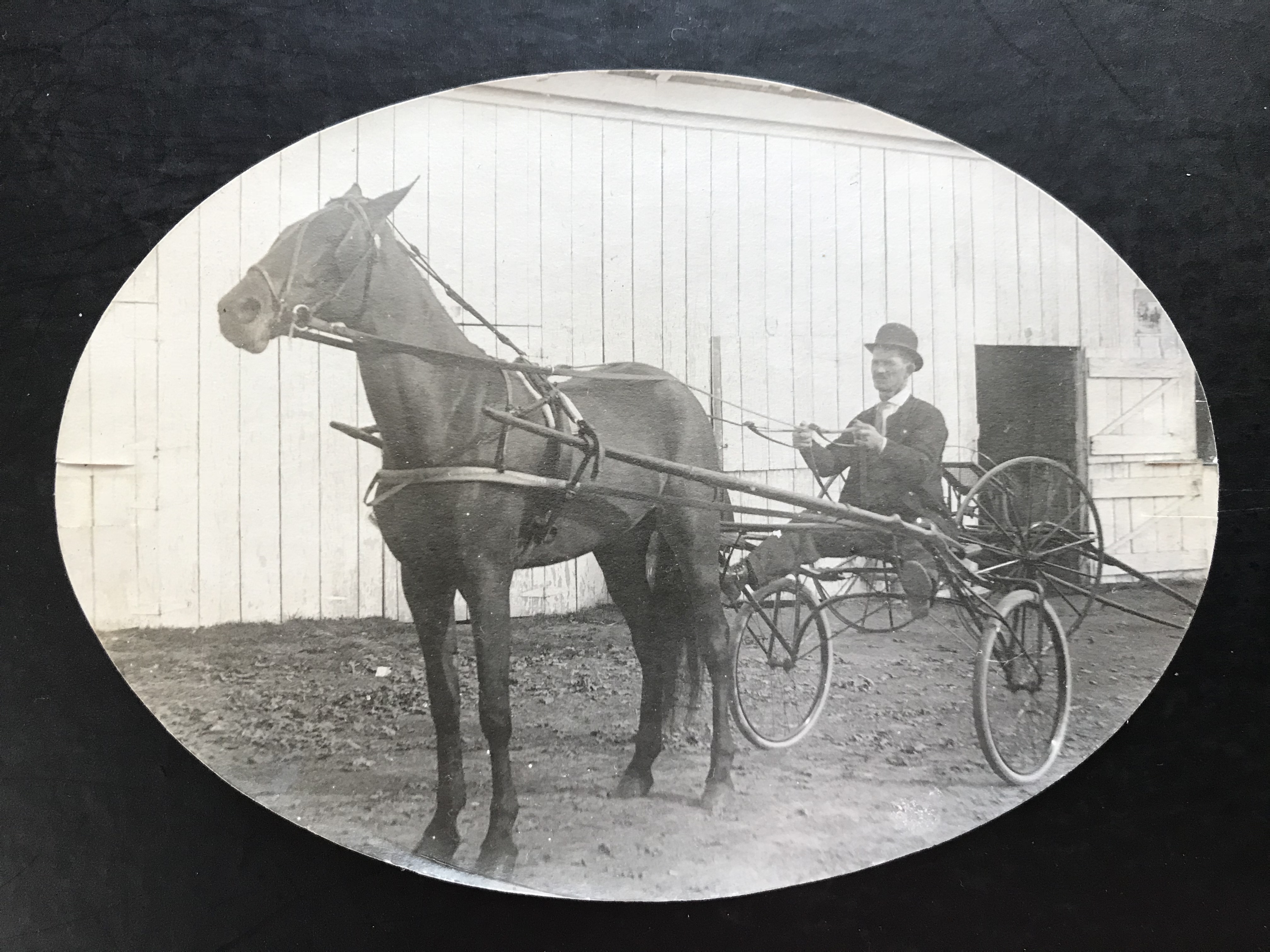
Race horses and two-wheeled sulkies (for trotting races) at the Rockville Fairground stables, Photo by Lewis Reed, ca. 1910.
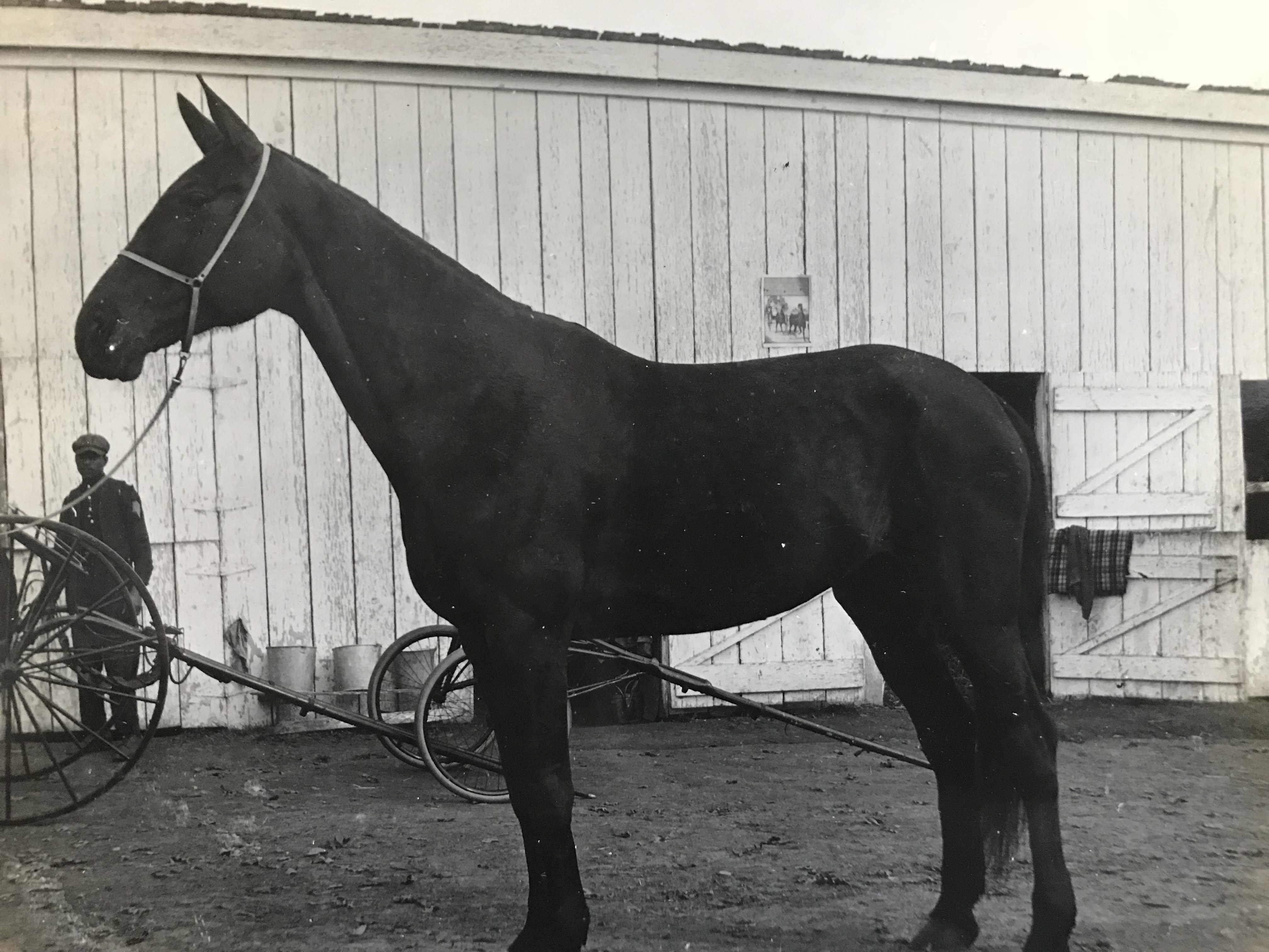
Race horse and two-wheeled sulkies (for trotting races) at the Rockville Fairground stables. Photo by Lewis Reed ca. 1910
First Auto Races at Rockville Fair Speedway
From The Baltimore Sun, August 27, 1923:
This is the first year that a Rockville Fair has continued through Saturday. The extra day was added this time as an experiment, the management believing that by substituting new features the additional day could be made a success. Automobile races, the first ever held at Rockville, were the day’s principal attraction and they attracted a good-sized crowd.
Early action shots like the ones below are rare, however, Lewis Reed was there to capture six epic moments of race history through the lens of his camera that day.
Rockville drew huge crowds for auto races. Rockville Fair, August 25, 1923. Photo by Lewis Reed
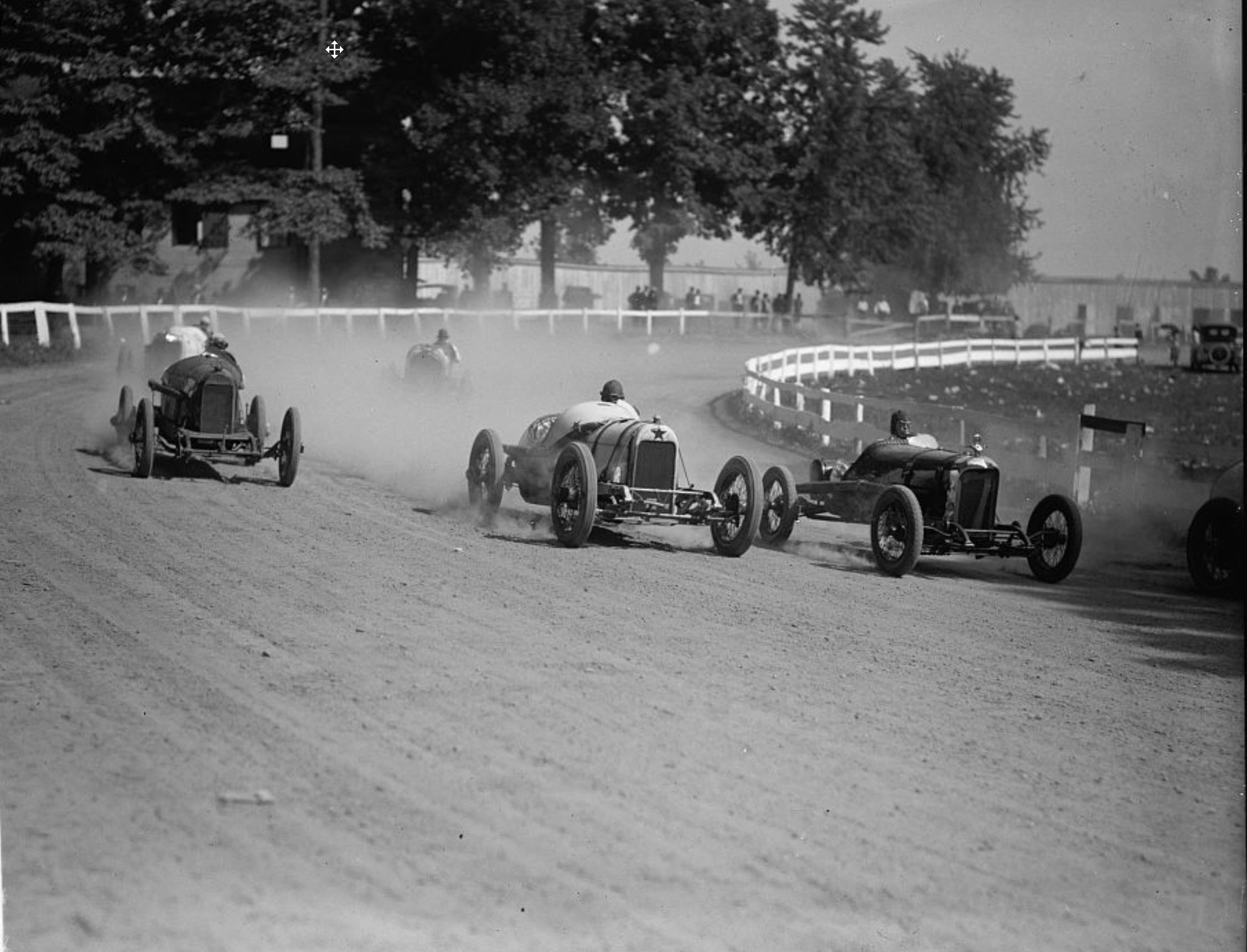
Dusty Action – 1923 photo of the exciting auto races at Rockville Fair. Five racers are just coming around the bend on this dirt track with their tires spinning up dust in their wake. Photo by Lewis Reed
Race car drivers deep in dust round a turn at the Rockville Fair auto races. Print made from a Lewis Reed glass negative.
High-powered race cars rounding a wide, sweeping curve at the Rockville Fair auto races, August 25, 1923. Print made from a Lewis Reed glass negative
Two-man race car. Some early race cars included both a driver and a ‘riding mechanic’. One of the key jobs of the second man in a race car was to look backward and alert the driver to what was going on behind him. Photo by Lewis Reed
Early race car drivers were required to have a riding mechanic, otherwise it was voluntary. Riding mechanics, who in addition to being lookouts, kept an eye on tire wear and would even hop out of the car and run back through the infield to get fuel. Special note: The above photograph was featured as a part of the London Array Series of “Impossible Engineering,” broadcast on January 24, 2019 on Discovery’s Science Channel. The photograph was used on the program that featured a segment on the development of the race car.
More dirt track action. Skinny tires make for slippery turns. Photo by Lewis Reed
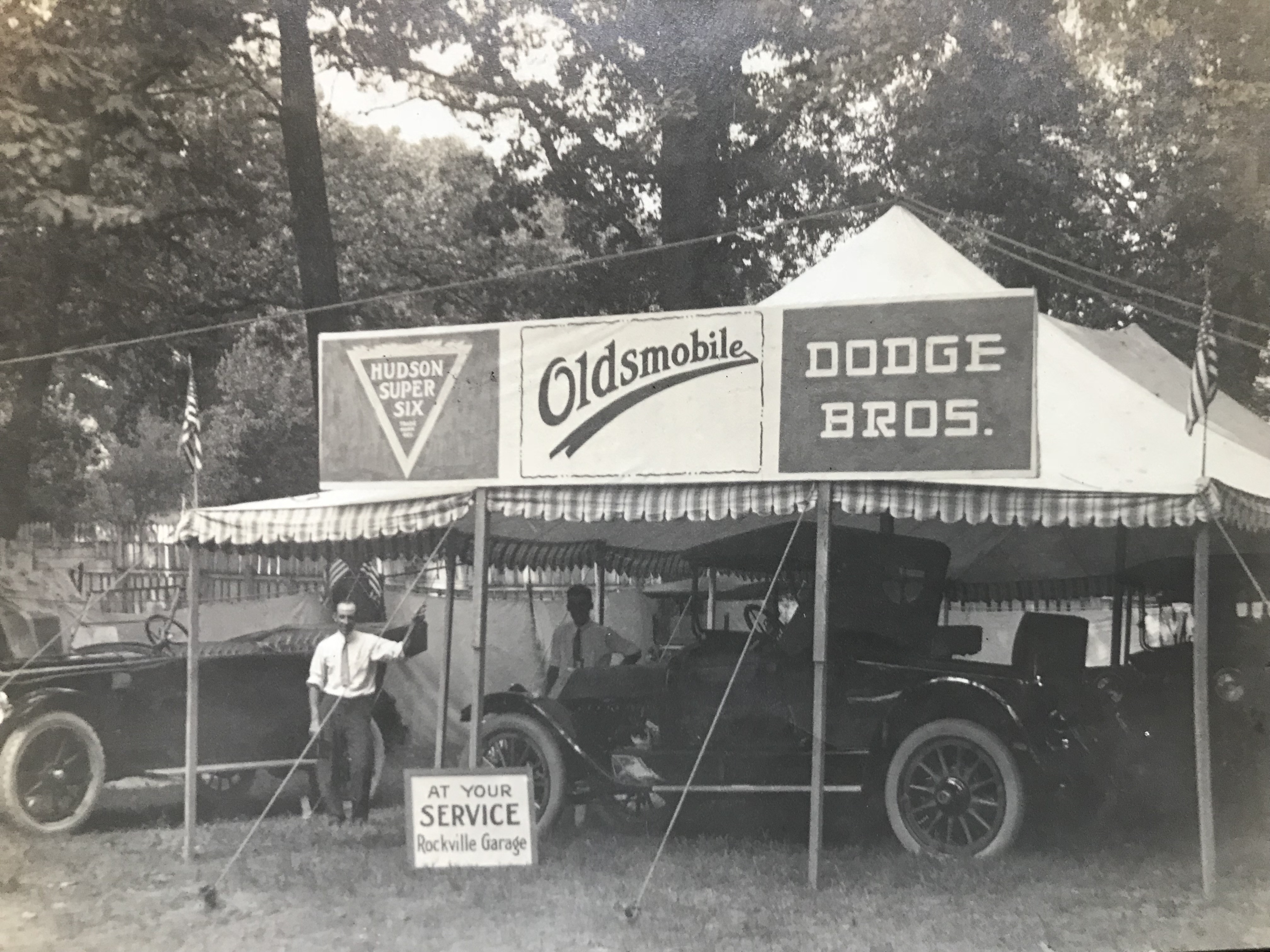
Rockville Garage Displaying New Model Cars at the Rockville Fair Grounds, 1918
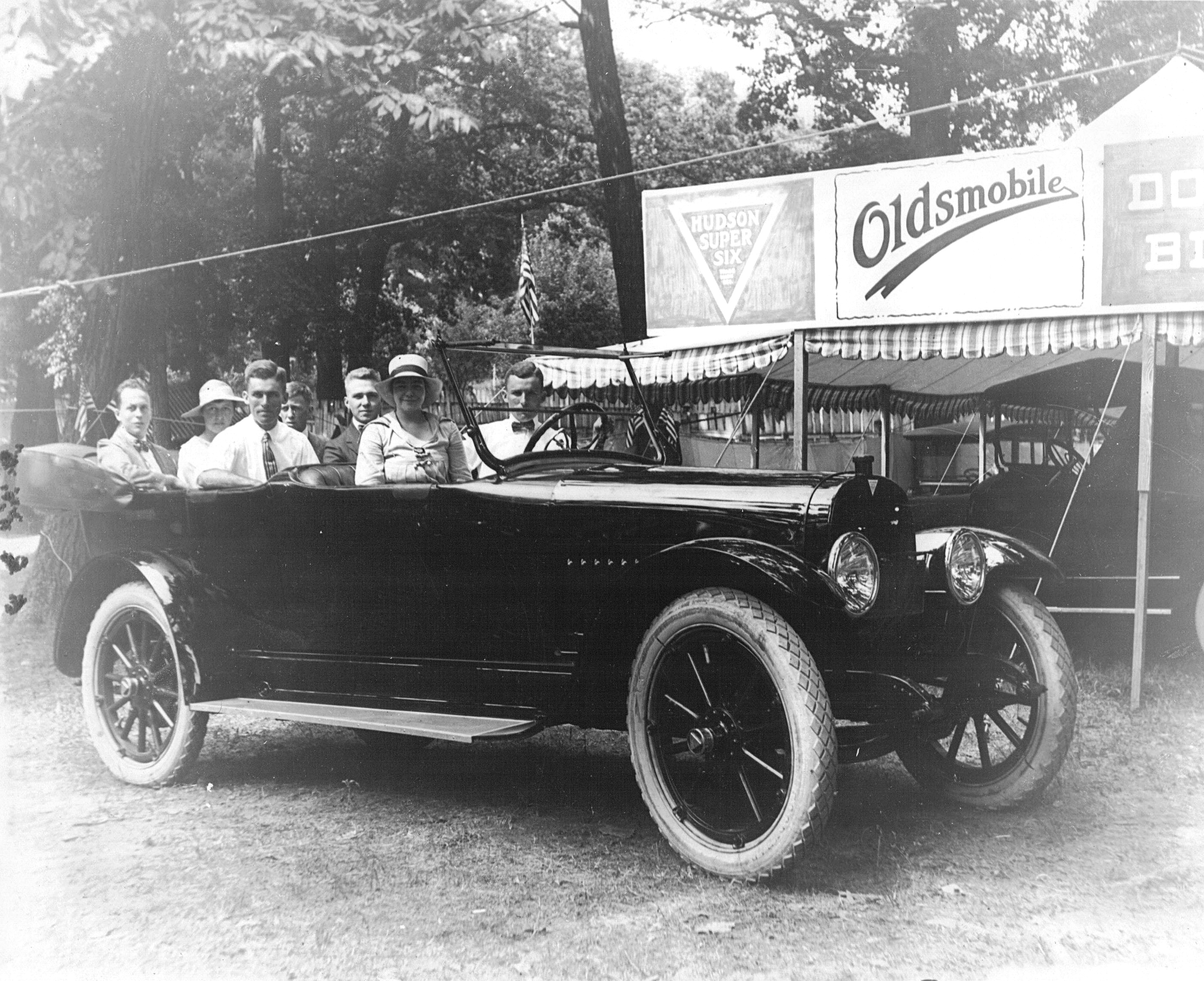
Anybody for a demonstration drive? Identified by the triangle logo on the grill and the number of passengers seated in it, the car appears to be a 1918 Hudson Super Six Seven Passenger Touring. Photo by Lewis Reed
Hudson Super Six, Oldsmobile, and Dodge Brothers Motor Cars on display. Lewis Reed in drivers seat.

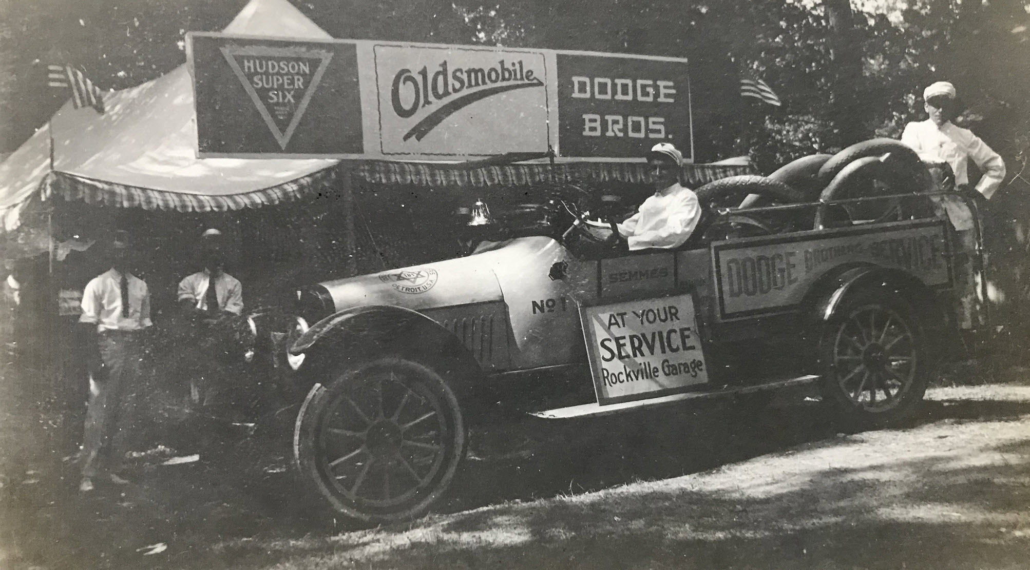
Rockville Garage displaying their new models at the Rockville Fair Grounds. Photo by Lewis Reed
At Your Service Rockville Garage. Lewis Reed on the left
Reed Brothers Company Softball Team at the Rockville Fairgrounds, late 1920s
From a distance, it looks and sounds like a regular baseball game: the crack of the bat, the cheering from the bench, the sliding into home plate. But a closer look at the field shows something is very different. They’re playing on a rough grass field, no one is using a batting helmet, fielding glove, or catcher’s mask. From the 1920s through the 1940s, Reed Brothers Dodge had their own company softball team that played on the fields at the Rockville Fairgrounds where Richard Montgomery High School now stands.
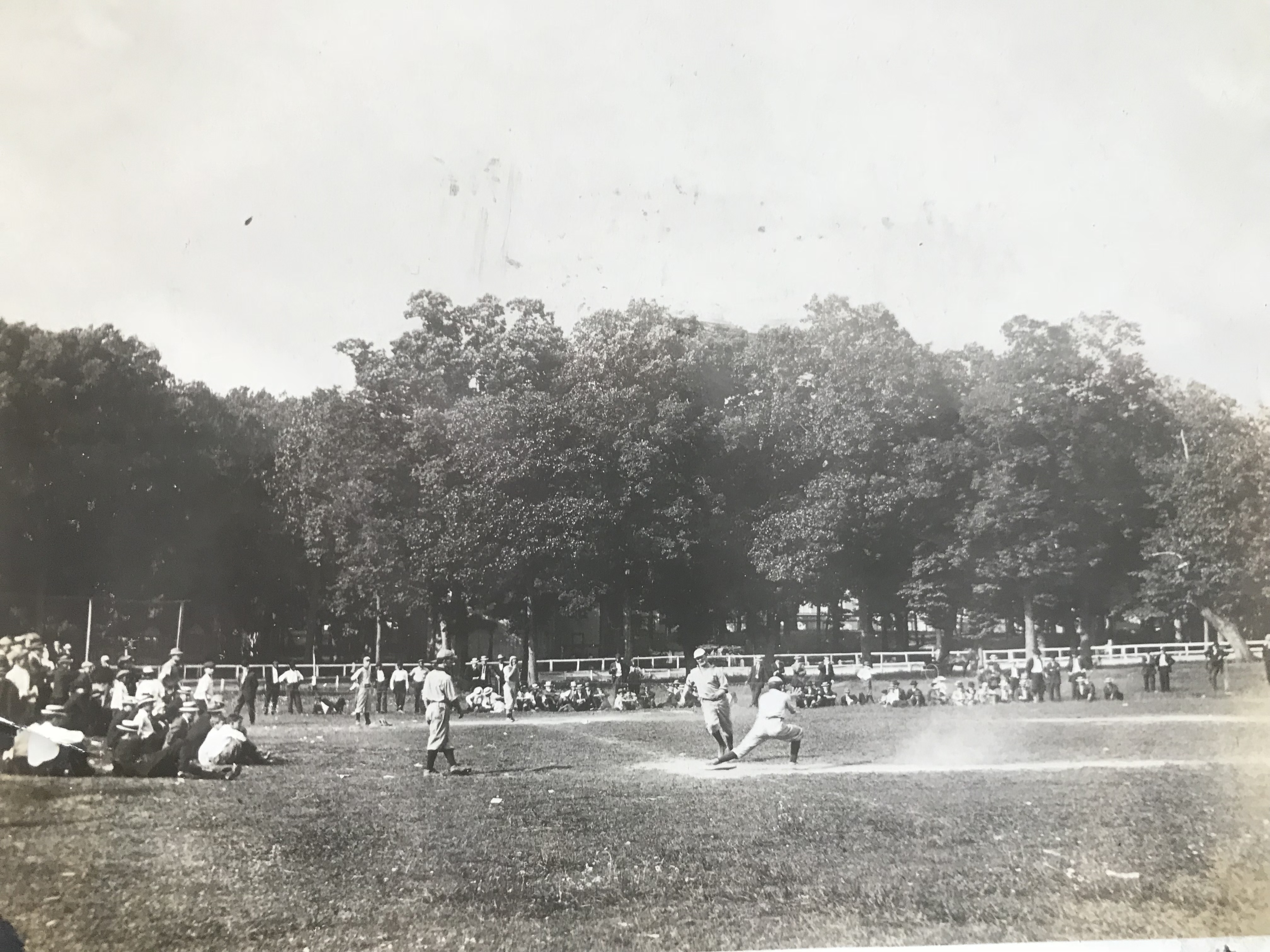
Reed Brothers Softball Team playing on a field set up inside the Rockville Fair racetrack oval, circa late 1920s. Photo by Lewis Reed
Fair Now History
From The Daily Mail (Hagerstown, Maryland) 23 Aug 1933:
The historic Rockville Fairgrounds, scene of many harness race programs, will be sold at a sheriff’s sale Friday afternoon at Rockville. The property consists of 26 acres, a dwelling and numerous stables, exhibition buildings and other structures. The sale is being made to satisfy a claim of a bank. It is rumored that the Montgomery County Board of Education will try to buy the grounds as a site for an elementary school and a future location for the entire Rockville educational plant.
Fair Ground Auctioned
From The Evening Sun (Baltimore, Maryland) 26 Aug 1933:
The Montgomery County National Bank submitted the only bid for the historic Rockville Fair Grounds at a public auction on August 25, 1933 to satisfy a bank’s claim. Its bid was $19,500.00 subject to a mortgage held by the Sandy Spring Savings Institution, and unpaid interest and taxes.
The Montgomery County Fair was reborn in 1949 and again started holding its annual Fair in Gaithersburg. On June 4th, 1949, close to 1,000 volunteers participated in an old-fashioned barn raising and 12 outbuildings were constructed in one day. The site of the new Montgomery County Agricultural Center was created.
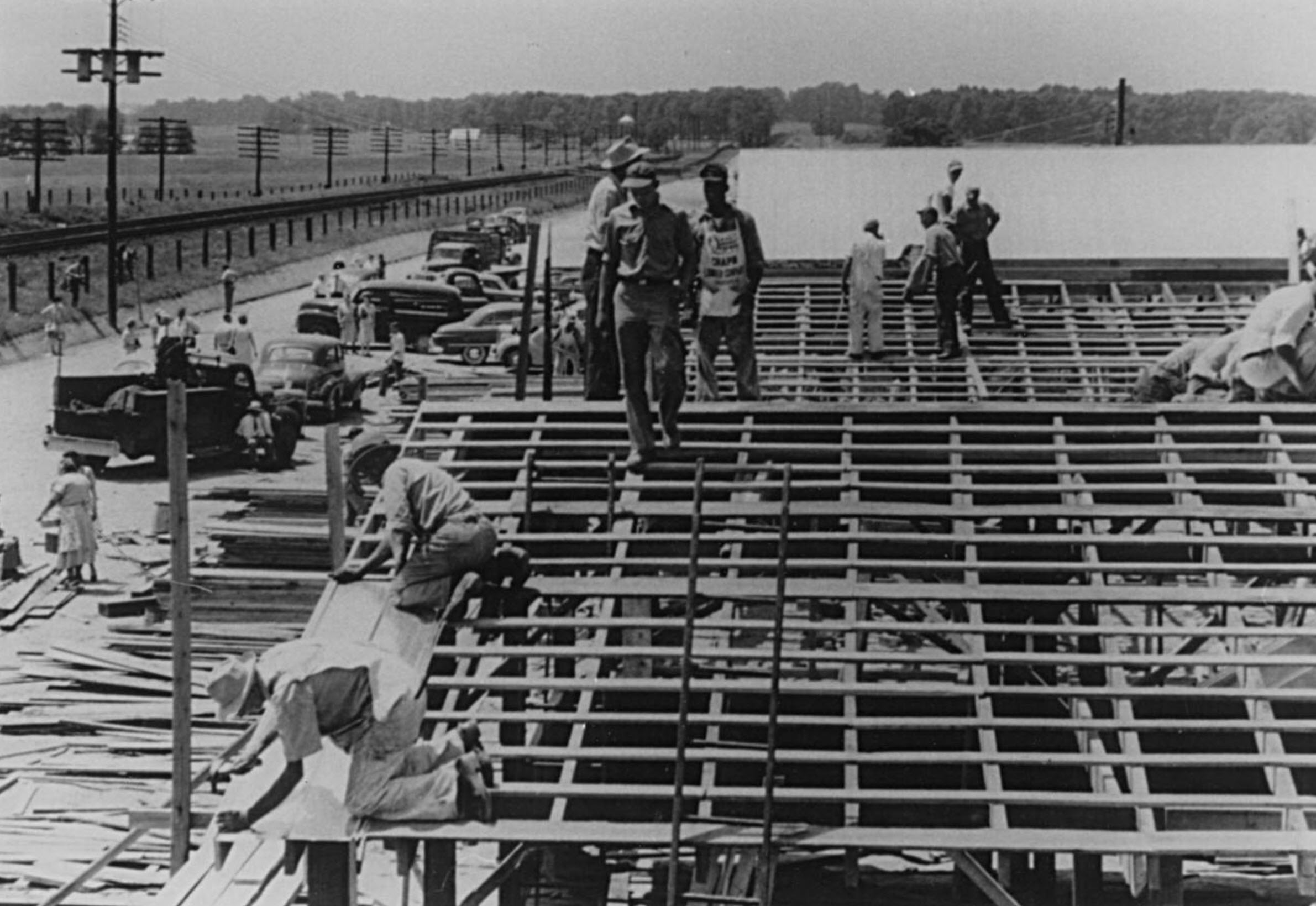
June 4, 1949 – Construction of the cattle barns along the railroad tracks. Photo courtesy of Montgomery County Agricultural Fair photo archives.
End of An Era
While many things about the fair have changed over the years, its mission has remained the same.
This event provides the opportunity for 4-H and FFA members to exhibit their livestock, homemaking and craft projects. We also focus on promoting the science and preservation of agriculture in Montgomery County and educating Fair patrons and the community regarding agricultural related topics.
To that end they have been successful since 1846. The Montgomery County Agricultural Fair is now today, one of the largest county Fairs in the State of Maryland.
Special note: According to Helen Caulfield Madine Gregory of The Woodlands, the Fair was held in Clopper at The Woodlands, home of the Huttons and Caulfields for several years before the current fairgrounds were built in Gaithersburg. O.W. Anderson wanted to purchase land from her father, John P. Caulfield, but he allowed fences for tethering the cattle, and pens for smaller animals to be built. There were also horse pulling contests. The Montgomery County Sentinel estimated about 3,000 people attended.
Find photos like these and much more on Montgomery History’s online exhibit, “Montgomery County 1900-1930: Through the Lens of Lewis Reed“.
References:
Chronicling America: Historic American Newspapers. Library of Congress
Newspapers.com: the largest online newspaper archive
Rockville, Portrait Of A City, Eileen S. McGuckian
Ag Center History
Helen Caulfield Madine Gregory
Then & Now: Baltimore & Ohio Railroad, Point of Rocks Tunnel
This post is a continuation of a series of “Then & Now” images from Lewis Reed’s Photo Collection alongside photographs of how they appear today. Lewis Reed worked hard to preserve a visual history of Montgomery County, Maryland and surrounding area long before automobiles were even around. As early as 1905, he toured on his motorcycle across the states of Maryland, Virginia, and Washington, D.C. and took photographs of many historic locations. Taken over 112 years apart, you can see how the Point of Rocks Train Tunnel in Maryland looks almost the same from over a century ago.
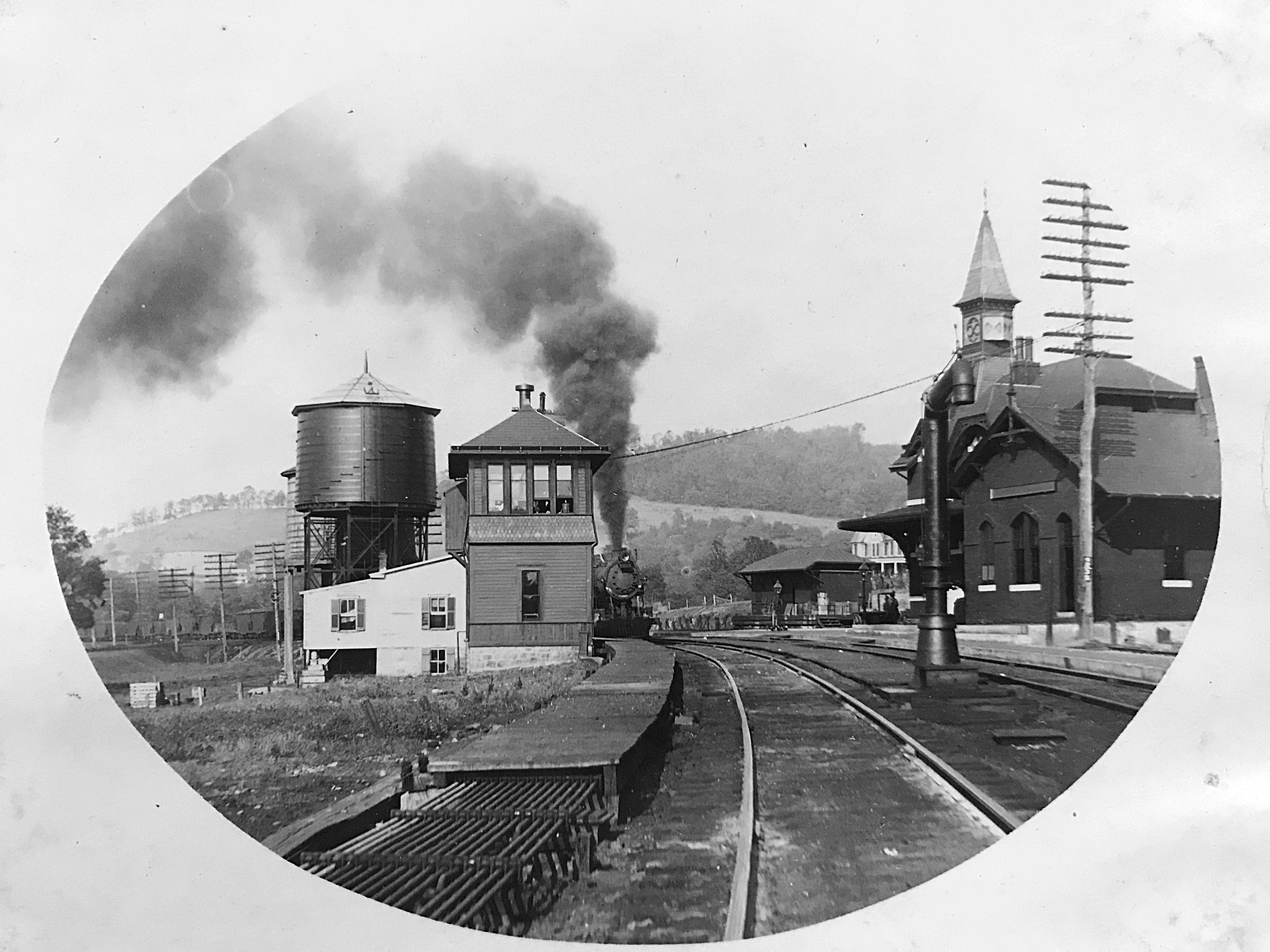
Point of Rocks Tunnel (THEN): Just west of the Point of Rocks Train Station is the Point of Rocks Tunnel. The original single-track main line is the track on the far left which goes around the cliff. A boxcar is visible just to the left of the tunnel opening. The tunnel was completed in 1902 when it became necessary to add a second track. The tunnel portal has a brick facade with the bricks forming the words, “Point of Rocks” above the opening. Just over the river bank from the original main line was the Chesapeake & Ohio Canal (C&O). Space is tight there and the railroad and canal folks were often at odds. A wall between the two was constructed to help ensure the trains did not scare the mules pulling the canal boats.
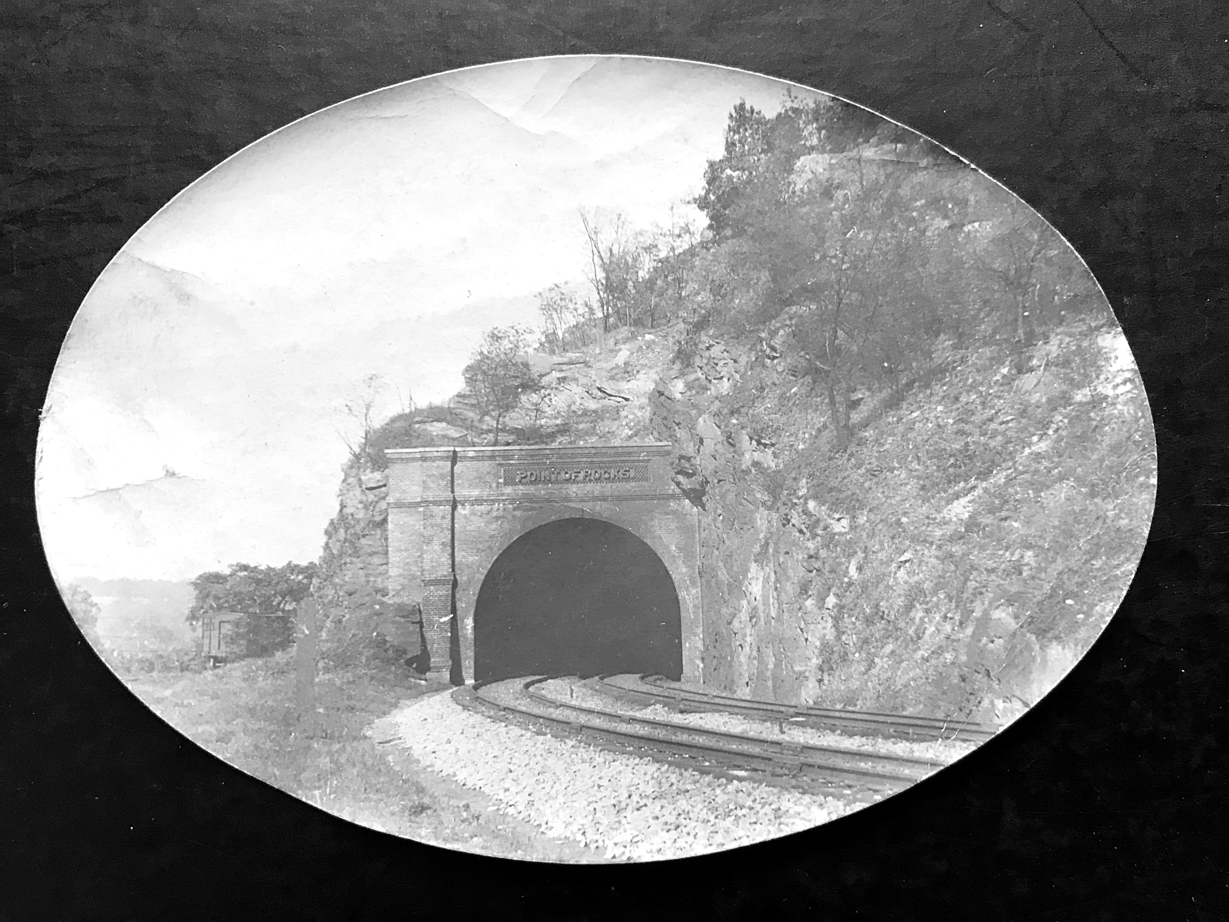
Point of Rocks Train Tunnel, 1911. Photo by Lewis Reed
Point of Rocks Tunnel (NOW): The tunnel was enlarged in 1902 to accommodate larger trains. In the early 1960s, the eastbound track was moved to the outside of the tunnel to accommodate still larger trains. This was done by blasting the rocks on the old alignment outside the tunnel, enlarging the road bed, and dumping the excavation rocks into the canal bed, where they remain today.
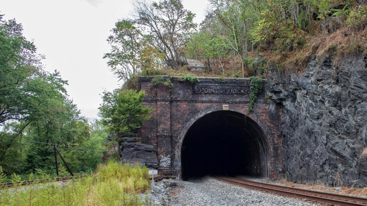
Point of Rocks Train Tunnel today
Point of Rocks Maryland, 1911
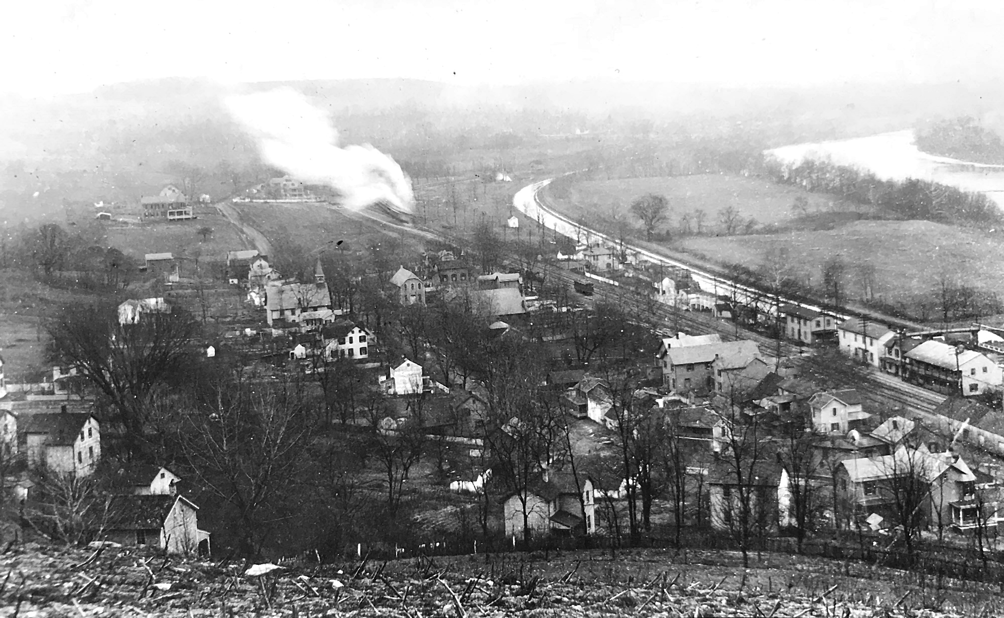
Point of Rocks, 1911. Photo by Lewis Reed
In 1835, the community of Point of Rocks, originally known as Trummelstown, was laid out at the foot of the Catoctin Mountains along the route of the C&O Canal and the B&O Railroad in order to provide dwellings for workers building the railroad and canal. The community was soon thereafter renamed for a nearby notable geographic feature of projecting rocks formed at the point where the Catoctin mountain range reached the Potomac River. This feature is no longer visible today, as it has been largely removed to accommodate the construction of the railroad and Point of Rocks Tunnel. The coming of the transportation routes and the construction of an adjacent bridge crossing and railroad spur over the Potomac River in 1852 lead to the growth of the town. By 1858, dwellings, a store, a hotel and a number of warehouses and flour mills that received grain from northern Virginia farmers for transport to Washington were located along the north side of the railroad.
Point of Rocks Railroad Station, 1911. Photo by Lewis Reed
The growth of the Point of Rocks area was further prompted by the erection of the largest iron forge in the tri-state area on the opposite bank of the Potomac in Loudoun County, Virginia. In the mid-19th century, the operation employed over 250 men, many of whom crossed over the bridge from Maryland. The town also served passenger traffic on the railroad and became one of a number of resort towns along the Potomac River. By 1873, warehouses, hotels, and other commercial building lined both sides of the railroad and canal in an area south of the present-day village. In 1873, a location about a mile to the southeast of Point of Rocks became the junction of the B&O Railroad’s Metropolitan Branch and the Old Main Line passenger trains. The station name was first Point of Rocks, then changed to Washington Station in 1876, and reverted back to Point of Rocks in 1923.

Point of Rocks Railroad Station, 1911. Photo by Lewis Reed
The growth of the low-lying village was inhibited throughout the 19th and 20th centuries by several floods. By 1910, few remnants of the original village remained, with most of the village now being located on higher ground. In 2009, the earliest extant buildings date to the late 19th century.
Books
![]()
Related Resources


Copyright Notice

Reed Brothers Dodge History (1915-2012) by Jeanne Gartner is licensed under a Creative Commons Attribution-NonCommercial 3.0 Unported License.

Recent Comments