
Rare 1920s Aerial Photos of Reed Brothers Dodge
A retrospective of Lewis Reed’s rare aerial photographs of Reed Brothers Dodge dealership and images of Rockville Maryland circa 1920s – 1930s. With photography for a hobby, one that began even before automobiles were around, Lewis Reed amassed a large library of photographs showing Montgomery County in the early 20th century. Many of his photographs are now part of the Montgomery County Historical Society photo archives.
Lewis Reed was not an aviator, but he obviously saw great potential in taking photographs from the air. The aerial photographs below were taken by Lewis Reed sometime during the 1920s and 30s and are quite possibly some of the earliest known aerial photographs taken of Rockville. (click on images to enlarge)

Aerial view of Reed Brothers Dodge circa 1936 with canopied Gulf Gas Station. A two-story house stands behind the dealership.

Later aerial view showing the used car lot where previously stood a two-story house. St Mary’s Church at lower portion of photo. The connector street behind the dealership was later named “Dodge Street” in honor of Lewis Reed because his dealership was located there for so many years (1914-1970).
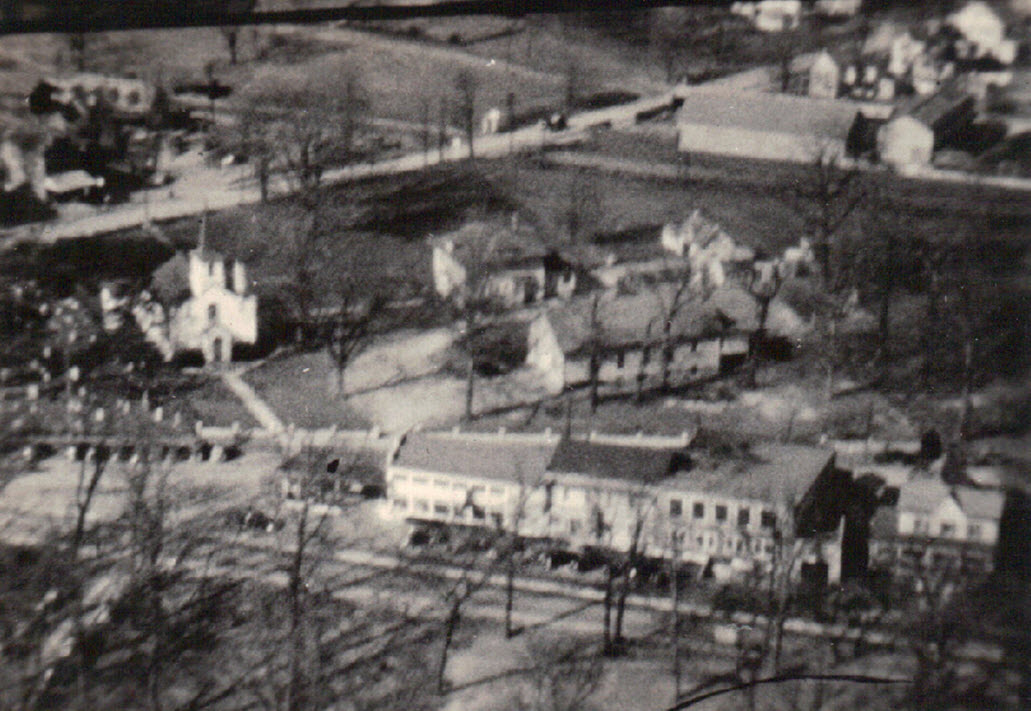
1920s – Original Reed Brothers facility with St Mary’s Church and Cemetery at upper portion of photo. The road at the bottom is Rockville Pike.

1920s – Original Reed Brothers facility at the intersection of Veirs Mill Road and Rockville Pike. “Pigeon Bridge” on Veirs Mill Road is at the top of the picture. Note the unpaved dirt road.

An early 1920s aerial view looking over Rockville. Red Brick Courthouse tower can be seen top left.

This 1920s aerial image of Rockville appears to be the opposite perspective as the one above. Confederate Monument is visible in the triangle at bottom left and the Red Brick Courthouse tower is across the street on the right.
How Dodge Street in Rockville Got Its Name
How Dodge Street In Rockville Got Its Name
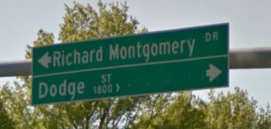
In honor of Rockville automobile pioneer, Lewis Reed, the State of Maryland named the connector street behind the dealership’s original location, “Dodge Street,” commemorating Reed Brothers’ presence from 1915-1970.
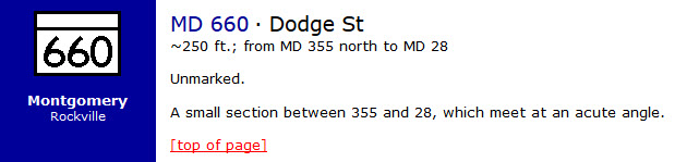
The connector street was so short that Lewis Reed always joked, if the state wanted to name a street after him, the street needed to be longer. Hence the street was named, “Dodge Street”. Maryland Route 660 is the unsigned designation for Dodge Street, which runs 0.05 mi from Rockville Pike (MD 355) north to Veirs Mill Road (MD 28) in Rockville. Dodge Street is one of the shortest highways in the state of Maryland.

Dodge Street Google capture 2017
By tracking Reed Brothers Dodge on successive Sanborn maps—1915, 1924, and 1949—I have confirmed that sometime between 1924 and 1949, CADIZ ALLEY became Dodge Street. CADIZ ALLEY is an arbitrary designation supplied by the Sanborn Map Company in the absence of a suitable official name. The street was named “Dodge Street” by the State of Maryland sometime following the dealership’s 1941 expansion.

Nov 1915 Rockville Maryland Sanborn Map, Sheet 5 (zoomed in)
When the state of Maryland widened the roads in 1970, Reed Brothers Dodge relocated from its original location at the triangle at Veirs Mill Road and Rockville Pike to a new complex at 15955 Frederick Road in Rockville. The dealership’s original site is now the Veterans Park.

2019 Google Map view showing the original location of Reed Brothers Dodge triangle and Dodge Street
Sources:
Wikipedia, List of state highways in Maryland shorter than one mile
MDRoads Routes 660-679 Maryland Highways of the Automobile Era
Books
![]()
Related Resources


Copyright Notice

Reed Brothers Dodge History (1915-2012) by Jeanne Gartner is licensed under a Creative Commons Attribution-NonCommercial 3.0 Unported License.

Recent Comments